Fannin, Texas

Last updated
Fannin, Texas
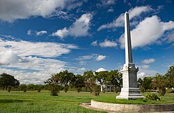
Fannin Battleground State Historic Site Wiki (1 of 1).jpg
Fannin Battleground State Historic Site
USA Texas location map.svg
Red pog.svg
Fannin
Usa edcp location map.svg
Red pog.svg
Fannin
Coordinates: 28°41′44″N97°14′9″W / 28.69556°N 97.23583°W / 28.69556; -97.23583 Coordinates: 28°41′44″N97°14′9″W / 28.69556°N 97.23583°W / 28.69556; -97.23583
Country United States
State Texas
County Goliad
Elevation
141 ft (43 m)
Time zone UTC-6 (Central (CST))
  Summer (DST) UTC-5 (CDT)
GNIS feature ID1373703

Fannin is an unincorporated community in eastern Goliad County, Texas, United States. [1] Its elevation is 141 feet (43 m). [2] It is part of the Victoria, Texas Metropolitan Statistical Area.

Contents

History

Fannin is named for James Fannin, [3] who commanded the group of Texans killed in the Goliad Massacre during the Texas Revolution.

Recreation

Fannin is home to the Coleto Creek Reservoir. It is a venue for camping, fishing and other outdoor recreation.

Related Research Articles

James Fannin American soldier and leader during the Texas Revolution

James Walker Fannin Jr. was an American military figure and slave trader in the Texas Army and leader during the Texas Revolution of 1835–36. After being outnumbered and surrendering to Mexican forces at the Battle of Coleto Creek, Colonel Fannin and nearly all his 344 men were executed soon afterward at Goliad, Texas, under Santa Anna's orders for all rebels to be executed.

Lodi, Texas Unincorporated community in Texas, United States

Lodi is an unincorporated community in northern Marion County, Texas, United States. Its elevation is 253 feet. It has a post office with the ZIP code 75564. The only business in Lodi, Texas is Lodi Drilling & Service Company Inc.

Tell, Texas unincorporated community in Texas, United States

Tell is an unincorporated community in southwestern Childress County, Texas, United States, to the southwest of the city of Childress, the county seat of Childress County. Its elevation is 1,903 feet (580 m). It has a post office with the ZIP code 79259.

Saint Lawrence, Texas Unincorporated community in Texas, United States

Saint Lawrence is an unincorporated community in Glasscock County, Texas, United States. It lies south of Garden City, the county seat of Glasscock County. Its elevation is 2,677 feet (816 m).

Crockett, Kentucky Unincorporated community in Kentucky, United States

Crockett is an unincorporated community in Morgan County, Kentucky, United States. It lies along Route 172 northeast of the city of West Liberty, the county seat of Morgan County. Its elevation is 912 feet (278 m). It has a post office with the ZIP code 41413.

Rio Frio, Texas Unincorporated community in Texas, United States

Rio Frio is an unincorporated community in southeastern Real County, Texas, United States. It lies just off U.S. Route 83, south of the city of Leakey, the county seat of Real County. Its elevation is 1,483 feet (452 m). It has a post office with the ZIP code 78879. The town is named after the Frio River, on which it is situated.

Myra, Texas Unincorporated community in Texas, United States

Myra is an unincorporated community in western Cooke County, Texas, United States. It lies just off U.S. Route 82 west of the city of Gainesville, the county seat of Cooke County. Its elevation is 935 feet (285 m). it had a post office, with the ZIP code 76253 until early 2013. It is now closed.

Presidio La Bahía United States historic place

The Presidio Nuestra Señora de Loreto de la Bahía, known more commonly as Presidio La Bahía, or simply La Bahía is a fort constructed by the Spanish Army that became the nucleus of the modern-day city of Goliad, Texas, United States. The current location dates to 1747.

Flint, Texas Unincorporated community in Texas, United States

Flint is an unincorporated community in southeastern Smith County, Texas, United States. It lies along FM 2493 south of the city of Tyler, the county seat of Smith County. Its elevation is 522 feet (159 m). Although Flint is unincorporated, it has a post office, with the ZIP code of 75762.

Cookville, Texas Unincorporated community in Texas, United States

Cookville is an unincorporated community in eastern Titus County, Texas, United States. It lies along U.S. Route 67 east of the city of Mount Pleasant, the county seat of Titus County. Its elevation is 433 feet (132 m). Although Cookville is unincorporated, it has a post office, with the ZIP code of 75558, located at the junction of US 67 and Farm to Market Road 1000.

Selman City, Texas Unincorporated community in Texas, United States

Selman City is an unincorporated community in western Rusk County, Texas, United States. It lies along State Highway 64 west of the city of Henderson, the county seat of Rusk County. Its elevation is 407 feet (124 m). Although Selman City is unincorporated, it has a post office, with the ZIP code of 75689.

Barker, Texas Unincorporated community in Texas, United States

Barker is an unincorporated community in western Harris County, Texas, United States. It lies along local roads off Interstate 10 and seventeen miles west of downtown Houston. Its elevation is 102 feet (31 m), and it is located at 29°47′4″N95°41′6″W.

Cat Spring, Texas Unincorporated community in Texas, United States

Cat Spring is an unincorporated community in southern Austin County, Texas, United States. It lies along FM 949 south of the city of Bellville, the county seat of Austin County. Its elevation is 308 feet (94 m). Although Cat Spring is unincorporated, it has a post office, with the ZIP code of 78933; the ZCTA for ZIP Code 78933 had a population of 76 at the 2000 census.

Weesatche, Texas Unincorporated community in Texas, United States

Weesatche is an unincorporated community in northern Goliad County, Texas, United States. It lies along State Highway 119 north of the city of Goliad, the county seat of Goliad County. Its elevation is 233 feet (71 m). Although Weesatche is unincorporated, it has a post office, with the ZIP code of 77993. The community is part of the Victoria, Texas Metropolitan Statistical Area.

Vancourt, Texas Unincorporated community in Texas, United States

Vancourt is an unincorporated community in eastern Tom Green County, Texas, United States. It lies along U.S. Route 87 east of the city of San Angelo, the county seat of Tom Green County. Its elevation is 1,867 feet (569 m). Although Vancourt is unincorporated, it has a post office, with the ZIP code of 76955; the ZCTA for ZIP Code 76955 had a population of 108 at the 2000 census.

Mereta, Texas Unincorporated community in Texas, United States

Mereta is an unincorporated community in eastern Tom Green County, Texas, United States. It lies along local roads east of the city of San Angelo, the county seat of Tom Green County. Its elevation is 1,755 feet (535 m). Although Mereta is unincorporated, it has a post office, with the ZIP code of 76940; the ZCTA for ZIP Code 76940 had a population of 138 at the 2000 census.

Waring, Texas Unincorporated community in Texas, United States

Waring is an unincorporated community in northwestern Kendall County, Texas, United States. It lies along local roads and the Guadalupe River, northwest of the city of Boerne, the county seat of Kendall County. Its elevation is 1,345 feet (410 m). Although Waring is unincorporated, it has a post office, with the ZIP code of 78074; the ZCTA for ZIP Code 78074 had a population of 59 at the 2000 census. The community is part of the San Antonio Metropolitan Statistical Area.

Kendalia, Texas Unincorporated community in Texas, United States

Kendalia is an unincorporated community in northeastern Kendall County, Texas, United States. It is part of the Texas-German belt.

Cee Vee, Texas Unincorporated community in Texas, United States

Cee Vee is an unincorporated community in northwestern Cottle County, Texas, United States. It lies along FM 1440 northwest of the town of Paducah, the county seat of Cottle County. Its elevation is 1,880 feet (573 m), and it is located at 34°13′23″N100°26′44″W. Although Cee Vee is unincorporated, it has a post office, with the ZIP code of 79223; the ZCTA for ZIP Code 79223 had a population of 35 at the 2000 census.

Goliad State Park and Historic Site

Goliad State Park and Historic Site is a 188.3 acres (76 ha) state park located along the San Antonio River on the southern edge of Goliad, Texas. It was listed on the National Register of Historic Places (#01000258) on March 12, 2001.

References

  1. Rand McNally. The Road Atlas '05. Skokie: Rand McNally, 2005, p. 98.
  2. U.S. Geological Survey Geographic Names Information System: Fannin, Texas, Geographic Names Information System, 1979-11-30. Accessed 2007-12-22.
  3. Gannett, Henry (1905). The Origin of Certain Place Names in the United States. Govt. Print. Off. pp.  123.