Fanshawe Pioneer Village

Last updated
Fanshawe Pioneer Village
Fanshawe Pioneer Village.jpg
Canada Ontario location map 2.svg
Red pog.svg
Location of the museum in London, Ontario
Established1959 (1959)
Location2609 Fanshawe Park Road East
London, Ontario, Canada
N5X 4A1
Coordinates 43°03′08″N81°11′41″W / 43.05222°N 81.19472°W / 43.05222; -81.19472
Typehistoric site
Collection size33 buildings
DirectorSheila Johnson
CuratorShanna Dunlop
OwnerLondon and Middlesex Heritage Museum
Public transit accessnone
Nearest car parkon-site, free
Website www.fanshawepioneervillage.ca

Fanshawe Pioneer Village is an open-air museum established in 1959 and located in the Fanshawe Conservation Area in London, Ontario. [1] The village uses historical re-enactments to communicate the history of rural communities in the former townships of Westminster, London, North Dorchester, Delaware, West Nissouri and Lobo in Middlesex County from 1820 to 1920 and the founding and development of the City of London up to 1840. [2]

Contents

The pioneer village is owned and operated by the London and Middlesex Heritage Museum, a not-for-profit charity, with the support of the City of London, the Upper Thames River Conservation Authority, the Municipality of Thames Centre and the Municipality of Middlesex Centre. The intended purpose of the pioneer village is to involve the community in the preservation of history and tradition through living history experiences. [3]

History

Fanshawe Pioneer Village was first conceived in 1955 under the Upper Thames River Conservation Authority's responsibility to conserve historic structures in the Upper Thames watershed. The Village officially opened on June 26, 1959 with support from Dr. Wilfrid Jury, Director of the University of Western Ontario's Museum of Indian Archaeology and Pioneer Life. In 1961, the site was enlarged to 2.2 acres and in 1963, the Authority set aside an additional 22 acres for future development. Wilfrid Jury had accumulated a large collection of pioneer artefacts which were exhibited at Middlesex College, University of Western Ontario. This collection was brought to the Village and formally donated to the Upper Thames River Conservation Authority in 1978. By 1980, the Village consisted of 23 buildings placed throughout the original 22 acres. Today the village consists of 33 original and replica historic structures on 46 acres.

Museum and programmes

Collection

Fanshawe Pioneer Village contains a collection of material culture significant to the history of the city of London and Middlesex County. The collection includes over 25,000 artefacts [4] representing furniture, decorative arts, costumes and textiles, archival materials, domestic tools, vehicles as well as agricultural and industrial tools and equipment. The collection has been assembled through donations from residents of London and Middlesex County who have donated their artefacts.

Educational events

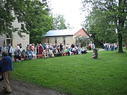
As part of their attempt to encourage community involvement, Fanshawe Pioneer Village hosts a number of historically based events every year.

Buildings

Fanshawe Pioneer Village is the site of 33 historic buildings with origins spanning one hundred years. The Village is separated into four historical clusters to depict the development of the community.

Fanshawe Settlement 1820-1850

Elgie Log House Fanshawe Pioneer Village log house.jpg
Elgie Log House

Fanshawe Settlement 1820-1850 is intended to be representative of the impact upon the land and aboriginal people by settlers who immigrated from Europe and other parts of North America to the London area in the first half of the 19th century.

Fanshawe Corners 1850-1880

Purple Hill Lodge Fanshawe Pioneer Village Loyal Orange Lodge.jpg
Purple Hill Lodge

Representative of the first stage of urban development at a transportation crossroads.

Fanshawe Township 1880-1910

Jury Farmstead Fanshawe Pioneer Village Jury farmhouse.jpg
Jury Farmstead

Tells the story of farming, as it becomes the economic engine that drives development in London and Middlesex County.

The Town of Fanshawe 1910-1920

Trinity Anglican Church Fanshawe Pioneer Village church.jpg
Trinity Anglican Church

Tells the story of the rapid changes that marks the 20th century.

See also

Related Research Articles

London, Ontario City in Ontario, Canada

London is a city in southwestern Ontario, Canada, along the Quebec City–Windsor Corridor. The city had a population of 383,822 according to the 2016 Canadian census. London is at the confluence of the Thames River, approximately 200 km (120 mi) from both Toronto and Detroit; and about 230 km (140 mi) from Buffalo, New York. The city of London is politically separate from Middlesex County, though it remains the county seat.

Middlesex County, Ontario County in Ontario, Canada

Middlesex County is a primarily rural county in Southwestern Ontario, Canada covering 3,317.27 square kilometres. Landlocked, the county is bordered by Huron and Perth counties on the north, Oxford County on the east, Elgin County on the south, and Chatham-Kent and Lambton County on the west.

Black Creek Pioneer Village

Black Creek Pioneer Village, previously Dalziel Pioneer Park, is an open-air heritage museum in Toronto, Ontario, Canada. The village is located in the North York district of Toronto, just west of York University and southeast of the Jane and Steeles intersection. It overlooks Black Creek, a tributary of the Humber River. The village is a recreation of life in 19th-century Ontario and gives an idea how rural Ontario might have looked in the early-to-mid-19th century. The village is a regular destination for field trips by schoolchildren from the Greater Toronto Area. It was opened in 1960 and is operated by the Toronto and Region Conservation Authority.

The Upper Thames River Conservation Authority is a body based in London, Ontario, Canada. It was created in 1947. It was responsible for the construction of the Fanshawe Dam, completed in the 1950s, to control flooding from the Thames River, which runs through London. During the last ice age, the site of London was the terminus of a large glacier. When the region warmed at the end of the ice age, the glacier melted and receded North, leaving behind a drainage ditch and features such as Sifton Bog. As such, the Thames is a watershed for most of Western Ontario, and is therefore highly susceptible to seasonal flooding. In 1937, such flooding had devastating consequences, destroying over 1,000 homes, and causing millions of dollars in damage.

Oxford County, Ontario Regional municipality in Ontario, Canada

Oxford County is a regional municipality in the Canadian province of Ontario. Highway 401 runs east–west through the centre of the county, creating an urban industrial corridor with more than half the county's population, spanning 25 km between the Toyota auto assembly plant in Woodstock and the CAMI General Motors auto assembly plant in Ingersoll. The local economy is otherwise dominated by agriculture, especially the dairy industry.

Flamborough, Ontario Former municipality, now part of Hamilton, Ontario, Canada

Flamborough is a district and former municipality in the city of Hamilton, Ontario, Canada. For most of its existence before amalgamation with Hamilton in 2001, Flamborough comprised the former townships of East Flamborough, West Flamborough, and Beverly, as well as the village of Waterdown. The largest suburban community is the former village of Waterdown containing perhaps one third of its thirty thousand or so inhabitants. Other Flamborough communities include Carlisle, Christie's Corners, Clappison's Corners, Copetown, Freelton, Greensville, Lynden, Kirkwall, Millgrove, Mountsberg, Orkney, Peter's Corners, Rockton, Troy, Sheffield, Valens, Strabane and Westover.

Highbury Avenue is an arterial road located in the Canadian province of Ontario. In addition to serving as a primary north–south thoroughfare in eastern London – through which part of it is a limited-access freeway – the road also provides access to Highway 401 and continues south to St. Thomas. The southern terminus of Highbury Avenue is an intersection with South Edgeware Road, just north of Highway 3 and the eastern end of the St. Thomas Expressway. From there, it travels 45.6 kilometres (28.3 mi) north to Highway 7, east of Elginfield. Outside of London and St. Thomas, the road also passes through the communities of Ballymote and Bryanston. It is designated as Elgin County Road 30 within Central Elgin, and as Middlesex County Road 23 within Middlesex Centre, the two rural municipalities through which the route passes.

Toronto and Region Conservation Authority(TRCA) is the largest of 36 conservation authorities in Ontario, Canada. It owns more than 16,000 hectares of land in the Toronto region and employs more than 400 full-time employees and coordinates more than 3,000 volunteers each year. TRCA's area of jurisdiction is watershed-based, and includes 3,467 square kilometres: 2,506 on land and 961 water-based in Lake Ontario. This area comprises nine watersheds from west to east: Etobicoke Creek, Mimico Creek, Humber River, Don River, Highland Creek, Petticoat Creek, Rouge River, Duffins Creek, Carruthers Creek.

Norwich, Ontario Township in Ontario, Canada

The Township of Norwich is a municipality located in Oxford County in Southwestern Ontario, Canada. At the centre of the Township of Norwich is the Town of Norwich. The preferred pronunciation of the town name is NOR-witch, which differs from the pronunciation NORR-ij used for the city of Norwich, England. The origin of Norwich, Ontario, is more likely Norwich in upper New York State, the area from which the pioneering families emigrated in the early 19th century, where the community was known as Norwichville.

Perth East, Ontario Township in Ontario, Canada

The Township of Perth East is a municipality in Perth County, Ontario, Canada and situated north of Stratford. It was created in 1998 when the Ontario government amalgamated the village of Milverton with the surrounding former townships of Ellice, Mornington, North Easthope and South Easthope.

Doon Heritage Village history and living history museum in Ontario, Canada

Doon Heritage Village, located at the Ken Seiling Waterloo Region Museum, is a picturesque 60 acre living history village that shows visitors what life was like in the Waterloo Region in the year 1914. It is located in the former Doon village, now part of Kitchener, Ontario, Canada, next to Homer Watson Park.

Levi Jackson Wilderness Road State Park

Levi Jackson Wilderness Road Park is a former state park located just south of London, Kentucky in Laurel County. It is now a city park under the auspices of the city of London, KY. The park encompasses 896 acres (363 ha) and includes a section of the Wilderness Road that early settlers used to reach Kentucky. The park is named for Levi Jackson, an early Kentucky pioneer. It serves as both a recreational and historic park.

Fanshawe Dam is a dam located on North Thames River near the eastern edge of London, Ontario. The crest of the dam is 625 metres long. It is 30.5 metres in height and drops the river surface 12 metres. Fanshawe Lake is the reservoir created by the dam. The hydroelectric generator of the Fanshawe Dam generates enough power to run 400 households. It is one of three dams on the Thames River and its tributaries.

Garfield Farm and Inn Museum United States historic place

The Garfield Farm and Inn Museum is a Registered Historic Place in Kane County, Illinois, United States. The property is a 375-acre (1.52 km2) farmstead, centered on an inn that served teamsters and the nearby community during the 1840s. It is currently a museum offering a variety of educational and entertainment events. The buildings that remain are three original 1840s structures, including the 1842 hay and grain barn, the 1849 horse barn, and the 1846 inn. Various other barns and outbuildings also stand, the last dated to 1906.

Pittock Dam Dam in Woodstock, Ontario

The Pittock Dam is a dam in Woodstock, Ontario, Canada. It lies on the main branch of the Thames River, and creates the Pittock Reservoir. This artificial lake forms the northeast boundary of the City of Woodstock.

Lang Pioneer Village Museum

Lang Pioneer Village Museum is a living history museum located in the hamlet of Lang in Peterborough County, Ontario. It was established in 1967 by the County of Peterborough. Lang Pioneer Village is situated on the shores of the historic Indian River. Lang Pioneer Village is an "outdoor museum" featuring more than 30 restored and furnished buildings, many of which were donated from the surrounding townships. The buildings, constructed between 1820 and 1910, are interpreted by costumed villagers portraying authentic 19th-century pioneer life. Since 2014 the Museum has been the site of the Aabnaabin Encampment, a pre-colonization representation of a Michi Saagiig camp where the story of the First Nations history and culture of the region is told by indigenous interpreters. Lang Pioneer Village Museum is owned and operated by the County of Peterborough.

Museum of Ontario Archaeology Archaeology museum in Ontario, Canada

The Museum of Ontario Archaeology is a museum located in northwest London, Ontario, Canada. It is dedicated to the study and public interpretation of over 11,000 years of human history in Ontario. It is adjacent to a reconstruction of the Lawson Site, a 16th-century pre-contact Attawandaron People's village. The museum offers permanent and temporary gallery space, a theatre, a classroom and children's activity space, along with tours of the reconstructed village.

Huron Tract

The Huron Tract Purchase also known as the Huron Block, registered as Crown Treaty Number 29, is a large area of land in southwestern Ontario bordering on Lake Huron to the west and Lake Erie to the east. The area spans the counties of Huron, Perth, Middlesex and present day Lambton County, Ontario in the province of Ontario.

Atherton Farmstead United States historic place

The Atherton Farmstead is a historic farm property at 31 Greenbush Road in Cavendish, Vermont. The farmhouse, built in 1785, is one of the oldest in the rural community, and is its oldest known surviving tavern house. It was listed on the National Register of Historic Places in 2002.

Friedrich Gaukel, also known as Frederick Gaukel, was a German-Canadian farmer, distiller, and innkeeper. He was born in Württemberg in what is now the Federal Republic of Germany. He immigrated first to Pennsylvania in the United States and later to Waterloo Township in Upper Canada, now the Canadian province of Ontario. He was instrumental in the early growth and establishment of Berlin, Ontario, of which he has been described as a "prominent founder". He operated an early tavern and inn near the site of the later Walper Hotel at the corner of King Street and Queen Street in downtown Kitchener. His donation of land to build a county courthouse and jail allowed Berlin to become the seat of Waterloo County, accelerating its urban development and growth toward becoming a city.

References

  1. Grainger, Jennifer (2002). Vanished villages of Middlesex. Dundurn Press Ltd. p. 128. ISBN   9781554883714.
  2. A Commemorative Look at the Creation of a Village: Celebrating Forty Years of History. 1996. p. 2.
  3. Carter, John C (2002). Ontario Conservation Authorities: Their Heritage Resources and Museums. pp. Ontario History Vol. XCIV, Number 1 Pg. 5–28.
  4. Pedro, Kelly (November 11, 2011). "Centre sets up pioneer village for all-year use". The London Free Press. Retrieved 8 March 2012.
  5. Neary, Hilary Bates; Michael Baker (2005). 100 Fascinating Londoners. James Lorimer & Company. p. 26.