Fara, Burkina Faso

Last updated
Fara
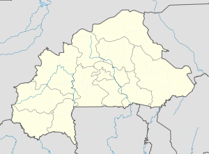
Burkina Faso location map.svg
Red pog.svg
Fara
Location in Burkina Faso
Coordinates: 11°32′N2°46′W / 11.533°N 2.767°W / 11.533; -2.767 Coordinates: 11°32′N2°46′W / 11.533°N 2.767°W / 11.533; -2.767
CountryFlag of Burkina Faso.svg  Burkina Faso
Region Boucle du Mouhoun Region
Province Balé
Department Fara Department
Population (1996)
  Total 9,259

Fara is a town in the Fara Department of Balé Province in southern Burkina Faso. It is the capital of the Fara Department and the town has a total population of 9,259. [1]

Fara Department Department in Balé, Burkina Faso

Fara is a department or commune of Balé Province in southern Burkina Faso. Its capital lies at the town of Fara. According to the 1996 census the department has a population of 35,120.

Balé Province Province in Boucle du Mouhoun, Burkina Faso

Balé is one of the 45 provinces of Burkina Faso, located in its Boucle du Mouhoun Region with Boromo as capital. Its area is 4,595 km2 (1,774 sq mi), and in 2006 had a population of 213,897. The province is known for its Deux Balé Forest, populated by savannah elephant herds. Boromo, the provincial capital, is located on the main road from Ouagadougou to Bobo-Dioulasso. In June 2007, the Canadian mining company, Semafo, open the third gold mine in the country in Mana in the province, with an investment of about $116 million.

Burkina Faso country in Africa

Burkina Faso is a landlocked country in West Africa. It covers an area of around 274,200 square kilometres (105,900 sq mi) and is surrounded by six countries: Mali to the north; Niger to the east; Benin to the southeast; Togo and Ghana to the south; and Ivory Coast to the southwest. The July 2018 population estimate by the United Nations was 19,751,651. Burkina Faso is a francophone country, with French as the official language of government and business. Roughly 40% of the population speaks the Mossi language. Formerly called the Republic of Upper Volta (1958–1984), the country was renamed "Burkina Faso" on 4 August 1984 by then-President Thomas Sankara. Its citizens are known as Burkinabé. Its capital is Ouagadougou.
Related Research Articles

Faras archaeological site in Sudan (Nubia)

Faras was a major city in Lower Nubia. The site of the city, on the border between modern Egypt and Sudan at Wadi Halfa Salient, was flooded by Lake Nasser in the 1960s and is now permanently underwater. Before this flooding, extensive archeological work was conducted by a Polish archeological team led by professor Kazimierz Michałowski.

Foreign Agents Registration Act United States law regulating foreign lobbying

The Foreign Agents Registration Act (FARA) is a United States law passed in 1938 requiring that agents representing the interests of foreign powers in a "political or quasi-political capacity" disclose their relationship with the foreign government and information about related activities and finances. The purpose is to facilitate "evaluation by the government and the American people of the statements and activities of such persons." The law is administered by the FARA Registration Unit of the Counterespionage Section (CES) in the National Security Division (NSD) of the United States Department of Justice. As of 2007 the Justice Department reported there were approximately 1,700 lobbyists representing more than 100 countries before Congress, the White House and the federal government.

Koumbia, Balé, Burkina Faso Place in Boucle du Mouhoun, Burkina Faso

Koumbia is a village in southwestern Burkina Faso in the Fara Department of Balé Province. The nearest larger town is Fara. In 1996 the village had a total population of 823.

Bilatio Place in Boucle du Mouhoun Region, Burkina Faso

Bilatio is a village in the Fara Department of Balé Province in southern Burkina Faso. The town has a total population of 224.

Bouzourou Place in Boucle du Mouhoun Region, Burkina Faso

Bouzourou is a village in the Fara Department of Balé Province in southern Burkina Faso. The town has a total population of 964.

Daho, Burkina Faso Place in Boucle du Mouhoun Region, Burkina Faso

Daho is a village in the Fara Department of Balé Province in southern Burkina Faso. The town has a total population of 647.

Dakayes Place in Boucle du Mouhoun Region, Burkina Faso

Dakayes is a village in the Fara Department of Balé Province in southern Burkina Faso. The town has a total population of 718.

Diansi is a village in the Fara Department of Balé Province in southern Burkina Faso. The town has a total population of 182.

Kabourou Place in Boucle du Mouhoun Region, Burkina Faso

Kabourou is a town in the Fara Department of Balé Province in southern Burkina Faso. The town has a total population of 2,674.

Karaba, Burkina Faso Place in Boucle du Mouhoun Region, Burkina Faso

Karaba is a town in the Fara Department of Balé Province in southern Burkina Faso. The town has a total population of 1,126.

Laro, Burkina Faso Place in Boucle du Mouhoun Region, Burkina Faso

Laro is a town in the Fara Department of Balé Province in southern Burkina Faso. The town has a total population of 2,819.

Nabou-nouni is a town in the Fara Department of Balé Province in southern Burkina Faso. The town has a total population of 1,897.

Nanano Place in Boucle du Mouhoun Region, Burkina Faso

Nanano is a town in the Fara Department of Balé Province in southern Burkina Faso. The town has a total population of 1,870.

Naouya is a town in the Fara Department of Balé Province in southern Burkina Faso. The town has a total population of 1,343.

Pomain is a town in the Fara Department of Balé Province in southern Burkina Faso. The town has a total population of 1,469.

Sadon-bobo Place in Boucle du Mouhoun Region, Burkina Faso

Sadon-bobo is a town in the Fara Department of Balé Province in southern Burkina Faso. The town has a total population of 1,075.

Toné Place in Boucle du Mouhoun Region, Burkina Faso

Toné is a town in the Fara Department of Balé Province in southern Burkina Faso. The town has a total population of 2,536.

Fara, Safad Village in Safad, Mandatory Palestine

Fara was a Palestinian Arab village in the Safad Subdistrict. It was depopulated during the 1948 Arab-Israeli War on October 30, 1948 under Operation Hiram. It was located 11.5 km north of Safad on the Wadi al-Fara.

References