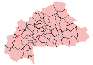
| Pani, Burkina Faso | |
|---|---|
| Country | |
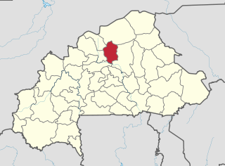
| Region | Boucle du Mouhoun Region |
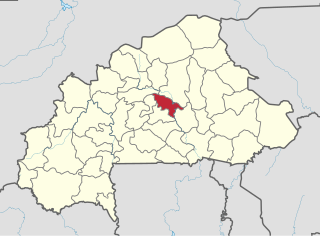
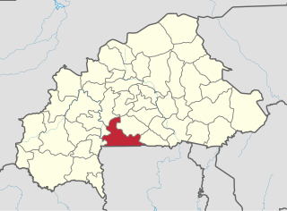
| Province | Balé |
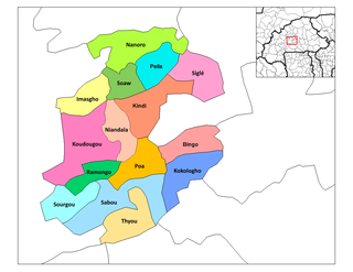
| Department | Pompoï Department |
| Population (1996) | |
| • Total | 158 |
| Time zone | GMT (UTC+0) |
Pani, Burkina Faso is a village in the Pompoï Department of Balé Province in southern Burkina Faso. The village has a total population of 158. [1]

Pompoï is a department or commune of Balé Province in southern Burkina Faso. Its capital lies at the town of Pompoï. According to the 1996 census the department has a total population of 10,613.

Balé is one of the 45 provinces of Burkina Faso, located in its Boucle du Mouhoun Region with Boromo as capital. Its area is 4,595 km2 (1,774 sq mi), and in 2006 had a population of 213,897. The province is known for its Deux Balé Forest, populated by savannah elephant herds. Boromo, the provincial capital, is located on the main road from Ouagadougou to Bobo-Dioulasso. In June 2007, the Canadian mining company, Semafo, open the third gold mine in the country in Mana in the province, with an investment of about $116 million.

Burkina Faso is a landlocked country in West Africa. It covers an area of around 274,200 square kilometres (105,900 sq mi) and is surrounded by six countries: Mali to the north; Niger to the east; Benin to the southeast; Togo and Ghana to the south; and Ivory Coast to the southwest. The July 2018 population estimate by the United Nations was 19,751,651. Burkina Faso is a francophone country, with French as the official language of government and business. Roughly 40% of the population speaks the Mossi language. Formerly called the Republic of Upper Volta (1958–1984), the country was renamed "Burkina Faso" on 4 August 1984 by then-President Thomas Sankara. Its citizens are known as Burkinabé. Its capital is Ouagadougou.