
USS Card (AVG-11/ACV-11/CVE-11/CVHE-11/CVU-11/T-CVU-11/T-AKV-40) was a Bogue-class American escort aircraft carrier. Her hull was laid down on 27 October 1941 as a Type C3-class ship but she was acquired from the Maritime Commission while under construction and was converted into an escort carrier.

Klešice is a small village in the Pardubice Region of the Czech Republic. It has around 300 inhabitants.
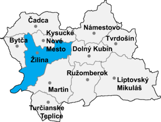
Lutiše is a village and municipality in Žilina District in the Žilina Region of northern Slovakia.
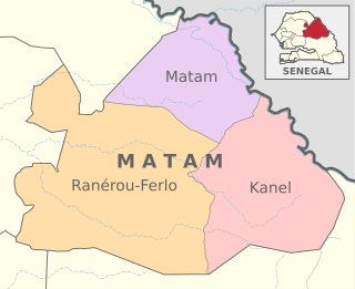
Ranérou Ferlo Department is one of the departments of Senegal, located in the Matam Region of the country.

Nigüelas is a municipality located in the province of Granada, Spain. According to the 2012 census (INE), the town has a population of 1203.
Gerindote is a municipality located in the province of Toledo, Castile-La Mancha, Spain. According to the 2006 census (INE), the municipality has a population of 2179 inhabitants.
Espinosa de Cerrato is a municipality located in the province of Palencia, Castile and León, Spain. According to the 2004 census (INE), the municipality has a population of 225 inhabitants.
Santo Domingo de Silos is a municipality and town located in the province of Burgos, Castile and León, Spain. According to the 2004 census (INE), the municipality has a population of 292 inhabitants. The village is preserved as a conjunto histórico.
Tramaced is a municipality located in the province of Huesca, Aragon, Spain. According to the 2004 census (INE), the municipality has a population of 108 inhabitants.
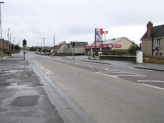
Drumahoe is a village and townland in County Londonderry, Northern Ireland. It lies to the east of Derry. It is home to Institute F.C., an NIFL Championship football club. The busy A6 road from Belfast to Derry passes through the townland. It is situated within Derry and Strabane district.

Siby is a department or commune of Balé Province in southern Burkina Faso. Its capital lies at the town of Siby. According to the 1996 census the department has a total population of 12,089.
Kossoba is a town in the Sanaba Department of Banwa Province in western Burkina Faso. As of 2005 it had a population of 1,975.
Somassi is a village in the Gaongo Department of Bazèga Province in central Burkina Faso. The village has a population of 196.

Vârciorog is a commune in Bihor County, northwestern Romania with a population of 2,304 people. It is composed of four villages: Fâșca (Várfancsika), Surducel (Kisszurdok), Șerghiș (Serges) and Vârciorog.
Kotou, Burkina Faso is a village in the Sidéradougou Department of Comoé Province in south-western Burkina Faso. The village has a population of 587.
Capel Bangor is a small village in Ceredigion, in Wales. Its population is around 600-1000, and it is also approximately five miles from the seaside and university town of Aberystwyth.

Dalnia is a village in the administrative district of Gmina Strzegowo, within Mława County, Masovian Voivodeship, in east-central Poland. It lies approximately 18 kilometres (11 mi) south of Mława and 96 km (60 mi) north-west of Warsaw.
Rydwągi is a village in the administrative district of Gmina Mrągowo, within Mrągowo County, Warmian-Masurian Voivodeship, in northern Poland. It lies approximately 12 kilometres (7 mi) north of Mrągowo and 57 km (35 mi) east of the regional capital Olsztyn.
Doumega is a village and rural commune in Niger.

Gornja Gorevnica is a village in the municipality of Čačak, Serbia. According to the 2011 census, the village had a population of 1,299 people.


