Farm to Market Road 192

Last updated

Texas FM 192.svg

Farm to Market Road 192
Route information
Maintained by TxDOT
Length25.447 mi [1] (40.953 km)
Existed1945–present
Major junctions
South endRanch Rd. along Rio Grande [2]
North endTexas 20.svg SH 20 at McNary
Location
Counties Hudspeth
Highway system
Texas FM 191.svg FM 191 FM 193 Texas FM 193.svg

Farm to Market Road 192 (FM 192) is a Farm to Market Road entirely in Hudspeth County in the U.S. state of Texas maintained by the Texas Department of Transportation (TxDOT). It generally parallels the Rio Grande for its entire length.

Farm-to-market road type of road

In the United States, a farm-to-market road or ranch-to-market road is a state road or county road that connects rural or agricultural areas to market towns. These are better quality roads, usually a highway, that farmers and ranchers use to transport products to market towns or distribution centers.

Hudspeth County, Texas County in the United States

Hudspeth County is a county located in the U.S. state of Texas. As of the 2010 census, the population was 3,476. Its county seat is Sierra Blanca, and the largest community is Fort Hancock. The county is named for Claude Benton Hudspeth, a state senator and United States Representative from El Paso. It is northeast from the Mexico–U.S. border.

Texas U.S. state in the United States

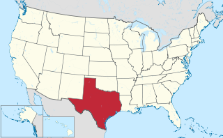
Texas is the second largest state in the United States by both area and population. Geographically located in the South Central region of the country, Texas shares borders with the U.S. states of Louisiana to the east, Arkansas to the northeast, Oklahoma to the north, New Mexico to the west, and the Mexican states of Chihuahua, Coahuila, Nuevo León, and Tamaulipas to the southwest, and has a coastline with the Gulf of Mexico to the southeast.

Contents

Route description

The southern terminus of FM 192 is along the Rio Grande in unincorporated Hudspeth County. From here, the road proceeds northwestward along the river, passing through Fort Quitman and Esperanza before ending at SH 20 at McNary [1] [2] [3] [4]

Fort Quitman Ghost Town in Texas, United States

Fort Quitman was a United States Army installation on the Rio Grande in Texas, south of present-day Sierra Blanca, 20 miles southeast of McNary in southern Hudspeth County. The fort, now a ghost town, was named for Mississippi Governor John A. Quitman, who served as a major general under Zachary Taylor during the Mexican–American War.

Esperanza, Hudspeth County, Texas Unincorporated community in Texas, United States

Esperanza is an unincorporated community in Hudspeth County, Texas, United States. Esperanza is located on Farm to Market Road 192 21 miles (34 km) west of Sierra Blanca.

Texas State Highway 20 highway in Texas

State Highway 20 or SH 20 is a 78.1-mile (125.7 km) highway maintained by the Texas Department of Transportation (TxDOT) that runs from New Mexico State Road 460 at the state line between Texas and New Mexico at Anthony in El Paso County to Interstate 10 at McNary in Hudspeth County. It largely follows a former alignment of U.S. Route 80. The route passes through the city of El Paso as well as suburban and rural farming communities along the Rio Grande. With the exception of a stretch north of central El Paso where the route crosses north of I-10, the route generally runs in a narrow belt between I-10 and the Rio Grande. The route has connections to every international border crossing with Mexico in the El Paso area and has important intersections with US 54, US 62, US 85, and US 180.

History

On June 11, 1945, FM 192 was assigned to a route from McNary on US 80 (present-day SH 20) via Esperanza to the Arroyo Balluco, approximately 12.0 miles. On July 21, 1949, the highway was extended 13.8 miles further down the river to the Cox School, its present southern terminus. [1]

U.S. Route 80 is a U.S. highway that begins in the state of Texas in Dallas at an interchange with I-30. US 80 runs in an east-west direction for most of its length from Dallas to Louisiana. Before the advent of the Interstate Highway System, US 80 through Texas was once a vital link in a major transcontinental highway with the national western terminus being in San Diego, California rather than Dallas. Since 1991, most of US 80 in Texas has been decommissioned in favor of I-10, I-20 and I-30 between the New Mexico state line and its current western terminus.

Major intersections

The entire route is in Hudspeth County.

LocationmikmDestinationsNotes
0.00.0Ranch Road Indian Hot Springs Southern terminus
Texas FM 34.svg FM 34
Texas FM 2217.svg FM 2217
McNary Texas 20.svg SH 20  Fort Hancock Former US 80
1.000 mi = 1.609 km; 1.000 km = 0.621 mi

See also

Related Research Articles

Farm to Market Road 973 is a paved rural road that connects agricultural areas to market towns in Travis and Williamson counties, Texas.

Farm to Market Road 1125 is a farm to market road that connects the farming areas of northern Jack County and southern Montague County with Bowie, Texas.

Farm to Market Road 1954 is a farm to market road in Archer and Clay counties, Texas.

Farm to Market Road 2127 is a farm to market road located in northeastern Jack, far southwestern Montague, and northwestern Wise counties, Texas.

Texas State Highway 315 highway in Texas

State Highway 315 or SH 315 is a state highway in Texas that runs from Mount Enterprise northeast to Carthage.

Farm to Market Road 118 is a 11.392-mile (18.334 km) farm to market road in Hunt County, Texas.

Farm to Market Road 1171 is a farm to market road in Denton County, Texas.

Farm to Market Road 1459 is a farm to market road in Brazoria County, Texas.

Farm to Market Road 1462 is a farm to market road located in Brazoria and Fort Bend counties, Texas.

Farm to Market Road 2917 is a farm to market road in Brazoria County, Texas.

Ranch to Market Road 169, Ranch Road 169, or RM 169 is a Ranch to Market Road in the U.S. state of Texas located entirely within Presidio County and maintained by the Texas Department of Transportation (TxDOT).

FM 2119 is a 40-mile farm to market road in West Texas.

FM 2185 is a 42-mile farm to market road entirely in Culberson County in West Texas.

Ranch to Market Road 1111 is a 47 miles (76 km) long Ranch to Market Road entirely in Hudspeth County in the U.S. state of Texas maintained by the Texas Department of Transportation (TxDOT). It runs generally from south to north.

Farm to Market Road 1437 is a 16-mile Farm to Market Road entirely in Hudspeth County in the U.S. state of Texas. It connects Dell City with US 62 / US 180.

Ranch to Market Road 2317 is a Ranch to Market Road entirely in Hudspeth County in the U.S. state of Texas maintained by the Texas Department of Transportation (TxDOT).

Farm to Market Road 2903 (FM 2903) is a Farm to Market Road in the U.S. state of Texas maintained by the Texas Department of Transportation (TxDOT). The route, located in southwestern Reeves County, begins at the junction of Interstate 10 (I-10) and Business Interstate 10-F northeast of Balmorhea and proceeds to the north ending at I-20 in Toyah. Between its end points, FM 2903 has one highway intersection with FM 3334.

Farm to Market Road 869 is a Farm to Market Road in the U. S. state of Texas maintained by the Texas Department of Transportation (TxDOT). The road, located in central Reeves County, connects State Highway 17 with Interstate 20 (I-20) to the north bypassing the city of Pecos. The road has an intersection with FM 1934.

Farm to Market Road 1450 is a Farm to Market Road in the U.S. state of Texas maintained by the Texas Department of Transportation (TxDOT). The road, located in southeastern Reeves and northern Pecos counties, begins at U.S. Route 285 near Pecos and intersects FM 1776, State Highway 18, and Ranch to Market Road 2593 before terminating at FM 1053. The route number was formerly designated over a road in Freestone County.

Farm to Market Road 1053 (FM 1053) is a Farm to Market Road in the U.S. state of Texas maintained by the Texas Department of Transportation (TxDOT). The road, located in Pecos, Crane, and Ector counties, begins along the concurrent routes of Business Interstate 10-G, U.S. Route 285 (US 285), and U.S. Route 385 (US 385) in the city of Fort Stockton and continues to the north ending at Interstate 20 (I-20) near Penwell. The road passes through the towns of Imperial, where it intersects FM 11, and Tubbs Corner, where it crosses State Highway 329 (SH 329). The road also has major intersections with I-10 / US 67 in Fort Stockton as well as FM 1450 and FM 1233.

References

  1. 1 2 3 Transportation Planning and Programming Division (n.d.). "Farm to Market Road No. 192". Highway Designation Files. Texas Department of Transportation . Retrieved 2011-09-22.
  2. 1 2 Transportation Planning and Programming Division (2012). Texas County Mapbook (PDF) (Map) (2012 ed.). 1:120,000. Texas Department of Transportation. p. 81. OCLC   867856197 . Retrieved 2011-09-22.[ dead link ]
  3. Transportation Planning and Programming Division (2012). Texas County Mapbook (PDF) (Map) (2012 ed.). 1:120,000. Texas Department of Transportation. p. 76. OCLC   867856197 . Retrieved 2011-09-22.[ dead link ]
  4. Transportation Planning and Programming Division (2012). Texas County Mapbook (PDF) (Map) (2012 ed.). 1:120,000. Texas Department of Transportation. p. 77. OCLC   867856197 . Retrieved 2011-09-22.[ dead link ]

Route map:

KML file (edithelp)
    KML is from Wikidata

    Openstreetmap logo.svg Geographic data related to Farm to Market Road 192 at OpenStreetMap

    OpenStreetMap Freely editable world map

    OpenStreetMap (OSM) is a collaborative project to create a free editable map of the world. Rather than the map itself, the data generated by the project is considered its primary output. The creation and growth of OSM has been motivated by restrictions on use or availability of map information across much of the world, and the advent of inexpensive portable satellite navigation devices. OSM is considered a prominent example of volunteered geographic information.