Related Research Articles
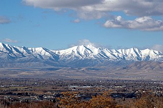
The Oquirrh Mountains is a mountain range that runs north-south for approximately 30 miles (50 km) to form the west side of Utah's Salt Lake Valley, separating it from Tooele Valley. The range runs from northwestern Utah County–central & eastern Tooele County, to the south shore of the Great Salt Lake. The highest elevation is Flat Top Mountain at 10,620 ft. The name Oquirrh was taken from the Goshute word meaning "wood sitting."
The Ohio Range is a mountain range in the Transantarctic Mountains of Antarctica. It is about 48 km (30 mi) long and 16 km (10 mi) wide, extending WSW-ENE from Eldridge Peak to Mirsky Ledge. The range forms the northeast end of the Horlick Mountains and consists primarily of a large snow-topped plateau with steep northern cliffs and several flat-topped ridges and mountains. The highest point is the summit of Mount Schopf.

The Pilot Range is a mountain range straddling the border of Box Elder County, Utah and Elko County, Nevada, United States. Lying 50 miles west of the Great Salt Lake, the range forms part of the north-west border of the Great Salt Lake Desert. The range reaches a maximum elevation of 10,716 feet at the summit of Pilot Peak. Most of the range is public Bureau of Land Management land and thus has no access restrictions. Its principal uses are mining, livestock grazing, and seasonal elk and deer hunting.
The Pequop Mountains are a mountain range located in eastern Elko County, in northeastern Nevada in the western United States. The range runs generally north-south for approximately 51 miles (82 km) The high point of the range is an unnamed peak located at 40°55.46'N and 114°35.38'W.
The Antelope Valley adjacent to the Nevada/Utah state line, and located in southeast Elko County and northeast White Pine County, Nevada is a 70 mi (113 km) long endorheic valley. The valley curves around the Dolly Varden and Kinsley Mountains, and the Antelope Range.
Mollie's Nipple or Molly's Nipple is the name given to as many as seven peaks, at least one butte, at least one well, and some other geological features in Utah. Some sources claim there are eleven geological features in Utah that bear this name. At least some of those names are attributed to John Kitchen – a pioneer of an early exploration of Utah, who named them to commemorate a nipple of his wife Molly.
Deep Creek Valley is a 35-mile (56 km) long valley located in southwest Tooele County at the Utah-Nevada border; the extreme south of the valley is in northwest Juab County. The valley parallels the west flank of the Deep Creek Range, both north-trending. In the north-northeast, its outlet widens into the southwest of the Great Salt Lake Desert region.
Temescal Mountains, also known as the Sierra Temescal, are one of the northernmost mountain ranges of the Peninsular Ranges in western Riverside County, in Southern California in the United States. They extend for approximately 25 mi (40 km) southeast of the Santa Ana River east of the Elsinore Fault Zone to the Temecula Basin and form the western edge of the Perris Block.
Frisco Peak is a summit near the north‑center edge of Beaver County, Utah, United States.
East Deep Creek is a stream tributary to Deep Creek in Tooele County, Utah.
Deep Creek is stream in Tooele County, Utah, USA. It heads in Deep Creek Valley at an elevation of 5,282 feet (1,610 m) at the confluence of West Deep Creek and East Deep Creek at 40°01′51″N113°59′40″W. From there it flows northeast to dissipate in the Great Salt Lake Desert at an elevation of 4,255 feet (1,297 m). At times of high water the stream may flow to Tank Wash 11 miles (18 km) north northeast of Gold Hill.
Tank Wash is a wash in Tooele County, Utah.
Woodman Peak is the lowest summit on the southwestern end of the ridge of 7,794 foot Dutch Mountain in Tooele County, Utah. Woodman Peak lies 3 miles northwest of Gold Hill, Utah. Woodman Peak reaches an elevation of 7,234 feet / 2,205 meters.
Dutch Mountain is a mountain summit in Tooele County, Utah. It reaches an elevation of 7,693 feet / 2,345 meters. Dutch Mountain summit is the northeasternmost of the summits found on the ridge of Dutch Mountain from Woodman Peak, at 7,260 feet, lowest of these summits, on the extreme southwest of the ridge. Dutch Mountain summit lies 4 miles north of Gold Hill, Utah.
White Sage Flat is a flat in Elko County, Nevada and Tooele County, Utah.
Ferber Peak is a summit in Elko County, Nevada. It rises to an elevation of 6,601 feet / 2,012 meters.

Graham Peak is a 7,563-foot elevation (2,305 m) mountain summit located in Tooele County, Utah, United States.
References
Coordinates: 40°15′50″N114°03′55″W / 40.26389°N 114.06528°W
| | This White Pine County, Nevada state location article is a stub. You can help Wikipedia by expanding it. |
| | This article about a location in Utah is a stub. You can help Wikipedia by expanding it. |