Related Research Articles

Wilkes Community College (WCC) is a public community college in Wilkesboro, North Carolina. It is part of the North Carolina Community College System and serves the people of Wilkes, Ashe and Alleghany counties, and beyond. The college is best known as the site of the annual MerleFest music festival.

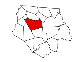
Piney Creek Township is one of seven townships in Alleghany County, North Carolina, United States. The township had a population of 858 according to the 2010 census.

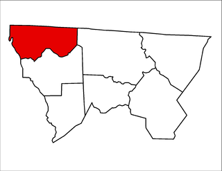
Grassy Creek Township is one of nineteen townships in Ashe County, North Carolina, United States. The township had a population of 455 as of the 2010 census.
Grassy Creek is an unincorporated community in the Grassy Creek Township of Ashe County, North Carolina, United States, near the border with the state of Virginia.

Clifton Township is one of nineteen townships in Ashe County, North Carolina, United States. The township had a population of 1,911 as of the 2010 census.

Elk Township is one of nineteen townships in Ashe County, North Carolina, United States. The township had a population of 613 as of the 2010 census.

Helton Township is one of nineteen townships in Ashe County, North Carolina, United States. The township had a population of 718 as of the 2010 census.
Sturgills is an unincorporated community in the Helton Township of Ashe County, North Carolina, United States, near the border with the state of Virginia.
Scottville is an unincorporated community in both Ashe and Alleghany counties, North Carolina, United States, on U.S. Route 221. It lies at an elevation of 2,854 feet. The ZIP Code for Scottville is 28672.
Parker is an unincorporated community in Ashe County, North Carolina, United States, on North Carolina Highway 88. It lies at an elevation of 3,136 feet.
Helton is an unincorporated community in Helton Township, Ashe County, North Carolina, United States, east of Sturgills. It lies at an elevation of 2,730 feet.
Grayson is an unincorporated community in Ashe County, North Carolina, United States, located northeast of Creston. It lies at an elevation of 3,343 feet.

Creston is an unincorporated community in Ashe County, North Carolina, United States, southwest of Grayson. It lies at an elevation of 2,861 feet. The ZIP Code for Creston is 28615.

Clifton is an unincorporated community in Ashe County, North Carolina, United States, located east of Fig. It lies at an elevation of 2,769 feet.
Chestnut Hill is an unincorporated community in Ashe County, North Carolina, United States, located south of Crumpler. It lies at an elevation of 2,756 feet.
Warrensville is an unincorporated community at the intersection of North Carolina Highways 88 and 194 in Ashe County, North Carolina, United States, east of Comet. It lies at an elevation of 2,707 feet. The ZIP Code for Warrensville is 28693.
Simone Mountain is a summit in Ashe County, North Carolina, in the United States. It has an elevation of 4,304 feet (1,312 m). Simone Mountain is the 574th-highest mountain in the state of North Carolina.
Oval is an unincorporated community in Ashe County, North Carolina, United States.
References
- ↑ U.S. Geological Survey Geographic Names Information System: Fig, North Carolina
- ↑ "Ashe County". Jim Forte Postal History. Retrieved June 8, 2015.
- ↑ LIFE. January 31, 1944. p. 57. ISSN 0024-3019.
