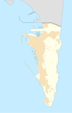
Fig Tree Cave

Last updated

Fig Tree Cave
Coordinates 36°07′25″N5°20′28″W / 36.12363°N 5.34105°W / 36.12363; -5.34105

Fig Tree Cave is a cave in the British Overseas Territory of Gibraltar. It is located on the eastern cliffs of the Rock of Gibraltar, not far from Martin's Cave within the Upper Rock Nature Reserve. [1]

History

According to former Governor of Gibraltar, William Jackson, Simón Susarte a recently exiled goatherd, led 500 Spanish troops up the east side of Gibraltar to reclaim the Rock following the Anglo-Dutch Capture of Gibraltar in 1704. The troops spent the night of 10 November 1704 on the east side of the Rock in this and Martin's Cave before ascending Middle Hill the next day. The invasion ended badly as ammunition ran out and reinforcements failed to arrive. [2] However Martin's Cave was not discovered for another 100 years.

In the 1860s, Captain Frederic Brome, the then Governor of the Military Prison on Windmill Hill, Gibraltar, sought permission from the Governor of Gibraltar to explore Poca Roca Cave, as well as St. Michael's Cave, Martin's Cave and this cave, with the objective of finding archaeological evidence of the past use of these caves. The Governor agreed for ten prisoners to begin work at Martin's Cave. [3]

The entrance to the cave is small widening to a shape 1 metre (3.3 ft) high and roughly 2 metres (6.6 ft) by 3 metres (9.8 ft). A path falls away at 40 degrees but ends in a muddy pit. The wildlife in the cave is very similar to nearby Martin's Cave. The cave is located within the Upper Rock Nature Reserve. [1]

Related Research Articles

<span class="mw-page-title-main">Rock of Gibraltar</span> Monolithic limestone promontory located in the British overseas territory of Gibraltar

The Rock of Gibraltar is a monolithic limestone promontory located in the British territory of Gibraltar, near the southwestern tip of Europe on the Iberian Peninsula, and near the entrance to the Mediterranean. It is 426 m (1,398 ft) high. Most of the Rock's upper area is covered by a nature reserve, which is home to around 300 Barbary macaques. These macaques, as well as a labyrinthine network of tunnels, attract many tourists each year.

<span class="mw-page-title-main">Gorham's Cave</span> Cave and archaeological site in Gibraltar

Gorham's Cave is a sea-level cave in the British overseas territory of Gibraltar. Though not a sea cave, it is often mistaken for one. Considered to be one of the last known habitations of the Neanderthals in Europe, the cave gives its name to the Gorham's Cave complex, which is a combination of four distinct caves of such importance that they are combined into a UNESCO World Heritage Site, the only one in Gibraltar. The three other caves are Vanguard Cave, Hyaena Cave, and Bennett's Cave.

<span class="mw-page-title-main">St. Michael's Cave</span> Caves in Gibraltar

St. Michael's Cave or Old St. Michael's Cave is the name given to a network of limestone caves located within the Upper Rock Nature Reserve in the British Overseas Territory of Gibraltar, at a height of over 300 metres (980 ft) above sea level. According to Alonso Hernández del Portillo, the first historian of Gibraltar, its name is derived from a similar grotto in Monte Gargano near the Sanctuary of Monte Sant'Angelo in Apulia, Italy, where the archangel Michael is said to have appeared.

<span class="mw-page-title-main">Thirteenth siege of Gibraltar</span>

The siege of Gibraltar of 1727 saw Spanish forces besiege the British garrison of Gibraltar as part of the Anglo-Spanish War. Depending on the sources, Spanish troops numbered between 12,000 and 25,000. British defenders were 1,500 at the beginning of the siege, increasing up to about 5,000. After a five-month siege with several unsuccessful and costly assaults, Spanish troops gave up and withdrew. Following the failure the war drew to a close, opening the way for the 1728 Treaty of El Pardo and the Treaty of Seville signed in 1729.

<span class="mw-page-title-main">Simón Susarte</span>

Simón Rodríguez Susarte, commonly known as Simón Susarte, was a Spanish goatherd from Gibraltar, who in 1704 aided a Bourbon Spanish attempt to seize Gibraltar during the Twelfth Siege of Gibraltar by revealing a concealed path to the attackers which led to the top of the Rock of Gibraltar. Susarte then guided a Bourbon contingent along this difficult trail, aiming to surprise the Grand Alliance garrison in hopes of recovering the town.

<span class="mw-page-title-main">History of Gibraltar</span> History of a peninsula on the Iberian coast

The history of Gibraltar, a small peninsula on the southern Iberian coast near the entrance of the Mediterranean Sea, spans over 2,900 years. The peninsula has evolved from a place of reverence in ancient times into "one of the most densely fortified and fought-over places in Europe", as one historian has put it. Gibraltar's location has given it an outsized significance in the history of Europe and its fortified town, established in the Middle Ages, has hosted garrisons that sustained numerous sieges and battles over the centuries.

<span class="mw-page-title-main">Charles V Wall</span> Defensive wall in Gibraltar

The Charles V Wall is a 16th-century defensive curtain wall that forms part of the fortifications of the British Overseas Territory of Gibraltar. Originally called Muralla de San Benito, it was built in 1540 and strengthened in 1552 by Holy Roman Emperor Charles V. The wall remains largely intact and extends from South Bastion, which was once at the water's edge in the harbour, to the top ridge of the Rock of Gibraltar.

<span class="mw-page-title-main">Middle Hill (Gibraltar)</span>

Middle Hill is a hill in the British Overseas Territory of Gibraltar. It is located at the northern end of the Upper Rock Nature Reserve. It figured prominently in the early history of the 1704 siege of Gibraltar by the Spanish and French. The artillery battery at Middle Hill had been constructed by 1727 and was active for more than two centuries. In the mid twentieth century, Middle Hill transitioned to use as an aerial farm for the Ministry of Defence. The radio farm was refurbished in 1958. About 1970, the Princess Caroline's Battery Group of Barbary macaques were moved to Middle Hill, where they were provisioned at a group of derelict buildings that were part of the battery complex. In 2005, much of Middle Hill was transferred from the Ministry of Defence to the Government of Gibraltar, and is now managed by the Gibraltar Ornithological and Natural History Society.

<span class="mw-page-title-main">Martin's Cave</span>

Martin's Cave is a cave in the British Overseas Territory of Gibraltar. It opens on the eastern cliffs of the Rock of Gibraltar, below its summit at O'Hara's Battery. It is an ancient sea cave, though it is now located over 700 feet (210 m) above the shore of the Mediterranean Sea. It is only accessible because Martin's Path was constructed.

<span class="mw-page-title-main">Poca Roca Cave</span> Cave in the British Overseas Territory of Gibraltar

Poca Roca Cave is a cave in the British Overseas Territory of Gibraltar.

Bray's Cave is a limestone cave in the British Overseas Territory of Gibraltar. The cave has yielded several significant human remains and artifacts from the Neolithic and Bronze Ages. Three almost complete skulls were discovered, along with other cranial fragments from multiple individuals. This suggests that people repeatedly returned to the site to reuse it as a burial ground.

<span class="mw-page-title-main">Twelfth siege of Gibraltar</span> Siege of War of the Spanish Succession

The twelfth siege of Gibraltar was fought between September 1704 and May 1705 during the War of the Spanish Succession. It followed the capture in August 1704 of the fortified town of Gibraltar, at the southern tip of Spain, by an Anglo–Dutch naval force led by Sir George Rooke and Prince George of Hesse-Darmstadt. The members of the Grand Alliance, the Holy Roman Empire, England, the Netherlands, Pro-Habsburg Spain, Portugal and Savoy, had allied to prevent the unification of the French and Spanish thrones by supporting the claim of the Habsburg pretender Archduke Charles VI of Austria as Charles III of Spain. They were opposed by the rival claimant, the Bourbon Philip, Duke of Anjou, ruling as Philip V of Spain, and his patron and ally, Louis XIV of France. The war began in northern Europe and was largely contained there until 1703, when Portugal joined the confederate powers. From then, English naval attentions were focused on mounting a campaign in the Mediterranean to distract the French navy and disrupt French and Bourbon Spanish shipping or capture a port for use as a naval base. The capture of Gibraltar was the outcome of that initial stage of the Mediterranean campaign.

<span class="mw-page-title-main">Great Gibraltar Sand Dune</span> Sand dune in Gibraltar

The Great Gibraltar Sand Dune is an ancient sand dune in the British Overseas Territory of Gibraltar. It forms part of the Upper Rock Nature Reserve and dominates the eastern cliffs of the Rock of Gibraltar. It was once used to capture rainwater which was contained in underground tanks within the Rock to satisfy the population's potable water needs.

<span class="mw-page-title-main">Fortifications of Gibraltar</span> Defensive military constructions at the Rock of Gibraltar

The Gibraltar peninsula, located at the far southern end of Iberia, has great strategic importance as a result of its position by the Strait of Gibraltar where the Mediterranean Sea meets the Atlantic Ocean. It has repeatedly been contested between European and North African powers and has endured fourteen sieges since it was first settled in the 11th century. The peninsula's occupants – Moors, Spanish, and British – have built successive layers of fortifications and defences including walls, bastions, casemates, gun batteries, magazines, tunnels and galleries. At their peak in 1865, the fortifications housed around 681 guns mounted in 110 batteries and positions, guarding all land and sea approaches to Gibraltar. The fortifications continued to be in military use until as late as the 1970s and by the time tunnelling ceased in the late 1960s, over 34 miles (55 km) of galleries had been dug in an area of only 2.6 square miles (6.7 km2).

<span class="mw-page-title-main">Tunnels of Gibraltar</span>

The tunnels of Gibraltar were constructed over the course of nearly 200 years, principally by the British Army. Within a land area of only 2.6 square miles (6.7 km2), Gibraltar has around 34 miles (55 km) of tunnels, nearly twice the length of its entire road network. The first tunnels, excavated in the late 18th century, served as communication passages between artillery positions and housed guns within embrasures cut into the North Face of the Rock. More tunnels were constructed in the 19th century to allow easier access to remote areas of Gibraltar and accommodate stores and reservoirs to deliver the water supply of Gibraltar.

<span class="mw-page-title-main">Mediterranean Steps</span>

<span class="mw-page-title-main">Water supply and sanitation in Gibraltar</span>

Water supply and sanitation in Gibraltar have been major concerns for its inhabitants throughout its history, from medieval times to the present day. The climate of Gibraltar is a mild Mediterranean one with warm dry summers and cool wet winters. Since daily records of rainfall began in 1790, annual rainfall has averaged a mean of 838 millimetres (33.0 in) with the highest volumes in December and the lowest in July. However, most of Gibraltar's small land area is occupied by the Rock of Gibraltar, a limestone outcrop that is riddled with caves and crevices. There are no rivers, streams, or large bodies of water on the peninsula, which is connected to Spain via a narrow sandy isthmus.

<span class="mw-page-title-main">Windmill Hill (Gibraltar)</span> A pair of plateaux

Windmill Hill or Windmill Hill Flats is one of a pair of plateaux, known collectively as the Southern Plateaux, at the southern end of the British Overseas Territory of Gibraltar. It is located just to the south of the Rock of Gibraltar, which descends steeply to the plateau. Windmill Hill slopes down gently to the south with a height varying from 120 metres (390 ft) at the north end to 90 metres (300 ft) at the south end. It covers an area of about 19 hectares, though about 6 hectares at the north end is built over. The plateau is ringed to the south and east with a line of cliffs which descend to the second of the Southern Plateaux, Europa Flats, which is itself ringed by sea cliffs. Both plateaux are the product of marine erosion during the Quaternary period and subsequent tectonic uplift. Windmill Hill was originally on the shoreline and its cliffs were cut by the action of waves, before the ground was uplifted and the shoreline moved further out to the edge of what is now Europa Flats.

The footpaths of Gibraltar provide access to key areas of the Upper Rock Nature Reserve, a refuge for hundreds of species of flora and fauna which in some cases are found nowhere else in Europe. The reserve occupies the upper part of the Rock of Gibraltar, a long and narrow mountain that rises to a maximum height of 424 metres (1,391 ft) above sea level, and constitutes around 40 per cent of Gibraltar's total land area. The unusual geology of the Rock of Gibraltar – a limestone peak adjoining a sandstone hinterland – provides a habitat for plants and animals, such as the Gibraltar candytuft and Barbary partridge, which are found nowhere else in mainland Europe. For many years, the Upper Rock was reserved exclusively for military use; it was fenced off for military purposes, but was decommissioned and converted into a nature reserve in 1993.

References

  1. 1 2 Perez, Charles E. (2005). Upper Rock Nature Reserve (PDF). Gibraltar Ornithological & Natural History Society.
  2. Jackson, Sir William G. F. (1990). The rock of the Gibraltarians : a history of Gibraltar (2nd ed.). Grendon: Gibraltar Books. p. 107. ISBN   0948466146.
  3. International Congress of Prehistoric Archaeology (1869). Transactions of the third session which opened at Norwich on the 20th August and closed in London on the 28th August 1868. London: Longmans, Green, and co. pp. 113, 134, 136-. Retrieved 3 January 2013.