Related Research Articles

The Soonwald is a forested, low mountain region, up to 657.5 m above sea level (NN), which forms part of the Hunsrück mountains in the German Central Uplands. It lies within the counties of Rhein-Hunsrück-Kreis and Bad Kreuznach in the state of Rhineland-Palatinate.
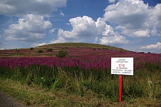
At 927.9 m above sea level (NN) the Dammersfeldkuppe in Bavaria is the second highest mountain after the Wasserkuppe in the Rhön, a low mountain range straddling the states of Bavaria, Hesse and Thuringia in Germany.

The Hohe Schrecke is a ridge of hills in central Germany. It lies mainly within Thuringia; the southeastern part around Lossa belongs to the state of Saxony-Anhalt.
The Hainleite is a Muschelkalk ridge of hills up to 463.2 m above sea level (NN) in northern Thuringia, Germany.
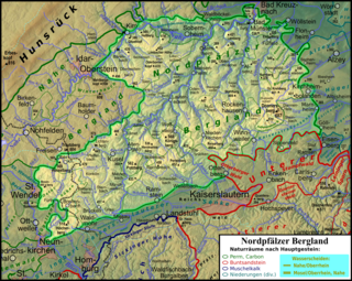
The North Palatine Uplands, sometimes shortened to Palatine Uplands, is a low mountain range and landscape unit in the German state of Rhineland-Palatinate and belongs mainly to the Palatinate region. It is part of the Saar-Nahe Uplands.
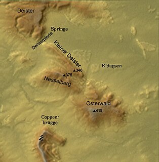
The Nesselberg is a ridge up to 378.2 m above sea level (NN) high in the Calenberg Highland which, together with the Kleiner Deister and the Osterwald, forms a group of three contiguous hill regions in the northwestern part of the Leine Uplands. It lies between Altenhagen I and Coppenbrügge in Lower Saxony, Germany.
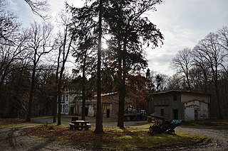
The Hohes Holz is an extended forest area on the western rim of the otherwise open, agriculturally intensively-farmed Magdeburg Börde region in the German state of Saxony-Anhalt.
The Aschentalshalbe is a ridge in the Harz Mountains of Germany that is up to 685 m above sea level (NN). It lies south of the village of Sieber in the unincorporated area of Harz in the district of Göttingen in the state of Lower Saxony.
The Braakberg is a 645.5 metre high mountain in the Harz in central Germany, in the unincorporated area of Harz in the district of Göttingen in the state of Lower Saxony.
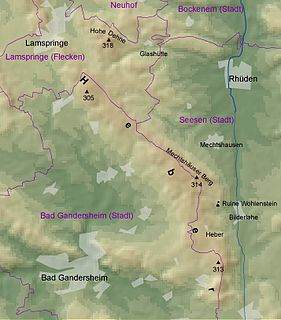
The Heber is a hogback ridge, relatively small in area and up to 313.5 metres high, in the Lower Saxon Hills within the districts of Goslar, Northeim and Hildesheim in the German state of Lower Saxony.

The Moltke Watchtower is an observation tower in the Harz Mountains of central Germany, near the village of Lengefeld, in the county of Mansfeld-Südharz in the state of Saxony-Anhalt.

The Ackeburg, also called the Ackenburg, in the Harz Mountains of central Germany, is the site of a high medieval hill castle, 333.2 m above sea level (NN), in the borough of Falkenstein/Harz in Harz district in the state of Saxony-Anhalt. It was first mentioned in 1216 and was abandoned or destroyed in 1400. There was also a village associated with it, known as Akkeburg.

The Harz/Saxony-Anhalt Nature Park is situated n the districts of Harz and Mansfeld-Südharz in the German state of Saxony-Anhalt. The nature park which lies in the Harz Mountains was founded in 2003 and has an area of around 1,660 km2. It is looked after by the Harz Regional Association.
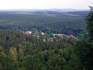
The Barenberg, also called the Bärenberg or Bärenkopf, is a mountain, 695.5 m above sea level (NN), in the Harz Mountains of Germany near the village of Schierke, Harz county, in the state of Saxony-Anhalt.
The Heibeeksköpfe in the Harz Mountains of central Germany are a double summit with a maximum height of 465.2 m above sea level (NN), near Bad Lauterberg in the unincorporated area of Harz in the district of Göttingen in Lower Saxony.

The High Fichtel Mountains, or High Fichtel, form a mountainous and heavily forested range consisting of several mountain chains in the shape of a horseshoe, the Fichtel Mountain Horseshoe (Fichtelgebirgs-Hufeisen), that rings the Selb-Wunsiedel Plateau.
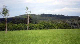
The Asberg is a hill, 441 m above sea level (NHN), on the Rheinwesterwald Volcanic Ridge on the northern edge of the Linz Heights. Until the 1970s it was the site of a basalt quarry.
The Lange Berge are a small range of the German Central Uplands, up to 527.2 m above sea level (NN), which lie mainly in the Bavarian provinces of Upper Franconia with northwestern foothills in Thuringia.

The Buocher Höhe is a wooded region and hill range up to 519.6 m above sea level (NN), around the village of Buoch in the county of Rems-Murr-Kreis in the German state of Baden-Württemberg.

The Harrl is a high, wooded western outlier of the Bückeberg hill ridge in the Weser Uplands of central Germany. It is up to 213 m above sea level (NN) and lies in the Lower Saxon county of Schaumburg.
References
- ↑ Map services of the Federal Agency for Nature Conservation
- ↑ The length of the Finne ridge measured from the Seligenbornsberg near Lossa in the northwest to its extreme southeast foothills at Bad Sulza (Bad Sulza Nord stop on the Peppermint Railway): around 23 km (according to the Map Service of the Federal Office of Nature Conservation Kartendienste des Bundesamtes für Naturschutz)