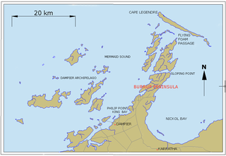
Dampier is a major industrial port in the Pilbara region in the northwest of Western Australia. It is located near the city of Karratha and Port Walcott.
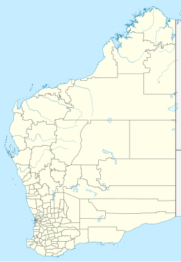
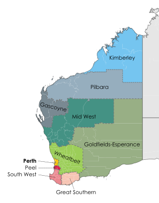
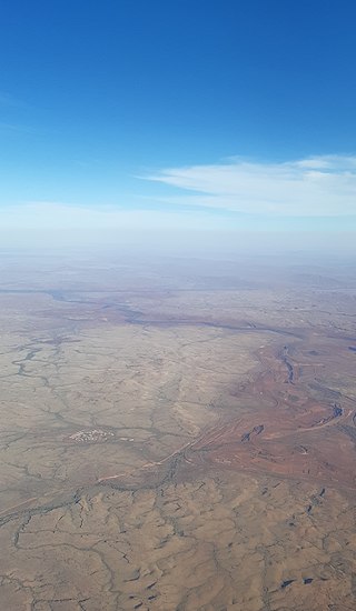
The Pilbara is a large, dry, sparsely populated region in the north of Western Australia. It is known for its Aboriginal people; its ancient landscapes; the prevailing red earth; and its vast mineral deposits, in particular iron ore. It is also a global biodiversity hotspot for subterranean fauna.

Port Hedland is the second largest town in the Pilbara region of Western Australia, with an urban population of 15,298 as of the 2021 census, including the satellite town of South Hedland, 18 kilometres (11 mi) away. It is also the site of the highest tonnage port in Australia.

Goldsworthy is a former mining town in Western Australia, east of Port Hedland and located in the Shire of East Pilbara. It was the first iron ore mine in the Pilbara region of Western Australia.
St Alouarn Islands are a group of islands and rocks south-east of Cape Leeuwin in Western Australia, approximately 11 km south of Augusta in Flinders Bay.

South Hedland or Port Hedland City Centre is a suburb of the Town of Port Hedland, in the Pilbara region in north-western Western Australia. It is the CBD of the Town of Port Hedland and is the Port Hedland Town Centre. It can be reached by the North West Coastal Highway and Great Northern Highway. It contains Hedland Senior High School.
Pilbara newspapers is a selection of newspapers published in the Pilbara region of Western Australia.
Oakajee Port is a proposed deep water port to be built in the Mid West region of Western Australia, 24 kilometres (15 mi) north of Geraldton, to service the region's growing iron ore industry.

The Goldsworthy railway, owned and operated by BHP, is a private rail network in the Pilbara region of Western Australia built to carry iron ore. It is one of two railway lines BHP operates in the Pilbara, the other being the Mount Newman railway.

The Mount Whaleback mine, officially the Newman West operation, is an iron ore mine located in the Pilbara region of Western Australia, six kilometres west of Newman.

Iron ore mining in Western Australia, in the 2018–19 financial year, accounted for 54 percent of the total value of the state's resource production, with a value of A$78.2 billion. The overall value of the minerals and petroleum industry in Western Australia was A$145 billion in 2018–19, a 26 percent increase on the previous financial year.
The Area C mine is an iron ore mine located in the Pilbara region of Western Australia, 92 kilometres west-north-west of Newman.
The Jimblebar mine is an iron ore mine located in the Pilbara region of Western Australia, 41 kilometres east of Newman.
The Yarrie mine is an iron ore mine located in the Pilbara region of Western Australia, 90 kilometres north-east of Marble Bar.
The Yandi mine is an iron ore mine located in the Pilbara region of Western Australia, 90 kilometres north-west of Newman. It should not be confused with Rio Tinto's nearby Yandicoogina mine, which is also sometimes shortened to Yandi.
The Orebodies 18, 23 and 25 mine, part of BHP's Eastern Ridge hub and officially referred to as the Newman East operation, is an iron ore mine located in the Pilbara region of Western Australia, 8 kilometres east of Newman. The mine is majority-owned and operated by BHP, and is one of seven iron ore mines the company operates in the Pilbara. The company also operates two port facilities at Port Hedland, Nelson Point and Finucane Island, and over 1,000 kilometres of rail in the Pilbara.
The Roy Hill mine is an iron ore mine in the Chichester Range in the Pilbara region of Western Australia, located 115 kilometres (71 mi) north of Newman and 277 kilometres (172 mi) south of Port Hedland. With indicated and inferred reserves of more than 2.4 billion tonnes, it is expected to become one of the largest mining projects in Australia. Mining operations will produce 55 million tonnes of iron ore per annum with an operating life of more than 20 years.

Port Hedland is one of the largest iron ore loading ports in the world and the largest in Australia. In 2022, it had the largest bulk cargo throughput in Australia. With the neighboring ports of Port Walcott and Dampier, Port Hedland is one of three major iron ore exporting ports in the Pilbara region of Western Australia.

Seal Island is located near Augusta, Western Australia in the South West region.
The heavy-haul railways in the Pilbara are a series of company-owned railways in the Pilbara region in the north-west of the state of Western Australia. Their routes total 2782 kilometres.