Shanty Point is a small point within Darbel Bay, lying close west of the mouth of Cardell Glacier on the west coast of Graham Land. Photographed by Hunting Aerosurveys Ltd. in 1955–57, and mapped from these photos by the Falkland Islands Dependencies Survey (FIDS). So named by the United Kingdom Antarctic Place-Names Committee (UK-APC) because, when seen from a distance, a large rectangular boulder on the point has the appearance of a small hut with a crooked chimney.

Prospect Point is a headland at the west extremity of Velingrad Peninsula on Graham Coast in Graham Land, four kilometres south of Ferin Head and immediately east of the Fish Islands. Roughly charted by the British Graham Land Expedition (BGLE) under Rymill, 1934–37. Photographed by Hunting Aerosurveys Ltd. in 1956–57. The name was suggested in 1957 by E. P. Arrowsmith, Governor of the Falkland Islands.

Flask Glacier, is a gently-sloping glacier, 25 nautical miles long, flowing east from Bruce Plateau to enter Scar Inlet between Daggoo Peak and Spouter Peak in Graham Land, Antarctica. The lower reaches of this glacier were surveyed and photographed by the Falklands Islands Dependencies Survey (FIDS) in 1947. The entire glacier was photographed by the Falkland Islands and Dependencies Aerial Survey Expedition in 1955–56, and mapped by the FIDS in 1957. It was named by the UK Antarctic Place-names Committee after the third mate on the Pequod in Herman Melville's Moby-Dick; or, The White Whale.

Posadowsky Glacier is a glacier about 9 nautical miles long, flowing north to Posadowsky Bay immediately east of Gaussberg. Posadowsky Bay is an open embayment, located just east of the West Ice Shelf and fronting on the Davis Sea in Kaiser Wilhelm II Land. Kaiser Wilhelm II Land is the part of East Antarctica lying between Cape Penck, at 87°43'E, and Cape Filchner, at 91°54'E, and is claimed by Australia as part of the Australian Antarctic Territory. Other notable geographic features in this area include Drygalski Island, located 45 mi NNE of Cape Filchner in the Davis Sea, and Mirny Station, a Russian scientific research station.

Cardell Glacier is a glacier draining the north slopes of Roygos Ridge and flowing northwestwards into Darbel Bay between Shanty Point and Panther Cliff, on the west coast of Graham Land, Antarctica.
Cumpston Glacier is a small glacier on the east coast of Graham Land, draining between Breitfuss Glacier and Quartermain Glacier into the head of Mill Inlet. It was named by the UK Antarctic Place-Names Committee for J.S. Cumpston, an Australian historian of the Antarctic.

Frigga Peak is a peak, 1,570 metres (5,150 ft) high, which stands at the south side of Anderson Glacier on the east coast of Graham Land, Antarctica. It was charted by the Falkland Islands Dependencies Survey (FIDS) and photographed from the air by the Ronne Antarctic Research Expedition in 1947. The FIDS named it after the Norse goddess Frigga, the "cloud spinner," because clouds were observed to form on the summit of this peak earlier than on any other feature in this vicinity. Nearby Mount Odin was named in association, since Odin is Frigga's wife in Norse mythology.
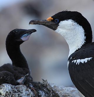
Trout Island is an island just east of Salmon Island in the Fish Islands, off the west coast of Graham Land. Charted by the British Graham Land Expedition (BGLE) under Rymill, 1934–37. So named by the United Kingdom Antarctic Place-Names Committee (UK-APC) in 1959 because it is one of the Fish Islands.
Dodman Island is an island 6.5 km (4.0 mi) long, lying 7.4 km (4.6 mi) south-east of Rabot Island and 18.5 km (11.5 mi) west of Ferin Head, off the west coast of Graham Land, Antarctica. The island was charted and named by the British Graham Land Expedition, 1934–37, under John Rymill.

Cape Evensen is a cape forming the north side of the entrance to Auvert Bay, on the northwest coast of Stresher Peninsula, Graham Land in Antarctica. It was discovered by the French Antarctic Expedition, 1903–05, and named by Jean-Baptiste Charcot for Captain C.J. Evensen of the Hertha, who explored along the west coast of the Antarctic Peninsula in 1893.
Flint Glacier is a glacier which flows south into Whirlwind Inlet between Demorest Glacier and Cape Northrop, on the east coast of Graham Land, Antarctica. It was discovered by Sir Hubert Wilkins on his flight of December 20, 1928, and photographed from the air by the United States Antarctic Service in 1940. It was charted in 1947 by the Falkland Islands Dependencies Survey, who named it for glaciologist Richard F. Flint, professor of geology at Yale University.
Flounder Island is the largest of the Fish Islands at the north side of Holtedahl Bay, off the west coast of Graham Land, Antarctica. It was charted by the British Graham Land Expedition under John Rymill, 1934–37, and so named by the UK Antarctic Place-Names Committee in 1959 after the flounder, in association with the Fish Islands.
The Minnows are a group of small islands and rocks lying east of Flounder Island in the Fish Islands, off the west coast of Graham Land, Antarctica. They were charted by the British Graham Land Expedition under John Rymill, 1934–37, and were so named by the UK Antarctic Place-Names Committee in 1959 because the group lies in the Fish Islands, and "minnow" is a term for a small fish.
Milnes Island is an island lying 2 nautical miles (4 km) north of Woolpack Island, in the Biscoe Islands of Antarctica. It was charted by the British Graham Land Expedition under John Rymill, 1934–37, and was named by the UK Antarctic Place-Names Committee in 1959 for Leading Seaman Arthur R. Milnes, Royal Navy, a member of the British Naval Hydrographic Survey Units in the area in 1956–57 and 1957–58.
Hoek Glacier is a glacier flowing into Dimitrov Cove northeast of Veshka Point on the northwest coast of Velingrad Peninsula on Graham Coast in Graham Land, Antarctica, southward of the Llanquihue Islands. It was charted by the British Graham Land Expedition under John Rymill, 1934–37, and was named by the UK Antarctic Place-Names Committee in 1959 for Henry W. Hoek (1878–1951), a pioneer Swiss ski-mountaineer and author of one of the earliest skiing manuals.

McCall Point is a point on the east side of Lallemand Fjord, 4 nautical miles (7 km) northwest of Salmon Cove on the west coast of Pernik Peninsula, on the Loubet Coast of Graham Land, Antarctica. It was mapped from air photos taken by the Falkland Islands and Dependencies Aerial Survey Expedition, 1956–57, and was named by the UK Antarctic Place-Names Committee after American engineer John G. McCall (1923–54) of the University of Alaska, who first measured the detailed internal movement of a cirque glacier in 1951–52.
Mackerel Island is an island immediately west of Flounder Island in the Fish Islands, off the west coast of Graham Land, Antarctica. It was charted by the British Graham Land Expedition under John Rymill, 1934–37, and was so named by the UK Antarctic Place-Names Committee in 1959 after the mackerel as it is one of the Fish Islands.

Mapple Glacier is a narrow glacier 15 nautical miles (28 km) long, flowing eastward between Arkovna Ridge and Stevrek Ridge in the Aristotle Mountains of Antarctica to enter Sexaginta Prista Bay on the east side of Graham Land. It lies 2 nautical miles (4 km) north of Melville Glacier and is separated from it by a line of small peaks. The glacier was surveyed by the Falkland Islands Dependencies Survey in 1961, and was named by the UK Antarctic Place-Names Committee after Father Mapple, the whalemen's Nantucket priest in Herman Melville's Moby-Dick.
Salmon Island is the westernmost of the Fish Islands, lying off the west coast of Graham Land. Charted by the British Graham Land Expedition (BGLE) under Rymill, 1934–37. So named by the United Kingdom Antarctic Place-Names Committee (UK-APC) in 1959 because it is one of the Fish Islands.

Luke Glacier is a glacier at least 15 nautical miles (28 km) long, flowing northwest into the head of Leroux Bay on the west coast of Graham Land, Antarctica. It is surmounted by Mount Chevreux on the south, Mount Perchot on the southwest and Mount Radotina on the northeast. The glacier was first sighted and roughly surveyed in 1909 by the Fourth French Antarctic Expedition. It was resurveyed in 1935–36 by the British Graham Land Expedition and later named for George Lawson Johnston, 1st Baron Luke of Pavenham, Chairman of Bovril Ltd, who contributed toward the cost of the expedition.
 Kayakers near the Fish Islands
 Seal on an ice floe near the Fish Islands
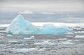 Iceberg near the Fish Islands

