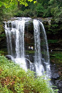
The Cullasaja River is a short river located entirely in Macon County, North Carolina. It is a tributary of the Little Tennessee River, into which it flows near the county seat of Franklin. It originates to the southeast, near Highlands, the county's only other town. It flows from manmade Lake Sequoyah, which is fed by Mirror Lake and other creeks and streams originating on the western side of the Eastern Continental Divide, which runs through the east side of Highlands.

The Uwharrie River () is a 61.84 mi (99.52 km) long river, in the Piedmont region of central North Carolina in the United States. It is a tributary of the Pee Dee River, which flows to the Atlantic Ocean.

The First Broad River is a tributary of the Broad River, about 60 mi (95 km) long in western North Carolina in the United States. Via the Broad and Congaree Rivers, it is part of the watershed of the Santee River, which flows to the Atlantic Ocean.
The Second Broad River is a tributary of the Broad River in western North Carolina in the United States. Via the Broad and Congaree rivers, it is part of the watershed of the Santee River, which flows to the Atlantic Ocean.
The Mitchell River is a tributary of the Yadkin River in northwestern North Carolina in the United States. Via the Yadkin it is part of the watershed of the Pee Dee River, which flows to the Atlantic Ocean. According to the Geographic Names Information System, it has also been known historically as "Mitchells River," "Mitchels River," and "Mountain Creek."
The Roaring River is a tributary of the Yadkin River in northwestern North Carolina in the United States. Via the Yadkin it is part of the watershed of the Pee Dee River, which flows to the Atlantic Ocean. According to the Geographic Names Information System, it has also been known historically as "Roaring Creek." The river's name comes from its headwaters in the Blue Ridge Mountains, where it flows through a series of small waterfalls.
The Reddies River is a tributary of the Yadkin River in northwestern North Carolina in the United States. Via the Yadkin it is part of the watershed of the Pee Dee River, which flows to the Atlantic Ocean. According to the Geographic Names Information System, it has also been known historically as "Reddis River."
The Ararat River is a tributary of the Yadkin River in southwestern Virginia and northwestern North Carolina in the United States. Via the Yadkin it is part of the watershed of the Pee Dee River, which flows to the Atlantic Ocean.
The Mayo River is a tributary of the Dan River, which in turn is a tributary of the Roanoke River. All three rivers flow through the U.S. states of Virginia and North Carolina. It is named for Major William Mayo.
The Flat River is a river in southern Person County, North Carolina and a portion of Durham County, North Carolina.

Abbotts Creek starts in Kernersville, NC in Forsyth County and becomes High Rock Lake near Lexington, NC in Davidson County just north of Hwy 47. The section of High Rock Lake that is officially Abbotts Creeks ends near the Hwy 8 causeway, in Southmont, NC.
Stewarts Creek is a 20.24 mi (32.57 km) long 4th order tributary to the Ararat River in Surry County, North Carolina.
Caddle Creek is a 4.02 mi (6.47 km) long 2nd order tributary to the Ararat River in Surry County, North Carolina.
Gully Creek is a 3.24 mi (5.21 km) long 1st order tributary to the Fisher River in Surry County, North Carolina.
Burris Creek is a 4.14 mi (6.66 km) long 2nd order tributary to the Fisher River in Surry County, North Carolina.
Little Fisher River is a 16.78 mi (27.00 km) long 4th order tributary to the Fisher River in Surry County, North Carolina. This is the only stream of this name in the United States.
Horns Creek is a 1.73 mi (2.78 km) long 2nd order tributary to the Fisher River in Surry County, North Carolina.
Little Beaver Creek is a 4.16 mi (6.69 km) long 2nd order tributary to the Fisher River in Surry County, North Carolina.
Cody Creek is a 6.80 mi (10.94 km) long 2nd order tributary to the Fisher River in Surry County, North Carolina.
Elkin Creek is a 3.91 mi (6.29 km) long 4th order tributary to the Yadkin River in Surry and Wilkes Counties, North Carolina. This is the only stream of this name in the United States.
