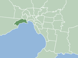
The City of Hobsons Bay is a local government area in Melbourne, Victoria, Australia. It comprises the south-western suburbs between 6 and 20 km from the Melbourne city centre.
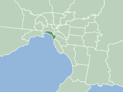
The City of Port Phillip is a local government area of Victoria, Australia on the northern shores of Port Phillip, south of Melbourne's central business district. It has an area of 20.7 km² and had a population of 113,200 in June 2018.
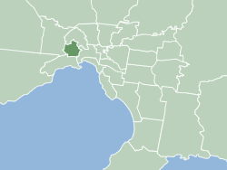
The City of Maribyrnong is a local government area within the metropolitan area of Melbourne, Australia. It comprises the inner western suburbs between 5 and 10 kilometres from Melbourne city centre. It was formed in 1994 from the merger of the City of Footscray and parts of the City of Sunshine. In June 2018, Maribyrnong had a population of 91,387.

The City of Melbourne is a local government area in Victoria, Australia, located in the central city area of Melbourne. In 2018, the city has an area of 37 square kilometres (14 sq mi) and had a population of 169,961. The city's motto is "Vires acquirit eundo" which means "She gathers strength as she goes."

Fitzroy is an inner-city suburb in Melbourne, Victoria, Australia, 3 km (1.9 mi) north-east of Melbourne's Central Business District, located within the City of Yarra local government area. Fitzroy recorded a population of 10,431 at the 2021 census.

Fitzroy North is an inner-city suburb in Melbourne, Victoria, Australia, 4 km (2.5 mi) north-east of Melbourne's Central Business District, located within the Cites of Moreland and Yarra local government areas. Fitzroy North recorded a population of 12,781 at the 2021 census.

Northcote is an inner-city suburb in Melbourne, Victoria, Australia, 7 km (4.3 mi) north-east of Melbourne's Central Business District, located within the City of Darebin local government area. Northcote recorded a population of 25,276 at the 2021 census.

Fitzroy High School is a school catering for Years 7 to 10, located in Falconer Street, Fitzroy, Melbourne, Australia. The school was first opened in 1915, but closed in 1992. After a long community campaign, it re-opened in 2004.

Brunswick Street is a street in inner northern Melbourne, known for cafés, live music venues and alternative fashion shops.

Westgarth is a neighbourhood within the suburb of Northcote, about 4 or 5 km north-east of Melbourne's central business district in Victoria, Australia. It is in the local government area of the City of Darebin. The neighbourhood has a commercial centre, distinct from the main commercial centre of Northcote, located near Westgarth railway station, just north of Clifton Hill. While Westgarth does not have any official borders, it is generally considered to extend from Merri Creek in the west to the boundary of Fairfield in the east.
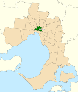
The Division of Melbourne is an Australian electoral division in the State of Victoria, represented since the 2010 election by Adam Bandt, leader of the Australian Greens.

Glen Waverley Secondary College is a non-selective public government school located in Glen Waverley, Victoria, Australia. It is one of the largest secondary schools in Victoria, with 1,979 students and 158 teachers as of 2017. In addition, the college is one of the highest performing state high schools in Victoria, it ranked 59 out of all 530 Victorian high-schools in 2013, based on the Australian Tertiary Admission Rank (ATAR).

Edinburgh Gardens is a large park located in the inner Melbourne suburb of North Fitzroy. It is bounded by Brunswick Street and St Georges Road to the west, the curve of Alfred Crescent to the north and east, and Freeman Street to the south. It was created from a grant of land in March 1862 by Queen Victoria and laid out by Clement Hodgkinson, who designed many of Melbourne's parks and gardens. At approximately 24 hectares in size, the park is large by inner urban standards.

Northcote High School is a co-educational, state secondary school in Northcote, Victoria, Australia. It is situated at the southern end of the City of Darebin, on St Georges Road, Northcote.

The Australian Ballet School is the premier ballet training facility in Australia, located in Melbourne.

The Division of Melbourne Ports was an Australian federal electoral division in the inner south-eastern suburbs of Melbourne, Victoria, Australia. It was located to the south of Melbourne's central business district and covered an area of approximately 40 km2 around the north and north-eastern shores of Port Phillip Bay.

St Georges Road is a main road in the inner northern suburbs of Melbourne, which passes through the suburbs of Fitzroy North, Northcote, Thornbury and Preston.
The Grange P-12 College is a Prep to Year 12 government school located in the outer western suburb of Hoppers Crossing, Melbourne, Australia.

The City of Fitzroy was a local government area located about 2 kilometres (1 mi) northeast of Melbourne, the state capital of Victoria, Australia. The city covered an area of 3.73 square kilometres (1.44 sq mi), making it the smallest municipality by land area in Victoria, and existed from 1858 until 1994.

Education in Victoria, Australia is supervised by the Department of Education and Training (DET), which is part of the State Government and whose role is to 'provide policy and planning advice for the delivery of education'. It acts as advisor to two state ministers, that for Education and for Children and Early Childhood Development.


