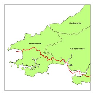
Pembrokeshire is a county in the south-west of Wales. It is bordered by Carmarthenshire to the east, Ceredigion to the northeast, and otherwise by the sea. Haverfordwest is the largest town and administrative headquarters of Pembrokeshire County Council.

Haverfordwest is the county town of Pembrokeshire, Wales, and the most populous urban area in Pembrokeshire with a population of 14,596 in 2011. It is also a community, being the second most populous community in the county, with 12,042 people, after Milford Haven. The suburbs include the former parish of Prendergast, Albert Town and the residential and industrial areas of Withybush.

Saint David's Day, or the Feast of Saint David, is the feast day of Saint David, the patron saint of Wales, and falls on 1 March, the date of Saint David's death in 589 AD.

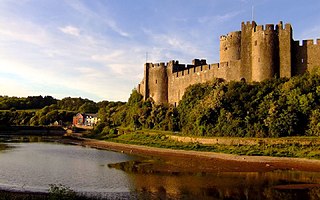
Pembroke is a town and community in Pembrokeshire, Wales, with a population of 7,552. The names of both the town and the county have a common origin; both are derived from the Cantref of Penfro: Pen, 'head' or 'end', and bro, 'region', 'country', 'land', which has been interpreted to mean either 'Land's End' or 'headland'.

The flag of Wales consists of a red dragon passant on a green and white field. As with many heraldic charges, the exact representation of the dragon is not standardised in law.

Little England beyond Wales is a name that has been applied to an area of southern Pembrokeshire and southwestern Carmarthenshire in Wales, which has been English in language and culture for many centuries despite its remoteness from England. Its origins may lie in the Irish, Norse, Norman, Flemish and Saxon settlement that took place in this area more than in other areas of South West Wales. Its northern boundary is known as the Landsker Line.

Tenby is a seaside town and community in the county of Pembrokeshire, Wales. It lies within Carmarthen Bay.

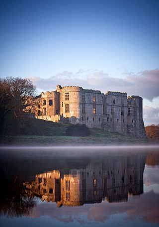
Carew Castle is a castle in the civil parish of Carew in Pembrokeshire, Wales. The Carew family take their name from this site and have owned the castle for more than 900 years. It is leased to the Pembrokeshire Coast National Park for administration purposes. .
Carew is a Welsh and Cornish habitation-type surname; it has also been used as a synonym for the Irish patronymic Ó Corráin. Carey can be a variant.

Henry Tudor School, formerly the Pembroke School, is a co-educational school of 1500 students in Pembroke, Wales.

Cilgerran Castle is a 13th-century ruined castle located in Cilgerran, Pembrokeshire, Wales, near Cardigan. The first castle on the site was thought to have been built by Gerald of Windsor around 1110–1115, and it changed hands several times over the following century between English and Welsh forces. In the hands of William Marshal, 2nd Earl of Pembroke, the construction of the stone castle began after 1223.

Narberth is a town and community in Pembrokeshire, Wales. It was founded around a Welsh court and later became a Norman stronghold on the Landsker Line. It became the headquarters of the hundred of Narberth. It was once a marcher borough. George Owen described it in 1603 as one of nine Pembrokeshire "boroughs in decay".

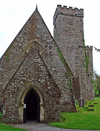
Llawhaden is a village, parish and community in mid-Pembrokeshire, West Wales, historically in the Hundred of Dungleddy. The community of Llawhaden includes the parish of Robeston Wathen, part of Narberth and the hamlet of Gelli, and had a population of 634 in 2001, increasing to 688 at the 2011 Census.

Freshwater East is a village in Pembrokeshire, Wales. The majority of the village is on a cliff overlooking a bay. It is approximately 7 miles (11 km) from Pembroke by road, and 2 miles (3.2 km) south of Lamphey, and is in the parish and community of Lamphey. Freshwater East is the site of a Green Coast Award Beach.

Gerald de Windsor, aliasGerald FitzWalter, was an Cymro-Norman lord who was the first Castellan of Pembroke Castle in Pembrokeshire. Son of the first Norman-French Constable of Windsor Castle, and married to a Welsh Princess daughter of the King of Deheubarth, he was in charge of the Norman forces in south-west Wales. He was also steward and governor for the Norman magnate Arnulf de Montgomery. His descendants were the FitzGerald dynasty, as well as the FitzMaurice, De Barry, and Keating dynasties of Ireland, who were elevated to the Peerage of Ireland in the 14th century. He was also the ancestor of the prominent Carew family, of Moulsford in Berkshire, the owners of Carew Castle in Pembrokeshire and of Mohuns Ottery in Devon.

The Hundred of Dewisland was a hundred in northwest Pembrokeshire, Wales. Formerly the pre-Norman cantref of Pebidiog, it included the city and the peninsula of St Davids. It was named after Dewi Sant, the Welsh name for Saint David.

Emlyn was one of the seven cantrefi of Dyfed, an ancient district of Wales, which became part of Deheubarth in around 950. It consisted of the northern part of Dyfed bordering on the River Teifi. Its southern boundary followed the ridge of the line of hills separating the Teifi valley from the valleys of the Tâf and Tywi.
This article is about the particular significance of the year 1702 to Wales and its people.

Tenby Castle was a fortification standing on a headland separated by an isthmus from the town of Tenby, Pembrokeshire, Wales. The remaining stone structure dates from the 13th century but there are mentions of the castle from as early as 1153. It is a Grade II* listed building.

Pembrokeshire has been called "the cottage garden of Wales", due to its good soil and the beneficial effects of the Gulf Stream, which provide a mild climate and a longer growing season than other parts of the country. The good climate and soil meant that the south of the peninsula was coveted by the Norsemen and Normans because it had "great plentie" of corn and cattle The county has prime agricultural land, much of which is located at about 70m above sea level, while to the north, the Preseli Hills rise to 500m above sea level and form uplands that are made up of heather and bracken, which are used for grazing sheep. Consequently, Pembrokeshire is classed as one of the most fertile counties in Wales, with its 392,300 agricultural acres having 14% of its land classed as of good quality, 67% being classed as medium quality and 19% being classed as poor quality. However, agricultural production is subject to market forces and in the 1890s, as a result of the Panic of 1893, a deep agricultural depression led to the area under cultivation falling by a third. Many labourers and farmers had no option but to emigrate to the New World and many of the large farming estates were sold. World War I brought prosperity again, but by the 1930s, as a result of the Great Depression, there was another agricultural depression which lasted until World War II. During the Post-war period agriculture has benefited from marketing schemes and marketing boards, which have helped in the regulation, marketing and distribution of the county's agricultural production.


