Related Research Articles
The Koyuk River is a river on the Seward Peninsula of western Alaska, in the United States. The river originates in the interior of the peninsula, at the Lost Jim Lava Flow of the Bering Land Bridge National Preserve, where it flows southeast towards the mouth of Norton Bay on Norton Sound. The native village of Koyuk is located at its mouth. The two major tributaries are the Peace and Salmon rivers; other tributaries include Dime and Sweepstakes.

The Fish River is a waterway in the U.S. state of Alaska. The 47-mile-long (76 km) river rises in the Bendeleben Mountains and flows south to Golovnin Lagoon, before emptying into Golovnin Bay, Norton Sound, and the Bering Sea. The basin formed by the Fish River is known for its placer gold deposits, and in particular, the Niukluk River and its tributaries; production from this tributary valley is reported to be more than from any other place in the region. A galena mine existed 40 miles (64 km) from the sea, worked on occasion by a San Francisco corporation with a few hundred tons of ore taken to the city for smelting and refining for silver. Walter Curran Mendenhall found obscure fossils on Fish River at White Mountain.

The Tubutulik River is a waterway in the U.S. state of Alaska. The 25-mile (40 km) long river is situated on the Seward Peninsula. It flows southeastwards to the Kwiniuk Inlet at the northwestern end of Norton Bay, 25 miles (40 km) southwest of Koyuk in the Bering Sea. Its Inuit name was reported as "Tubuktulik" in 1849 by Capt. Mikhail Dmitrievich Tebenkov of the Imperial Russian Navy. Exploration for placer gold occurred in the Council district area where the river valley is located, and in 1898, mining commenced. The production was substantial and ranked second only to that of Nome.

Cape Nome is a headland on the Seward Peninsula in the U.S. state of Alaska. It is situated on the northern shore of Norton Sound, 15 miles (24 km) to the east of Nome also on Norton Sound. It is delimited by the Norton Sound to the south, Hastings Creek on the west, a lagoon on the east and an estuary formed by the Flambeau River and the Eldorado River. From the sea shore, Cape Nome extends inland by about 4 miles (6.4 km), connected by road with Nome.
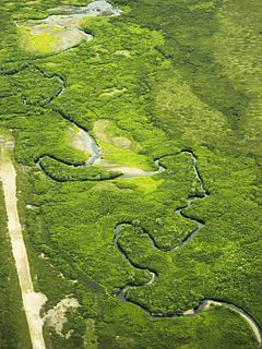
Niukluk River is a waterway in the U.S. state of Alaska. It rises in the Bendeleben Mountains and, after flowing across a broad valley lowland for about 15 miles (24 km), enters a narrower valley, in which it flows for about 20 miles (32 km). Below the mouth of Melsing Creek, the valley broadens out and merges with that of Fish River, to which the Niukluk is tributary. It receives many tributaries, of which the Koksuktapaga, joining it from the south, is the largest. In Niukluk River itself, gold was found at its head, though most abundant below the mouth of American Creek. Just below the mouth of Ophir Creek, a little gold has been rocked out on the bars. The broad gravel flood plain in this part of the basin is said to be auriferous. Below the mouth of Ophir Creek the river has cut a small rock canyon 50 feet (15 m) below an old valley floor, leaving broad benches on either side. These benches are sheeted over by a few feet of gravel.
Solomon River is a waterway in the U.S. state of Alaska, near Nome.
Shovel Creek is a waterway in the U.S. state of Alaska, near Nome. It flows into Solomon River from the west about 4 miles (6 km) from the coast. It heads in a divide about 2 miles (3 km) from the Casadepaga River and flows nearly southward to its junction with Solomon River. Although not a very long stream, it has a large drainage area and carries during ordinary seasons about 500 inches (1,300 cm) of water. It has a gradient of about 100 feet per mile (19 m/km). Through the greater part of its course, it spreads over wide gravel bars. The bed rock of the Shovel Creek basin consists for the most part of limestones and calcareous mica schists. Near the head of the creek, there are some intrusions of greenstone. Mining operations in the Shovel Creek basin occurred at three small tributaries—Mystery, West, and Kasson creeks.
Klokerblok River is a waterway in the U.S. state of Alaska, near Nome. This river rises a few miles from the coast, north of Cape Topkok. It flows in an easterly direction, and joins Fish River in its delta mouth. Front the upper end of Golofnin Sound, a broad depression extends inland, which includes the lower parts of the valleys of Fish, Klokerblok, and Niukluk Rivers. Except for a 50-foot (15 m) gravel terrace on the western side of Golofnin, there are few, if any, terraces or benches in this area.
Eldorado River is a waterway on the Seward Peninsula]] in the U.S. state of Alaska. It is situated 14 miles (23 km) west of Solomon. This river has its source within a few miles of Salmon Lake, from which it is separated by a low divide. It flows southeast through a broad gravel-filled valley for 30 miles (48 km) to Flambeau River before emptying into Safety Sound. Its headwaters reach the limestones of the Nome series and much of its course lies in a chlorite-albite-schist belt. The Eldorado River provides a southerly drainage into the Bering Sea.
Mint River is a waterway in the U.S. state of Alaska. It rises in the York Mountains, north of the source of the Anikovik River. It reaches the ocean through Lopp Lagoon that extends about 20 miles (32 km) to the east from Cape Prince of Wales. In its upper course, it has a narrow valley. Near the sea, it winds for about 10 miles (16 km) across the tundra.
Anikovik River is a waterway in the U.S. state of Alaska. It heads in the York Mountains about 15 miles (24 km) from the Bering Sea. As it leaves the mountains, it has a westerly course, but bending sharply to the south, it flows in that direction to the sea. It has a broad, flat flood plain, from 300 feet (91 m) to 0.5 miles (0.80 km) in width. In the upper part of its course, the river flows in greenstones, but below its bend, to the south, it cuts phyllites and slates. A rough estimate of the fall of river makes it about 15–18 feet (4.6–5.5 m) per mile. Buhner Creek joins Anakovik River about 2 miles (3.2 km) above the mouth of Deer Creek.
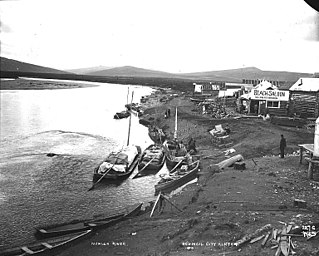
York was a settlement in the U.S. state of Alaska. The mining camp was situated at the mouth of Anikovik River, at Cape York on the Seward Peninsula. It was a distributing point for the region lying to the north. In the spring of 1900, York promised to be a place of importance, but in the early fall, its population had been reduced to about 20-30. The settlement included a number of log cabins and half a dozen substantial frame buildings. During the stormy months of the fall, landing at York was difficult. It was reached overland with horses from Port Clarence. Fifteen miles to the west of York, at Cape Prince of Wales, is the city of Kengegan (Wales), which is the westernmost settlement on the North American continent. York is about 80 miles (130 km) from Nome and 45 miles (72 km) from Port Clarence. The lack of shelter from southerly storms made the landing at York during the fall months often both difficult and dangerous. The post office established here in April 1900 was discontinued in 1902. York's entire population was killed off during the Spanish flu and the disease likely reached Wales from York where it went on to kill 170 of the town's 310 residents.

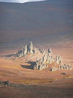
York Mountains are located on the Seward Peninsula in the U.S. state of Alaska. They extend inland from the Bering Sea to the rocky cape of the same name. On the seaward sides, the streams have incised canyon-like valleys. Eastward, the York Mountains are extended by the highlands lying north of Port Clarence. Their western flanks fall off rather abruptly to the York PIateau. The general aspect of these mountains is rugged. The York Mountains and several other highland masses form isolated groups in the northern half of the peninsula, while in the southern half of the peninsula, the Kigluaik, Bendeleben, and Darby mountains form a broken range along a crescentic axis.
Bonanza River is a waterway on the Seward Peninsula in the U.S. state of Alaska. The headwaters lie close to Venetia Creek and the Koksuktapaga River. It flows southeast for 25 miles (40 km) before reaching Safety Sound, as do the Flambeau and Eldorado Rivers, and then through Safety Inlet to Norton Sound. The village of Solomon is approximately 2 miles (3.2 km) away. Across the divide of West Creek, in the Bonanza River drainage, and lying above the West Creek schists, is a series of green chloride schists and sills of greenstone; these chloritic schists are the prevailing rocks of the divide between Eldorado and Bonanza rivers. In its general character, it is similar to the Eldorado River. Also called Bonanza Cal, later maps indicate California Creek to be a principal tributary of Bonanza River. According to Alfred Hulse Brooks, the Eskimo name is Ki-ul-uk.
Fox River is a waterway on the Seward Peninsula in the U.S. state of Alaska. It is 32 miles (51 km) from Solomon. The Fox flows eastward for 18 miles (29 km) before reaching the Fish River from the west.
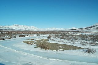
Nome River is a waterway on the Seward Peninsula in the U.S. state of Alaska. It has its source in a narrow valley in the southern margin of the Kigluaik Mountains, 4.5 miles (7.2 km) west of Salmon Lake.
Serpentine River is a waterway on the Seward Peninsula in the U.S. state of Alaska. It debouches at Shishmaref Inlet from the southeast. It was explored and named in 1900 by the prospector Charles McLennan.

Norton Bay is a waterway classified bay located on the northeastern part of the Norton Sound, on the Seward Peninsula in the Nome Census Area of the Bering Sea of the U.S. state of Alaska. The mouths of several rivers debouch at Norton Bay, including the Kwik, Kwiniuk, and Tubutulik rivers.
Cape Mountain is located 3 miles (4.8 km) southeast of Cape Prince of Wales on the Seward Peninsula in the U.S. state of Alaska. It was named by the surveyor, Alfred Hulse Brooks, in 1900.
Bluestone River is a waterway located on the Seward Peninsula in the U.S. state of Alaska. A tributary of the Tuksuk Channel from the south, Bluestone is a north-flowing stream situated 11 miles (18 km) southeast of Teller. It was named in 1900 by Edward Chester Barnard, topographer of the United States Geological Survey.
References

- ↑ Geological Survey (U.S.); Brooks, Alfred Hulse; Collier, Arthur James; Walter Curran Mendenhall; George Burr Richardson (1901). Reconnaissances in the Cape Nome and Norton Bay regions, Alaska, in 1900 (Public domain ed.). Government Printing Office. pp. 54–. Retrieved 29 March 2013.
- ↑ Baker, Marcus (1906). Geographic dictionary of Alaska (Public domain ed.). Government Printing Office. pp. 258–. Retrieved 30 March 2013.
- ↑ ""Flambeau River" in Nome, AK, Gold Prospect" . Retrieved 19 June 2017.
Coordinates: 64°28′12″N164°52′01″W / 64.470°N 164.867°W
| This article about a location in the Nome Census Area, Alaska is a stub. You can help Wikipedia by expanding it. |
| This article related to a river in Alaska is a stub. You can help Wikipedia by expanding it. |