
A flash is a body of water that forms where the land below it has subsided. [1] Whilst these are mostly found in areas where mining has taken place, some can occur naturally.
A flash is a body of water that forms where the land below it has subsided. [1] Whilst these are mostly found in areas where mining has taken place, some can occur naturally.
Flash is recorded as being a dialectal word from Cheshire describing the water-filled depressions caused by subsidence. Some have said that word was used as far back as the 17th century when describing small bodies of water across Cheshire, and was derived from a French word for puddle (today's flaque). [2] Another writer states the "Flash or Plash, deriving from splash, are small puddles left over after a thunderstorm". [3] In William Gresley's book A Glossary of Terms Used in Coal-Mining, Gresley states that the word originated in the salt mining districts of Cheshire and defines it as
A subsidence of the surface due to the working of rock salt and pumping of brine. [4]
Flashes are common in former mining areas such as Cheshire, Lancashire and Yorkshire, where mining has had an effect on the landscape. In Cheshire especially, rock salt and brine extraction beneath the ground has had a profound effect on the surface, creating flashes even some time after the human involvement has ended. [5] A similar result has occurred in certain areas of Worcestershire, such as at Upton Warren, where the flash is a result of brine extraction too. [6]
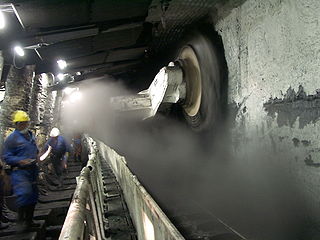
The industrial extraction of salt, or the abstraction of it by natural causes, has a greater effect on the depth of the flashes than those in former coal mining areas. The removal of minerals is usually maintained by use of supports to stop the tunnels or caves collapsing. In coal mining, the normal procedure in the 18th, 19th and early 20th centuries was to install wooden pit props; [7] historically, however, the industrial mining of rock salt used a room and pillar (or pillar and stall) [8] method, with salt pillars supporting the roof. [9] But when water finds its way into such salt workings, it erodes the salt pillars supporting the roof, making the ceiling area collapse and causing subsidence to a greater depth. [10] [note 1]
Brine extraction underneath the River Weaver in Cheshire accounted for the development of several lakes along the course of the river. During the Great subsidence of 1880, [12] flashes appeared across the salt mining district on a daily basis. [13] One of the largest, Witton Flash in Northwich, was listed by Ordnance Survey mapping to have been created between 1890 and 1897, with a measurement of the surface water dated also. This was to indicate that the water had not finished filling the void, and the ground beneath was still in the process of settling. [14] Along the same watercourse just upstream is Winsford, where the river filled three voids now known as the Top, Middle and Bottom Flashes. [15] During the late 19th and early 20th century, the chemical companies mining the salt dumped waste chemicals in the flashes. [16]
Brine and salt extraction in the Davenham area of Cheshire has also led to flashes being created on the Trent and Mersey Canal. [17] One of the flashes here (Billinge Green Flash) has been turned into a marina. [18]
Coal extraction in Lancashire has resulted in flashes occurring in and around Leigh such as Pennington Flash Country Park, which now covers over 70 acres (28 ha) with the park being over 200 acres (80 ha). [19] Similarly, in Yorkshire, Sprotborough Flash is the result of magnesian limestone extraction. The flash was created around 1900, but in 1990, the Environment Agency turned the flash into an overflow lake for the River Don when it was under flood conditions. [20] Several other flashes have been created or are created when the River Don is in spate. [21]
Other flashes caused by mining subsidence are at Fairburn Ings along the River Aire. [22] Previously, the area around Fairburn had been a wetland in medieval times, but was drained to provide agricultural land. The name ing itself means wet field, and alludes to its previous habitat before human intervention. [23] Another flash in Yorkshire is at Catcliffe, which filled when sub-surface mining caused the land to drop and get filled by water from the River Rother. [24] [note 2]
Several flashes occur in Hellifield in North Yorkshire, but these are field ponds, which are the result of low-lying land filling with water. The flashes at Hellifield are known for attracting a large variety of migratory wildfowl. [26] [27]

Fairburn Ings Nature Reserve is a protected area in West Yorkshire, England, noted for its avian biodiversity. The reserve has recorded around 280 bird species, remarkable for an inland site in the United Kingdom. This is explained by the site being on migration routes as well as the diversity of habitats.

The River Dearne South Yorkshire, England flows roughly east for more than 30 kilometres (19 mi), from its source just inside West Yorkshire. It flows through Denby Dale, Clayton West, Darton, Barnsley, Darfield, Wath upon Dearne, Bolton on Dearne, Adwick upon Dearne and Mexborough to its confluence with the River Don at Denaby Main. Its main tributary is the River Dove, which joins it at Darfield. The river was one of those affected by the 2007 United Kingdom floods.

Northwich is a market and port town and civil parish in the unitary authority of Cheshire West and Chester in the ceremonial county of Cheshire, England. It lies in the heart of the Cheshire Plain, at the confluence of the rivers Weaver and Dane. The town is about 18 miles (29 km) east of Chester, 15 miles (24 km) south of Warrington, and 19 miles (31 km) south of Manchester.

Salt, also referred to as table salt or by its chemical formula NaCl, is an ionic compound made of sodium and chloride ions. All life depends on its chemical properties to survive. It has been used by humans for thousands of years, from food preservation to seasoning. Salt's ability to preserve food was a founding contributor to the development of civilization. It helped eliminate dependence on seasonal availability of food, and made it possible to transport food over large distances. However, salt was often difficult to obtain, so it was a highly valued trade item, and was considered a form of currency by many societies, including Rome. According to Pliny the Elder, Roman soldiers were paid in salt, from which the word salary is derived, although this is disputed by historians. Many salt roads, such as the Via Salaria in Italy, had been established by the Bronze Age.
Winsford is a town and civil parish in the unitary authority of Cheshire West and Chester and the ceremonial county of Cheshire, England, on the River Weaver south of Northwich and west of Middlewich. It grew around the salt mining industry after the river was canalised in the 18th century, allowing freight to be conveyed northwards to the Port of Runcorn on the River Mersey. The town of Winsford has an estimated population of 35,500 in 2024.
Longwall mining is a form of underground coal mining where a long wall of coal is mined in a single slice. The section of rock that is being mined, known as the longwall panel, is typically 3–4 km (1.9–2.5 mi) long, but can be up to 7.5 km (4.7 mi) long and 250–400 m (820–1,310 ft) wide.
Middlewich, a town in northwest England, lies on the confluence of three rivers – the Dane, the Croco and the Wheelock. Most importantly for the history of salt making, it also lies on the site of a prehistoric brine spring.

Moulton is a civil parish and village in Cheshire, England, 3 miles (4.8 km) south of Northwich and 3 miles (4.8 km) north of Winsford.
The geology of Cheshire in England consists mainly of Triassic sandstones and mudstones. To the north west of Cheshire, these rocks are heavily faulted and the underlying Carboniferous Coal Measures are thrown up. Around the areas of Poynton and Macclesfield, the coal is close to the surface and was easily mined. Below the Coal Measures is the Millstone Grit, which appears towards the Derbyshire border on the flanks of the Peak District dome.

Cheshire is a county in North West England. Rock salt was laid down in this region some 220 million years ago, during the Triassic period. Seawater moved inland from an open sea, creating a chain of shallow salt marshes across what is today the Cheshire Basin. As the marshes evaporated, deep deposits of rock salt were formed.

Open-pan salt making is a method of salt production wherein salt is extracted from brine using open pans.
Room and pillar or pillar and stall is a variant of breast stoping. It is a mining system in which the mined material is extracted across a horizontal plane, creating horizontal arrays of rooms and pillars. To do this, "rooms" of ore are dug out while "pillars" of untouched material are left to support the roof – overburden. Calculating the size, shape, and position of pillars is a complicated procedure, and an area of active research. The technique is usually used for relatively flat-lying deposits, such as those that follow a particular stratum. Room and pillar mining can be advantageous because it reduces the risk of surface subsidence compared to other underground mining techniques. It is also advantageous because it can be mechanized, and is relatively simple. However, because significant portions of ore may have to be left behind, recovery and profits can be low. Room and pillar mining was one of the earliest methods used, although with significantly more manpower.
Warmingham is a village and civil parish in the unitary authority of Cheshire East and ceremonial county of Cheshire, England, on the River Wheelock, 3.25 miles (5.23 km) north of Crewe, 3.25 miles (5.23 km) south of Middlewich and 3.25 miles (5.23 km) miles west of Sandbach. The parish also includes the small settlement of Lane Ends, with a total population of just under 250. Nearby villages include Minshull Vernon, Moston and Wimboldsley.

The River Don Navigation was the result of early efforts to make the River Don in South Yorkshire, England, navigable between Fishlake and Sheffield. The Dutch engineer Cornelius Vermuyden had re-routed the mouth of the river in 1626, to improve drainage, and the new works included provision for navigation, but the scheme did not solve the problem of flooding, and the Dutch River was cut in 1635 to link the new channel to Goole. The first Act of Parliament to improve navigation on the river was obtained in 1726, by a group of Cutlers based in Sheffield; the Corporation of Doncaster obtained an Act in the following year for improvements to the lower river. Locks and lock cuts were built and by 1751 the river was navigable to Tinsley.
The history of Northwich can be traced back to the Roman period. The area around Northwich has been exploited for its salt pans since this time. The town has been severely affected by salt mining with subsidence historically being a large issue. A programme of mine stabilisation has recently been undertaken.

The Catcliffe Glass Cone is a glass cone in the village of Catcliffe in South Yorkshire, England. It is the oldest surviving structure of its type in Western Europe, and it is a Grade I listed building and Scheduled Ancient Monument. Only three other glass cones survive in the United Kingdom; at Lemington, Wordsley and Alloa.

Mining in the United Kingdom produces a wide variety of fossil fuels, metals, and industrial minerals due to its complex geology. In 2013, there were over 2,000 active mines, quarries, and offshore drilling sites on the continental land mass of the United Kingdom producing £34bn of minerals and employing 36,000 people.

The New Cheshire Salt Works Ltd was a salt manufacturer formerly located in Wincham, north east of Northwich in Cheshire, UK. Run by the Stubbs family until its acquisition by British Salt, it operated between around 1923 and 2006. The company itself continues to exist as a subsidiary of British Salt. It produced white or brine salt from naturally occurring underground brine using natural or wild pumping. The salt was extracted by vacuum evaporation and was of a high quality. It was used for human consumption under the brandname "Selva" and in the pharmaceutical industry; New Cheshire was the only British company to supply salt for pharmaceutical use.

Sprotbrough Flash is a nature reserve south of Sprotbrough near Doncaster, South Yorkshire, on the north bank of the River Don. It is named after its main feature, a long, water-filled depression parallel to the river. The reserve is managed by the Yorkshire Wildlife Trust. It overlaps with Sprotbrough Gorge, a Site of Special Scientific Interest. The size of the protected area is 28 hectares. The Trans Pennine Trail passes through the area.

The Don Gorge is the valley of the River Don to the west of Doncaster, south of the village of Sprotbrough. The gorge is known as a 'green corridor'.