Flat River (South Branch Pawtuxet River)

Last updated

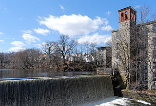
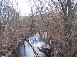
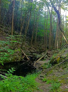
The Flat River is a river in the U.S. state of Rhode Island. It flows approximately 8.2 miles (13.2 km). [1] There are no dams along the river's length.

River Natural flowing watercourse

A river is a natural flowing watercourse, usually freshwater, flowing towards an ocean, sea, lake or another river. In some cases a river flows into the ground and becomes dry at the end of its course without reaching another body of water. Small rivers can be referred to using names such as stream, creek, brook, rivulet, and rill. There are no official definitions for the generic term river as applied to geographic features, although in some countries or communities a stream is defined by its size. Many names for small rivers are specific to geographic location; examples are "run" in some parts of the United States, "burn" in Scotland and northeast England, and "beck" in northern England. Sometimes a river is defined as being larger than a creek, but not always: the language is vague.

United States Federal republic in North America

The United States of America (USA), commonly known as the United States or America, is a country composed of 50 states, a federal district, five major self-governing territories, and various possessions. At 3.8 million square miles, the United States is the world's third or fourth largest country by total area and is slightly smaller than the entire continent of Europe's 3.9 million square miles. With a population of over 327 million people, the U.S. is the third most populous country. The capital is Washington, D.C., and the largest city by population is New York City. Forty-eight states and the capital's federal district are contiguous in North America between Canada and Mexico. The State of Alaska is in the northwest corner of North America, bordered by Canada to the east and across the Bering Strait from Russia to the west. The State of Hawaii is an archipelago in the mid-Pacific Ocean. The U.S. territories are scattered about the Pacific Ocean and the Caribbean Sea, stretching across nine official time zones. The extremely diverse geography, climate, and wildlife of the United States make it one of the world's 17 megadiverse countries.

Rhode Island State of the United States of America

Rhode Island, officially the State of Rhode Island and Providence Plantations, is a state in the New England region of the United States. It is the smallest state in area, the seventh least populous, and the second most densely populated, but it has the longest official name of any state. Rhode Island is bordered by Connecticut to the west, Massachusetts to the north and east, and the Atlantic Ocean to the south via Rhode Island Sound and Block Island Sound. It also shares a small maritime border with New York. Providence is the state capital and most populous city in Rhode Island.

Contents

Course

The river is formed in Coventry by the confluence of Sawmill and Pine Swamp brooks. The river flows east to converge with the Big River to form the South Branch Pawtuxet River in the area now flooded by the Flat River Reservoir.

Coventry, Rhode Island Town in Rhode Island, United States

Coventry is a town in Kent County, Rhode Island, United States. The population was 35,014 at the 2010 census.

The Big River is a river in the U.S. state of Rhode Island. It flows 6.8 miles (10.9 km). There are no dams along the river's length.

South Branch Pawtuxet River river in the United States of America

The South Branch Pawtuxet River is a river in the U.S. state of Rhode Island. It flows approximately 9.8 miles (15.8 km). There are 11 dams along the river's length.

Crossings

Below is a list of all crossings over the Flat River. The list starts at the headwaters and goes downstream.

Tributaries

Above Flat River Reservoir, the tributaries of the Flat River include: Turkey Meadow Brook, Negro Sawmill Brook, Pine Swamp Brook, Whaley Brook, and McCuster Brook, as well as various other unnamed streams.

See also

The Flat River is a river in the U.S. state of Rhode Island. It flows approximately 5 km (3 mi). There are no dams along the river's length.

Related Research Articles

Woonasquatucket River river in the United States of America

The Woonasquatucket River is a river in the U.S. state of Rhode Island. It flows approximately 15.8 miles (25.4 km) and drains a watershed of 130 km2 (50 sq mi).

West River (Rhode Island)

The West River is a river in the U.S. state of Rhode Island. It flows approximately 7.6 miles (12.2 km) and is the only named tributary of the Moshassuck River. It has a history of providing water to textile mills during the Industrial Revolution as evidenced by the 7 dams along the river's length.

Kickamuit River river in the United States of America

The Kickamuit River is a river in the U.S. states of Massachusetts and Rhode Island flowing approximately 7.9 miles (12.7 km).

Chockalog River river in the United States of America

The Chockalog River is a river in the U.S. states of Massachusetts and Rhode Island. It flows approximately 4 km (2 mi). Its name is said to mean "fox place".

Wood River (Pawcatuck River tributary) river in United States of America

The Wood River is a river in the U.S. states of Connecticut and Rhode Island. It flows approximately 25 miles (40 km) and is a major tributary of the Pawcatuck River. There are 8 dams along the river's length.

The Stillwater River is a river in the U.S. state of Rhode Island. It flows approximately 6.1 miles (9.8 km). There are four dams along the river's length.

The Sevenmile River or Seven Mile River is a river in the U.S. states of Massachusetts and Rhode Island. It flows approximately 9.8 miles (15.8 km).

The Queen River is a river in the U.S. state of Rhode Island. It flows approximately 10.7 miles (17.2 km). There is one dam along the river's length.

The Ponaganset River is a river in the U.S. state of Rhode Island. It flows approximately 12.5 miles (20.1 km). There are three dams along the river's length.

Peters River river in the United States of America

The Peters River is a river in the U.S. states of Massachusetts and Rhode Island. It flows 7.0 miles (11.3 km).

The Nooseneck River is a river in the U.S. state of Rhode Island. It flows approximately 5.5 miles (8.9 km). There are three dams along the river's length.

The Moswansicut River is a river in the U.S. state of Rhode Island. It flows approximately 6.2 miles (10.0 km), including its portion within the Scituate Reservoir. There are two dams along the river's length.

The Mishnock River is a river in the U.S. state of Rhode Island. It flows 3.1 miles (5.0 km). There are two dams along the river's length.

The Mill River is a river in the U.S. states of Massachusetts and Rhode Island. It flows approximately 17.1 miles (27.5 km).

Green Fall River river in the United States of America

The Green Fall River is a river in the U.S. states of Connecticut and Rhode Island. It flows approximately 13 km (8 mi).

The Chepachet River is a river in the U.S. state of Rhode Island. It flows 5.2 miles (8.4 km). There are eight dams along the river's length.

Abbott Run is a de facto river in the U.S. state of Massachusetts and Rhode Island. It flows approximately 10 miles (16 km).

References

  1. U.S. Geological Survey. National Hydrography Dataset high-resolution flowline data. The National Map Archived 2012-04-05 at WebCite , accessed April 1, 2011