
Dyfed is a preserved county in southwestern Wales. It is a mostly rural area with a coastline on the Irish Sea and the Bristol Channel.
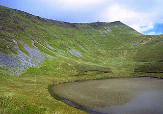
The Berwyn range is an isolated and sparsely populated area of moorland in the northeast of Wales, roughly bounded by Llangollen in the northeast, Corwen in the northwest, Bala in the southwest, and Oswestry in the southeast.
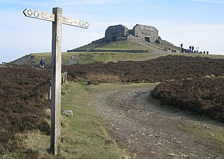
Moel Famau is the highest hill in the Clwydian Range and the highest point of the county of Flintshire in Wales. It lies on the boundary between Denbighshire and Flintshire. The hill, which also gives its name to the Moel Famau country park, has been classed as an Area of Outstanding Natural Beauty since 1985. It is also surrounded by several well-preserved Iron Age hill forts. It is also the fourth-highest peak in the extended AONB of the Clwydian Range and Dee Valley.
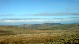
The Preseli Mountains, also known as the Preseli Hills, or just the Preselis, is a range of hills in western Wales, mostly within the Pembrokeshire Coast National Park and entirely within the county of Pembrokeshire.

Mynachlog-ddu is a village, parish and community in the Preseli Hills, Pembrokeshire, Wales. The community includes the parish of Llangolman.
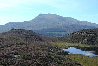
Moel Siabod is a mountain in Snowdonia, Wales, which sits isolated above the village of Dolwyddelan. At 872 metres (2,861 ft), it is the highest peak in the Moelwynion mountain range. The UK National Mountain Centre, Plas-y-Brenin, is located at the foot of Moel Siabod. From the top of the mountain, it is reputedly possible to see 13 of the 14 highest peaks in Wales on a clear day without turning one's head.

Cadair Berwyn, Cader Berwyn or Craig Uchaf is a mountain summit in north-east Wales with a height of 832 metres (2,730 ft) above sea level. It is the highest point in the Berwyn range, the highest in North East Wales and the highest significant summit in Wales outside the National Parks. Cadair Berwyn and Foel Cedig to the west are the two Marilyns that form the Berwyn range. The undulating plateau of the range also includes a large number of other summits above 2,000 feet (610 m), including satellite summits of Cadair Berwyn and many which are classed as Nuttalls.
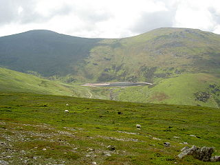
Foel-fras is a mountain in the Carneddau range, about 10 km east of Bethesda in North Wales. It lies on the border between the counties of Gwynedd and Conwy. With a summit elevation of 944 metres, it is officially the eleventh-highest summit in Wales. Foel-fras is located at the northern end of the main ridge of the Carneddau, between Drum to the north and Foel Grach to the south with the subsidiary summit of Garnedd Uchaf between it and Foel Grach. Due south and 400 m below lies the reservoir of Llyn Dulyn, while the smaller reservoir of Llyn Anafon lies to the north.

Foel Fenlli or Moel Fenlli is a hill in Denbighshire, North Wales. With a summit at an elevation of 511 metres (1,677 ft), it is the second highest peak of the Clwydian Range.

Moel Eilio is a mountain in Snowdonia, North Wales, that is situated approximately 3 miles north-west of Snowdon itself. It has two subsidiary tops, Foel Gron and Foel Goch (Eilio). The average annual temperature of the mountain is around 6 °C (43 °F). During the winter season, some significant accumulations of snowfall is known to take place on Moel Eilio, due to its relatively flat, grassy slopes.

Fan Brycheiniog is the highest peak at a height of 802.5 metres (2,633 ft) in the Black Mountain region of the Brecon Beacons National Park in southern Wales. There is a trig point at the peak and on the edge of the escarpment, and nearby, a stone shelter with an inner seat. It lies just inside the historic county of Brecknockshire which gives the mountain its Welsh name. A subsidiary top, less than a kilometre from the summit along the ridge to the northwest, is the highest point of the neighbouring county of Carmarthenshire. Fan Brycheiniog is also within the Fforest Fawr Geopark designated in 2005 in recognition of the area's geological heritage. The views of the moorland and open country to the north are spectacular when the weather is clear, and reveals the isolation of the range, especially when compared with the more popular Pen y Fan range to the east.
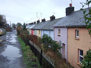
Rosebush is a small village in the community of Maenclochog, Pembrokeshire, southwest Wales, UK. It lies in the southern slopes of the Preseli Hills, about 1 mile (1.6 km) north west of the village of Maenclochog. Slate was extensively quarried nearby, and was exported by the Narberth Road and Maenclochog Railway, which was later extended towards Fishguard. Today, Rosebush is a centre for exploring the Preseli Hills. Rosebush is the highest village in Pembrokeshire, at 264m above sea level.
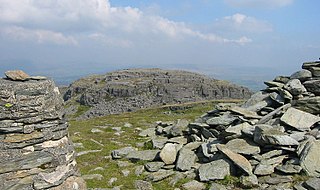
Foel Penolau is a mountain close to Moel Ysgyfarnogod in Snowdonia, North Wales and is the northernmost summit of the Rhinogydd, and overlooks Llyn Trawsfynydd. From the summit it is possible to see the towns of Porthmadog and Blaenau Ffestiniog. As a result of a revised survey of its topographical prominence, Foel Penolau gained Hewitt and Simms status in December 2018 when its prominence was measured to be above 30 m (98 ft).

The River Gwaun is a river in Pembrokeshire, West Wales, which flows west to the sea at Fishguard.

Foel y Geifr is a subsidiary summit of Esgeiriau Gwynion, and included in a group of hills known as the Hirnantau. These hills rise from the south east shores of Bala Lake. Confusion arises when trying to establish to which mountain range these belong to. Since, Foel y Geifr forms part of the Hirnant horseshoe, many consider it to be a Berwyn peak. However, geographically it belongs to the Aran Fawddwy group, its parent peak being Esgeiriau Gwynion. It is the eastern outpost of the Arans.

Foel Fraith is a hill in the Black Mountain in the county of Carmarthenshire, southwest Wales. It lies within the Brecon Beacons National Park and Fforest Fawr Geopark. Its plateau-like summit attains a height of 602 metres (1,975 ft) above sea level. To the north the subsidiary summit of Cefn y Cylchau reaches 556 feet (169 m), and to the southeast is the subsidiary summit of Carn Fadog or Cefn Carn Fadog, which reaches a height of 512 metres (1,680 ft).
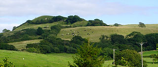
A Hardy is any one of a category of mountain, hill or high point in the United Kingdom, the Channel Islands and Isle of Man which is the highest point in either a hill range, an island over 1,000 acres (400 ha), or a top-tier administrative area.
Voyle is both a given name and a surname. The origin of the name is from the Welsh language. It was originally moel, meaning bald, but became mutated It can refer to a person or a land feature such as the poorly vegetated top of a round hill. The name is often mis-spelt on census returns and the like, as it became anglicised. As the Welsh letter f is sounded as v then the name became spelled as the following variants;

Foel Drygarn is an Iron Age hillfort, within which are three Bronze Age burial cairns. The site is about 1.5 miles (2 km) west of the village of Crymych in Pembrokeshire, Wales. It is a scheduled monument.


