This article needs additional citations for verification . (June 2015) (Learn how and when to remove this template message) |
Fort Canning Reservoir | |
---|---|
Fort Canning Service Reservoir | |
Location | Fort Canning Singapore |
Coordinates | Coordinates: 1°17′37″N103°50′48″E / 1.29361°N 103.84667°E |
Type | Reservoir |
Basin countries | Singapore |
Built | 1927 |
Surface area | 27,875.5 square metres (300,049 sq ft) |
The Fort Canning Service Reservoir (Chinese: 福康宁备水池) is an underground reservoir located on top of Fort Canning Hill [1] in Singapore. Construction of the reservoir began on 1 April 1927 on the former site of a large artillery barracks and parade ground to help supplement the large impounding reservoirs. The reservoir was constructed in two sections, the southern section was ready for water storage by 1 August 1928, and the final work completed by the middle of January 1929. [2] Water is pumped from the large reservoirs into the service reservoirs, thus enabling water to flow down the hill into houses.
Fort Canning Hill, formerly Government Hill, Singapore Hill and Bukit Larangan, is a small hill about 48 metres (157 ft) high in the southeast portion of the island city-state of Singapore, within the Central Area that forms Singapore's central business district. Although small in physical size, it has a long history intertwined with that of the city-state due to its location as the highest elevation within walking distance to the city's civic district within the Downtown Core. It is also a popular venue for music shows and concerts.
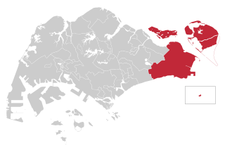
Singapore, officially the Republic of Singapore, is an island city-state in Southeast Asia. It lies one degree north of the equator, at the southern tip of the Malay Peninsula, with Indonesia's Riau Islands to the south and Peninsular Malaysia to the north. Singapore's territory consists of one main island along with 62 other islets. Since independence, extensive land reclamation has increased its total size by 23%. The country is known for its transition from a developing to a developed one in a single generation under the leadership of its founder Lee Kuan Yew.
Earlier service reservoirs were built on Mount Emily (1878), Pearl's Hill (1903), and Bukit Timah Hill. The size of the Fort Canning Reservoir is 27,875.5 m2.[ citation needed ]
Pearl's Hill, briefly Mount Stamford, is a small hill in Singapore. Located in the vicinity of Chinatown, it is one of the few surviving hills in the city area. Pearl's Hill is well known for once being the site of the former multiple notable institutional buildings such as the Tan Tock Seng Hospital, Seaman's hospital and the Pearl's Hill Prison. The Pearl's Hill Prison is located there because of the close proximity to Sepoy Lines as it was thought to provide protection and security for the prison.
Bukit Timah Hill is a hill located within the planning area of Bukit Panjang in Singapore. The hill stands at an altitude of 163.63 metres (537 ft.) above ground level and 178 metres above sea level, making it the highest natural point in the city-state.
A spring used to exist on the west side of Fort Canning Hill and served as a source of water in the early days of Singapore. The spring was called pancur larangan or "forbidden spring", where the women of the ruler's household were said to bathe in ancient times. In the early period of the 19th century Singapore, the stream was used to provide clean drinking water for all ships stopping at the port until the demand exceeded the capacity by the 1830, and the spring then dried up as wells were dug around the hill. [3] A cache of Javanese-style gold ornaments dating to the mid-14th century were discovered when workers were excavating for the reservoir at Fort Canning in 1928. [4] [5]
Geylang is a planning area and township located on the eastern fringe of the Central Region of Singapore, bordering Hougang and Toa Payoh in the north, Marine Parade in the south, Bedok in the east, and Kallang in the west.
Kallang is a planning area and residential town located in the Central Region of Singapore.
The Kallang River is the longest river in Singapore, flowing for 10 kilometres from the Lower Peirce Reservoir to the Kallang Basin. It originates in the planning area of Central Water Catchment, flows in a southeast direction through Bishan and Toa Payoh, before finally arriving in Kallang.
East Coast Group Representation Constituency is a four-member Group Representation Constituency in the eastern area of Singapore. The areas of the Group Representation Constituency consists of East Coast, Bedok, Changi-Simei, Siglap, Tampines, Pasir Ris, Kampong Chai Chee, Changi Airport and the offshore islands of Pulau Tekong, Pulau Ubin and Pedra Branca. The GRC also covers a large portion of Singapore's eastern territorial waters.
Taman Jurong is a residential precinct in Jurong West, Singapore. It is one of the oldest residential precincts in Singapore and a division of Jurong GRC, with the area's HDB flats under the management of Jurong-Clementi Town Council and Tharman Shanmugaratnam as the area's MP.
Kampong Ubi, also known as Ubi Estate, is a subzone located in the planning area of Geylang in the Central Region of Singapore. It lies within a somewhat rhombic piece of land bounded by Airport Road at the north, the Pan-Island Expressway at the south, Eunos Link at the east and Paya Lebar Road at the west. The area was formerly a Malay village.
Bartley Road is a major road in Singapore extending from Upper Serangoon Road to Tampines Avenue 10. The road has a distance of 5.8 km. En route, it passes through the areas of Serangoon, Bartley, Paya Lebar, Defu, Kaki Bukit and Bedok Reservoir. Bus services 28, 93 and 158 ply along the original Bartley Road from Upper Serangoon Road to Upper Paya Lebar Road.
Teban Gardens is a residential precinct located in Jurong East, Singapore. Immediately north of Pandan Reservoir, it comprises exclusively public housing built by the JTC Corporation and Housing and Development Board.
The Thomson–East Coast Line (TEL) is a medium-capacity Mass Rapid Transit (MRT) line in Singapore that is currently under construction, being the sixth line to be built. The line was announced on 15 August 2014 by the Land Transport Authority as a merger of the then planned Thomson Line (TSL) and the Eastern Region Line (ERL). The stretch from Woodlands North to Gardens by the Bay costs around S$18 billion. The line will open in five stages from 2019 onwards, and interchanges with all existing lines. When the line fully opens, it is expected to serve about 500,000 commuters daily in the initial years, rising to one million commuters daily in the long term. It will be the fourth MRT line to be operated by SMRT, after the North South Line, East West Line and the Circle Line and also the fourth to be completely automated and driverless. The line is coloured brown on the rail map.
Kaki Bukit MRT station (DT28) is an underground Mass Rapid Transit station on the Downtown Line in Bedok planning area, Singapore, located along Kaki Bukit Avenue 1, near the junction with Jalan Damai. The station serves both the industrial and residential areas in the Kaki Bukit district.
Kaki Bukit is an industrial area located in Bedok in the East Region of Singapore. It is home to many high tech industrial companies and warehouses. There used to be a prison complex called Kaki Bukit Centre, which was converted to a prison school in 2000, however it has since moved to Tanah Merah and the Acacia Welfare Home now stands in its place. On the south of Kaki Bukit is Jalan Tenaga and Jalan Damai neighbourhoods of Bedok Reservoir Road. Redevelopments are in the pipeline for Kaki Bukit beyond 2030 when Paya Lebar Airbase located just north of the estate relocates to Changi. Not only would land be freed up for use but building height restrictions, that are currently in place for safety reasons because the estate is directly aligned with the airbase runway, would also be lifted. Kaki Bukit is classified by Urban Redevelopment Authority (URA) as a subzone under the planning area of Bedok, its boundaries differ from the constituency boundaries used by the Singapore Parliament.
David Joseph Murnane (1892–1953) was Singapore's longest serving municipal water engineer, serving from 1925 to 1947.
Masjid Alkaff Kampung Melayu, is a mosque located on the junction of Kaki Bukit Avenue 1 and Bedok Reservoir Road in Bedok, Singapore. The institution mainly serves worshippers from the Bedok Reservoir area.
![]() | This Singapore location article is a stub. You can help Wikipedia by expanding it. |