Apache Pass, also known by its earlier Spanish name Puerto del Dado, is a historic mountain pass in the U.S. state of Arizona between the Dos Cabezas Mountains and Chiricahua Mountains at an elevation of 5,110 feet (1,560 m). It is approximately 20 miles (32 km) east-southeast of Willcox, Arizona, in Cochise County.
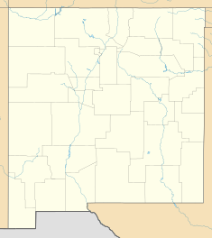
Fort Fillmore, located at 32°13′30″N 106°42′52″W, was a United States military fortification established by Colonel Edwin Vose Sumner in September 1851 near Mesilla in what is now New Mexico, primarily for the purpose of protecting settlers and traders traveling to California. Early frontier migrants were under constant threat from attack by local Native Americans, and a network of forts was eventually created by the U.S. government to protect and encourage westward expansion. Fort Fillmore was intended to protect a corridor plagued by hostile Apaches, where several migration routes converged between El Paso and Tucson to take advantage of Apache Pass.

The California Column was a force of Union volunteers sent to Arizona and New Mexico during the American Civil War. The command marched over 900 miles (1,400 km) from California through Arizona and New Mexico Territory to the Rio Grande and as far east as El Paso, Texas, between April and August 1862.

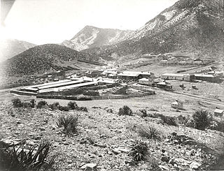
Fort Bowie was a 19th-century outpost of the United States Army located in southeastern Arizona near the present day town of Willcox, Arizona. The remaining buildings and site are now protected as Fort Bowie National Historic Site.
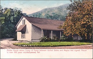
Warner's Ranch, near Warner Springs, California, was notable as a way station for large numbers of emigrants on the Southern Emigrant Trail from 1849 to 1861, as it was a stop on both the Gila River Trail and the Butterfield Overland Mail stagecoach line (1859-1861). It was also operated as a pioneering cattle ranch.

Oak Grove Butterfield Stage Station is located in the western foothills of the Laguna Mountains, in northern San Diego County, California. It is located on State Route 79, 13 miles (21 km) northwest of Warner Springs and Warner's Ranch. The station was built on the site of Camp Wright, an 1860s Civil War outpost.

The 5th Regiment California Volunteer Infantry was an infantry regiment in the Union Army during the American Civil War. It spent its entire term of service in the western United States, attached to the Department of the Pacific and Department of New Mexico.
The Department of New Mexico was a department of the United States Army during the mid-19th century. It was created as the 9th Department, a geographical department, in 1848 following the successful conclusion of the Mexican–American War, and renamed Department of New Mexico in 1853. It had to contend with an invading Confederate force during the New Mexico Campaign of the American Civil War from mid-1861 to early 1862, then with Apache tribes during the remainder of the conflict. It was merged into the Department of California after the end of the war as the District of New Mexico.

The 1st Battalion of California Veteran Infantry was a California Volunteer infantry battalion in the Union Army during the American Civil War. It spent its entire term of service in the western United States.
Fort Quitman was a United States Army installation on the Rio Grande in Texas, United States, south of present-day Sierra Blanca, 20 miles southeast of McNary in southern Hudspeth County. The fort, now a ghost town, was named for former Mississippi Governor John A. Quitman, who served as a major general under Zachary Taylor during the Mexican–American War.

The Butterfield Overland Mail in California was created by the United States Congress on March 3, 1857, and operated until June 30, 1861. Subsequently, other stage lines operated along the Butterfield Overland Mail in route in Alta California until the Southern Pacific Railroad arrived in Yuma, Arizona in 1877.

Southern Emigrant Trail, also known as the Gila Trail, the Kearny Trail, Southern Trail and the Butterfield Stage Trail, was a major land route for immigration into California from the eastern United States that followed the Santa Fe Trail to New Mexico during the California Gold Rush. Unlike the more northern routes, pioneer wagons could travel year round, mountain passes not being blocked by snows; however, it had the disadvantage of summer heat and lack of water in the desert regions through which it passed in New Mexico Territory and the Colorado Desert of California. Subsequently, it was a route of travel and commerce between the eastern United States and California. Many herds of cattle and sheep were driven along this route and it was followed by the San Antonio-San Diego Mail Line in 1857–1858 and then the Butterfield Overland Mail from 1858 to 1861.
The Butterfield Overland Mail was a transport and mail delivery system that employed stagecoaches that travelled on a specific route between St. Louis, Missouri and San Francisco, California and which passed through the New Mexico Territory. It was created by the United States Congress on March 3, 1857, and operated until March 30, 1861. The route that was operated extended from where the ferry across the Colorado River to Fort Yuma Station, California was located, through New Mexico Territory via Tucson to the Rio Grande and Mesilla, New Mexico then south to Franklin, Texas, midpoint on the route. The New Mexico Territory mail route was divided into two divisions each under a superintendent. Tucson was the headquarters of the 3rd Division of the Butterfield Overland Mail Company. Franklin Station in the town of Franklin,, was the headquarters of the 4th Division.
Edwin Augustus Rigg (1822–1882), 49er, was a military officer in the American Civil War and the Apache Wars.
The Skirmish in Doubtful Canyon took place on May 3, 1864, between a company of infantry from the California Column and a band of about 100 Apaches. The fighting occurred near Steins Peak in Doubtful Canyon, Arizona Territory. Doubtful Canyon, along with Apache Pass and Cookes Canyon, was a favored location for an ambush by the Apache along the Butterfield Overland Mail route.
The Butterfield Overland Mail route in Baja California was created as a result of an act by the United States Congress on March 3, 1857, and operated until June 30, 1861 as part of the Second Division of the route. Subsequently other stage lines operated along the route until the Southern Pacific Railroad arrived in Yuma, Arizona.
Cooke's Spring, or Cookes Spring, is a spring in Luna County, New Mexico at an elevation of 4839 feet. Cooke's Spring is located at the eastern mouth of the narrow upper Cooke's Canyon, part of what was called Cooke's Pass, a narrow gap, running east and west, through the Cooke's Range.
Cooke's Spring Station, located near Cooke's Spring, New Mexico was a stage station of the Butterfield Overland Mail stage route from 1858 to 1861 and of subsequent stage lines until made obsolete by the arrival of the transcontinental railroad in New Mexico.
Cooke's Pass, also known as Massacre Canyon, is a narrow gap running east and west through the Cookes Range In Luna County, New Mexico. Its apex is a saddle, at an elevation of about 5100 feet between Fryingpan Canyon on the west and the narrow upper part of Cooke's Canyon west of Cooke's Spring. Cooke's Pass is just north of Massacre Peak.
Massacre Peak, a summit at an elevation of 5,667 feet (1,727 m) in the Cookes Range in Luna County, New Mexico.


