Fort Hampton (Alabama)

Last updated
Fort Hampton
Athens, Alabama in United States
Fort Hampton Historical Marker.jpg
Historical marker for Fort Hampton
USA Alabama location map.svg
Red pog.svg
Fort Hampton
Usa edcp location map.svg
Red pog.svg
Fort Hampton
Coordinates 34°48′23″N87°11′55″W / 34.80639°N 87.19861°W / 34.80639; -87.19861
TypeLog buildings
Site information
OwnerPrivate
Controlled byPrivate
Open to
the public
No
ConditionSite occupied by private home
Site history
Built1810
Built byUnited States Army
In use1810–1817
Battles/wars War of 1812

Fort Hampton was a collection of log buildings and stables built in present-day Limestone County, Alabama, on a hill near the Elk River. It was named for Brigadier General Wade Hampton by Alexander Smyth, and once complete in the winter of 1810 both men visited the site. [1] [2] The fort was originally built to deter Americans from settling in Chickasaw territory, then was garrisoned during the War of 1812. [1] Later, it was used for United States governmental functions prior to being abandoned.

Contents

History

Background

Immediately prior to contact with Europeans, the area that became Alabama was occupied by multiple groups of Native Americans, including the Creek, Cherokee, Choctaw, and Chickasaw. As American settlement expanded west, Native American tribal territory and alliances evolved due to increased contact with the new settlers. Prior to being controlled by the newly formed United States, the current area of Limestone County was claimed at times by the Chickasaw, Cherokee, or the British. After defeating the Shawnee (who had previously occupied the territory in the early 1700s), the Chickasaw gained control of the Tennessee Valley in northwest Alabama. [3] In 1806, the Cherokee sold their claim on Limestone County, north of the Tennessee River, but the Chickasaw retained their rights to the land, causing a boundary to be created to separate Chickasaw land from land available for purchase and settlement. [4]

The first Anglo settlers in North Alabama are believed to have arrived via flatboats on the Tennessee River from East Tennessee. Other settlers came from Georgia, South Carolina, North Carolina, and Virginia, and followed established Native American trading paths. Many of these early settlers were drawn to the area by the easy access to navigable waterways and fertile soil that afforded ample areas for growing cotton. [5] Some of these settlers ignored previously established boundary lines and settled on land claimed by the Chickasaw. The Chickasaw (through the family of George Colbert) petitioned the United States to stop illegal settling of their land, and in response, the United States ordered these settlers to leave the area. In 1809, Colonel Return J. Meigs Sr. and a company of thirty soldiers marched from Kingston, Tennessee, and forced settlers to move out of Chickasaw territory. [6] Even so, many settlers did not leave or soon returned, and Meigs suggested a permanent military presence would be required to prevent them from returning again. This resulted in the construction of Fort Hampton by the United States Army in the fall of 1810. [7]

Construction

Alexander Smyth sketch of Fort Hampton Fort Hampton plan.jpg
Alexander Smyth sketch of Fort Hampton

In 1810, Brigadier General Wade Hampton ordered Major John Fuller and one hundred and four men (two companies) of the Regiment of Riflemen to march from Cantonment Washington to the Elk River region of North Alabama. After a forty-eight day march in the middle of the summer, the soldiers arrived at the site of Fort Hampton without any tools, tents or other supplies, their barge of supplies delayed. [2]

Fort Hampton was built on a hill southeast of the Elk River in what is now Limestone County, Alabama. This location was chosen due to its close proximity to the intruding settlements and to Melton's Bluff, a nearby community where it was originally intended to be built. [8] Initially, the fort only consisted of a collection of log cabins, a brickyard and stables and had no fortifications or armory. [2] [9] The fort also had no prominent forms of defense due to its designed nature as a diplomatic establishment. [10] Eventually, a central courtyard surrounded by thirty-two log cabins was constructed. [11] In 1812, it was made defensive, enclosed, blockaded and cannons were placed outside. [8]

Military use

After construction, Fort Hampton was used as a base from which soldiers performed various duties, mostly road building, but also patrols and protection of Chickasaw property. [12] The primary role of the troops was to keep settlers off Chickasaw lands, and as part of this process they burned the cabins of numerous early inhabitants of Limestone and Lauderdale counties. [13]

Fort Hampton was initially garrisoned by a company of soldiers from the newly organized Regiment of Riflemen under Major John Fuller, but he was soon arrested and relieved of duty and Colonel Robert Purdy of the 7th United States Infantry assumed command. [2] The Regiment at the fort consisted of one hundred riflemen, Colonel Smyth, who assumed command when Purdy returned to his post, Captains George W. Sevier (son of John Sevier) and James McDonald, and Major Fuller until early 1811. [8] Colonel John Williams of the 39th Infantry Regiment was also stationed at Fort Hampton for a time. [14]

Sam Houston was stationed at Fort Hampton after joining the United States Army in 1813. [15] His brother Robert was the commanding officer of the 8th Infantry at the fort from 1816 until the fort was abandoned in 1817. [16]

In a letter to Major General John Alexander Cocke in October 1813, Andrew Jackson warned of a possible impending Creek attack on Fort Hampton and Huntsville. In response, Jackson ordered General John Coffee to reinforce the militia at Huntsville and Captain McClellan and his troops at Fort Hampton. [17] The attack never occurred, and after temporarily staying at Fort Hampton, Coffee proceeded to the Black Warrior River valley to scout out hostile Creeks and burn any villages his troops found. [18]

When Jackson began offensives against Pensacola and New Orleans, David Holmes, governor of Mississippi Territory, ordered soldiers and supplies from Fort Hampton to be sent to Jackson's forces. [19] When these forces left, militia Captain John Allen's men occupied Fort Hampton for almost an entire year. In addition to his military service, Allen served as a subagent for the Chickasaw. [20] Allen's men performed their duty without initially being paid, but were compensated within two years of their service. [21]

Fort Hampton in relation to other contemporary forts. Fort Hampton is located in the upper left corner. Fort Hampton map.jpg
Fort Hampton in relation to other contemporary forts. Fort Hampton is located in the upper left corner.

The 1st Regiment of West Tennessee Volunteer Mounted Gunmen were briefly stationed at Fort Hampton en route to New Orleans in the winter of 1814. [22]

In August 1816, the 8th Infantry Regiment of the United States was stationed at Fort Hampton under the direction of Robert Butler, Andrew Jackson’s Adjutant General of the 7th Military District of the South. [23]

Postwar

After the Chickasaw sold the territory surrounding Fort Hampton to the United States, the presence of U.S. troops was no longer needed and the military post at the fort was disbanded. Troops were sent to begin construction of the northern portion of the Jackson military road. [23]

Some of the buildings of Fort Hampton were still standing in 1821, but most were believed to have been moved from the original site. [24] Fort Hampton was then used as a court site for Elk County, Mississippi Territory and Limestone County, Alabama Territory. [25]

A community of the same name developed around Fort Hampton and a post office operated under that name from 1861 to 1872. [26] The Improved Order of Red Men and Independent Order of Good Templars both had lodges in Fort Hampton. [27] [28]

Present

The original site of Fort Hampton is now occupied by a private residence. A historical marker was placed by the Limestone County Historical Society on the shoulder of U.S. Route 72 in the 1970s. [29]

The site was excavated by a team from the University of West Florida in 2013. The fort site was positively identified and some artifacts related to the fort's military use were recovered. [30]

Related Research Articles

<span class="mw-page-title-main">Muscogee</span> Indigenous people from Southeastern Woodlands

The Muscogee, also known as the Mvskoke, Muscogee Creek, and the Muscogee Creek Confederacy, are a group of related Indigenous peoples of the Southeastern Woodlands in the United States of America. Their historical homelands are in what now comprises southern Tennessee, much of Alabama, western Georgia and parts of northern Florida.

<span class="mw-page-title-main">Lauderdale County, Alabama</span> County in Alabama, United States

Lauderdale County is a county located in the northwestern corner of the U.S. state of Alabama. At the 2020 census the population was 93,564. Its county seat is Florence. Its name is in honor of Colonel James Lauderdale, of Tennessee. Lauderdale is part of the Florence-Muscle Shoals, AL Metropolitan Statistical Area, also known as "The Shoals".

<span class="mw-page-title-main">Chickasaw</span> Indigenous people of Southeastern Woodlands of the USA

The Chickasaw are an Indigenous people of the Southeastern Woodlands, United States. Their traditional territory was in northern Mississippi, northwestern and northern Alabama, western Tennessee and southwestern Kentucky. Their language is classified as a member of the Muskogean language family. In the present day, they are organized as the federally recognized Chickasaw Nation.

<span class="mw-page-title-main">Elkmont, Alabama</span> Town in Alabama, United States

Elkmont is a town in Limestone County, Alabama, United States, and is included in the Huntsville-Decatur Combined Statistical Area. As of the 2010 census, the population of the town was 434, down from its record high of 470 in 2000.

<span class="mw-page-title-main">Battle of Horseshoe Bend</span> Penultimate battle of the Creek War (1814)

<span class="mw-page-title-main">Willie Blount</span> American politician (1768–1835)

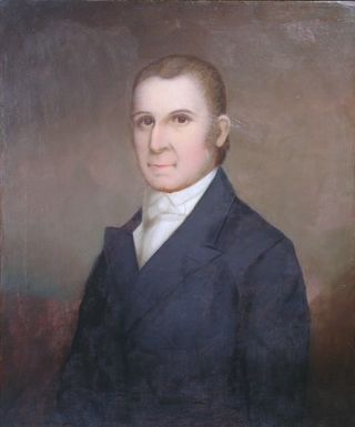
Willie Blount was an American politician who served as the third Governor of Tennessee from 1809 to 1815. Blount's efforts to raise funds and soldiers during the War of 1812 earned Tennessee the nickname, "Volunteer State." He was the younger half-brother of Southwest Territory governor, William Blount. He was a member of the Democratic-Republican Party.

<span class="mw-page-title-main">Creek War</span> 1813–14 US Indian War

The Creek War, was a regional conflict between opposing Native American factions, European powers, and the United States during the early 19th century. The Creek War began as a conflict within the tribes of the Muscogee, but the United States quickly became involved. British traders and Spanish colonial officials in Florida supplied the Red Sticks with weapons and equipment due to their shared interest in preventing the expansion of the United States into regions under their control.

Red Sticks —the name deriving from the red-painted war clubs of some Native American Creek—refers to an early 19th century traditionalist faction of Muscogee Creek people in the Southeastern United States. Made up mostly of Creek of the Upper Towns that supported traditional leadership and culture, as well as the preservation of communal land for cultivation and hunting, the Red Sticks arose at a time of increasing pressure on Creek territory by European American settlers. Creek of the Lower Towns were closer to the settlers, had more mixed-race families, and had already been forced to make land cessions to the Americans. In this context, the Red Sticks led a resistance movement against European American encroachment and assimilation, tensions that culminated in the outbreak of the Creek War in 1813. Initially a civil war among the Creek, the conflict drew in United States state forces while the nation was already engaged in the War of 1812 against the British.

<span class="mw-page-title-main">Edmund P. Gaines</span> American general (1777–1849)

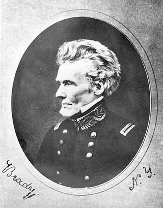
Edmund Pendleton Gaines was a career United States Army officer who served for nearly fifty years, and attained the rank of major general by brevet. He was one of the Army's senior commanders during its formative years in the early to mid-1800s, and was a veteran of the War of 1812, Seminole Wars, Black Hawk War, and Mexican–American War.

<span class="mw-page-title-main">John Coffee</span>

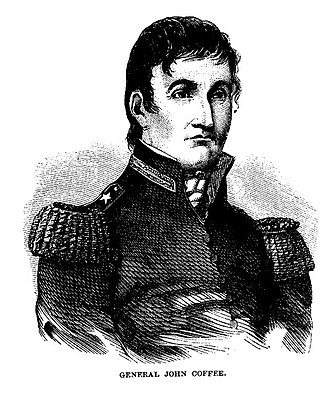
John R. Coffee was an American planter of Irish descent, and a state militia brigadier general in Tennessee. He commanded troops under General Andrew Jackson during the Creek Wars (1813–14) and during the Battle of New Orleans in the War of 1812.

<span class="mw-page-title-main">Fort Mims massacre</span> Part of the Creek War (1813)

The Fort Mims massacre took place on August 30, 1813, during the Creek War, when a force of Creek Indians belonging to the Red Sticks faction, under the command of head warriors Peter McQueen and William Weatherford, stormed the fort and defeated the militia garrison. Afterward, a massacre ensued and almost all of the remaining mixed Creek, white settlers, and militia at Fort Mims were killed. The fort was a stockade with a blockhouse surrounding the house and outbuildings of the settler Samuel Mims, located about 35 miles directly north of present-day Mobile, Alabama.

Chief George Colbert, also known as Tootemastubbe in Chickasaw, was a leader and war chief of the Chickasaw people in the early 19th century, then occupying territory in what are now the jurisdictions of Alabama and Mississippi. During the Creek War of 1813–1814, he commanded 350 Chickasaw auxiliary troops, whom he had recruited, as a militia captain under Andrew Jackson. Later he joined the US Army under Jackson for the remainder of the War of 1812.

<span class="mw-page-title-main">Fort Strother</span> United States historic site

Fort Strother was a stockade fort at Ten Islands in the Mississippi Territory, in what is today St. Clair County, Alabama. It was located on a bluff of the Coosa River, near the modern Neely Henry Dam in Ragland, Alabama. The fort was built by General Andrew Jackson and several thousand militiamen in November 1813, during the Creek War and was named for Captain John Strother, Jackson's chief cartographer.

<span class="mw-page-title-main">Fort Claiborne</span> United States historic site in Alabama

Fort Claiborne was a stockade fort built in 1813 in present-day Monroe County, Alabama during the Creek War.

<span class="mw-page-title-main">Regiment of Riflemen</span> US military unit of War of 1812 era

The Regiment of Riflemen was a unit of the U.S. Army in the early nineteenth century. Unlike the regular US line infantry units with muskets and bright blue and white uniforms, this regiment was focused on specialist light infantry tactics, and were accordingly issued rifles and dark green and black uniforms to take better advantage of cover. This was the first U.S. rifleman formation since the end of the American Revolutionary War 25 years earlier.

Where can you find troops more efficient than Morgan's riflemen of the Revolution or Forsyth's riflemen of the last war with Great Britain?

John Gordon, was an American pioneer, Indian trader, planter, and militia captain in several Indian wars. Part of the post-Revolutionary War settlement of the trans-Appalachian frontier, Gordon was an early settler in the Nashville, Tennessee area. He gained notability and rank in the Tennessee Militia, fighting against the Creeks and Seminoles for Andrew Jackson, during the War of 1812. Jackson referred to him as his "Captain of the Spies."

<span class="mw-page-title-main">Fort Decatur (Alabama)</span> United States historic site

Fort Decatur was an earthen fort established in March 1814 on the banks of the Tallapoosa River as part of the Creek War and the larger War of 1812. The fort was located on the east bank of the Tallapoosa River, near the modern community of Milstead. Fort Decatur was also located near the Creek town of Tukabatchee. It was most likely named for Stephen Decatur.

<span class="mw-page-title-main">Fort Armstrong (Alabama)</span> United States historic site

Fort Armstrong was a stockade fort built in present-day Cherokee County, Alabama during the Creek War. The fort was built to protect the surrounding area from attacks by Red Stick warriors but was also used as a staging area and supply depot in preparation for further military action against the Red Sticks.

Fort Montgomery was a stockade fort built in August 1814 in present-day Baldwin County, Alabama, during the Creek War, which was part of the larger War of 1812. The fort was built by the United States military in response to attacks by Creek warriors on encroaching American settlers and in preparation for further military action in the War of 1812. Fort Montgomery continued to be used for military purposes but in less than a decade was abandoned. Nothing exists at the site today.

Fort Pierce, was two separate stockade forts built in 1813 in present-day Baldwin County, Alabama, during the Creek War, which was part of the larger War of 1812. The fort was originally built by settlers in the Mississippi Territory to protect themselves from attacks by Creek warriors. A new fort of the same name was then built by the United States military in preparation for further action in the War of 1812, but the fort was essentially abandoned within a few years. Nothing exists at the site today.

References

  1. 1 2 Harris 1977, pp. 42.
  2. 1 2 3 4 Cole & Hoksbergen 2020, pp. 3.
  3. Chandler 2014, pp. 11–13.
  4. Chandler 2014, pp. 20.
  5. Chandler 2014, pp. 22.
  6. Chandler 2014, pp. 24.
  7. Chandler 2014, pp. 25.
  8. 1 2 3 Cole & Hoksbergen 2020, pp. 5.
  9. Roberts 2020, pp. 103.
  10. Chandler 2014, pp. 98.
  11. Chandler 2014, pp. 30.
  12. Cole & Hoksbergen 2020, pp. 6.
  13. Chandler 2014, pp. 25–26.
  14. Roberts 2020, pp. 115.
  15. Lester 1883, pp. 21.
  16. Cole & Hoksbergen 2020, pp. 7.
  17. Jackson 1926, pp. 332.
  18. Weir 2016, pp. 210.
  19. Holmes 1927, pp. 44.
  20. "Signers – Allen, John L." Indian Land Tenure Foundation Initiative Treaty Signers Project. Retrieved 25 June 2021.
  21. Roberts 2020, pp. 117.
  22. Kanon, Tom. "Regimental Histories of Tennessee Units During the War of 1812". Tennessee State Library and Archives. State of Tennessee. Retrieved 22 June 2021.
  23. 1 2 Cole & Hoksbergen 2020, pp. 8.
  24. Chandler 2014, pp. 41.
  25. Chandler 2014, pp. 33.
  26. "Limestone County". Jim Forte Postal History. Retrieved 22 June 2021.
  27. Lindsay, Conley & Litchman 1893, pp. 439.
  28. Spencer 1870, pp. 10.
  29. "The Big Dig: Limestone Native to Discuss the Real Fort Hampton". The News Courier. 16 January 2015. Retrieved 19 June 2021.
  30. Chandler 2014, pp. 45.

Sources