
Parramatta is a major suburb and commercial district in Greater Western Sydney, located approximately 24 kilometres (15 mi) west of the Sydney CBD, on the banks of the Parramatta River. It is often regarded as the secondary central business district in metropolitan Sydney.
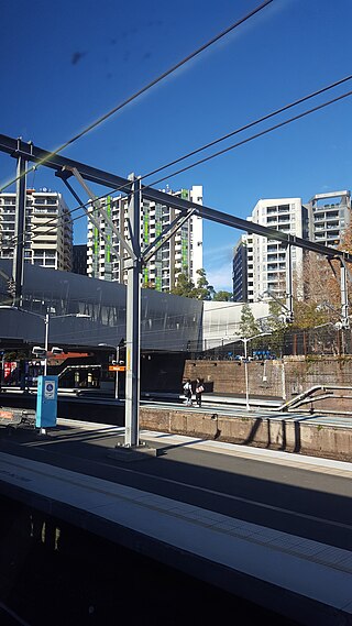
Redfern is an inner southern suburb of Sydney located 3 kilometres (1.9 mi) south of the Sydney central business district and is part of the local government area of the City of Sydney. Strawberry Hills is a locality on the border with Surry Hills. The area experienced the process of gentrification and is subject to extensive redevelopment plans by the state government, to increase the population and reduce the concentration of poverty in the suburb and neighbouring Waterloo.

Richmond is a historic town in north-west of Sydney, New South Wales, Australia. Richmond is in local government area of City of Hawkesbury and comes under Sydney Metropolitan area. It is located 20 metres above sea level on the alluvial Hawkesbury River flats, at the foot of the Blue Mountains. It is about 65 km by road from Sydney, 22 km from Penrith, 26 km from Blacktown, 40 km from Parramatta, 78 km from Lithgow and 5 km from Windsor. Richmond Town is now part of Sydney urban area have all amenities including Shopping Malls, Service NSW, Schools, TAFE, University, Post Office, Restaurants, Railway Station, Cafe, Hotel and Supermarkets.
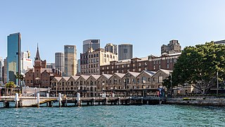
The Rocks is a suburb, tourist precinct and historic area of Sydney's city centre, in the state of New South Wales, Australia. It is located on the southern shore of Sydney Harbour, immediately north-west of the Sydney central business district.
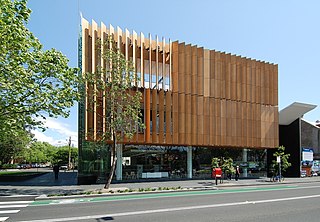
Surry Hills is an inner-east suburb of Sydney, in the state of New South Wales, Australia. Surry Hills is immediately south-east of the Sydney central business district in the local government area of the City of Sydney. Surry Hills is surrounded by the suburbs of Darlinghurst to the north, Chippendale and Haymarket to the west, Moore Park and Paddington to the east and Redfern to the south. It is often colloquially referred to as "Surry".

Windsor is a historic town in north-west of Sydney, New South Wales, Australia. It is the council seat of the Hawkesbury local government area. The town sits on the Hawkesbury River, enveloped by farmland and Australian bush. Many of the oldest surviving European buildings in Australia are located at Windsor. It is 56 km (35 mi) north-west of the Sydney CBD, on the fringes of urban sprawl.
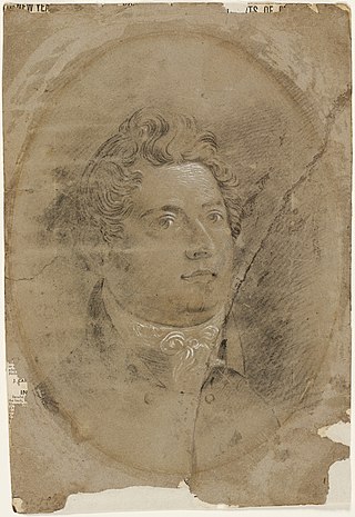
Francis Howard Greenway was an English-born architect who was transported to Australia as a convict for the crime of forgery. In New South Wales he worked for the Governor, Lachlan Macquarie, as Australia's first government architect. He became widely known and admired for his work displayed in buildings such as St Matthew's Church, St James' Church and Hyde Park Barracks.
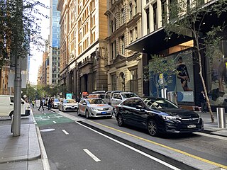
Pitt Street is a major street in the Sydney central business district in New South Wales, Australia. The street runs through the entire city centre from Circular Quay in the north to Waterloo, although today's street is in two disjointed sections after a substantial stretch of it was removed to make way for Sydney's Central railway station. Pitt Street is well known for the pedestrian only retail centre of Pitt Street Mall, a section of the street which runs from King Street to Market Street.

Linden is a village in the Blue Mountains of New South Wales, Australia. It is in the City of Blue Mountains, 82 km west of Sydney and 23 km east of Katoomba. The village is on the Great Western Highway and has a railway station on the Main Western railway line served by NSW TrainLink's Blue Mountains Line. It shares a post office, and therefore the 2778 postcode, with adjoining Woodford. In the 2011 census, its population was 594, including 19 indigenous people (3.2%).
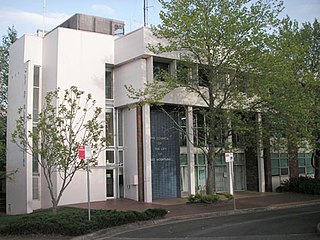
The City of Blue Mountains is a local government area of New South Wales, Australia, governed by the Blue Mountains City Council. The city is located in the Blue Mountains, on the Great Dividing Range at the far western fringe of the Greater Sydney area. Major settlements include, Katoomba, Lawson, Springwood and Blaxland.
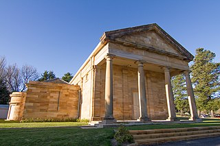
Berrima is a historic village in the Southern Highlands of New South Wales, Australia, in Wingecarribee Shire. The village, once a major town, is located on the Old Hume Highway between Sydney and Canberra. It was previously known officially as the Town of Berrima. It is close to the three major towns of the Southern Highlands: Mittagong, Bowral and Moss Vale.

Millers Point is an inner-city suburb of Sydney, in the state of New South Wales, Australia. It is on the north-western edge of the Sydney central business district, adjacent to The Rocks and is part of the local government area of the City of Sydney.

The Sydney Observatory is a heritage-listed meteorological station, astronomical observatory, function venue, science museum, and education facility located on Observatory Hill at Upper Fort Street, in the inner city Sydney suburb of Millers Point in the City of Sydney local government area of New South Wales, Australia. It was designed by William Weaver (plans) and Alexander Dawson (supervision) and built from 1857 to 1859 by Charles Bingemann & Ebenezer Dewar. It is also known as The Sydney Observatory; Observatory; Fort Phillip; Windmill Hill; and Flagstaff Hill. It was added to the New South Wales State Heritage Register on 22 December 2000.

Colonel Walter Liberty Vernon was an English architect who migrated to Australia and pursued his career as an architect in Sydney, New South Wales. In his role as the New South Wales Government Architect he is noted for designing multiple government buildings, many of which are extant with listings on national and state heritage registers.

Queens Square is a public square in central Sydney, Australia. The square is located at the junction of King Street with Phillip Street and Macquarie Street. It is bounded on the south by St James Road and Prince Albert Road.

Mortimer William Lewis was an English-born architect, surveyor and public servant who migrated to Australia and became Colonial Architect in the colony of New South Wales from 1835 to 1849. Lewis was responsible for designing and overseeing many government buildings in Sydney and rural New South Wales, many of which are heritage listed.

Bridge Street is a street in the central business district of Sydney, Australia. Bridge Street runs for 500 metres (1,600 ft) in a west–east direction with traffic flowing in both directions. It is situated in the northern portion of the central business district. The western terminus of Bridge Street is at George Street, with the eastern terminus at Macquarie Street, adjacent to the Chief Secretary's Building. From west to east, Bridge Street crosses Pitt and Phillip streets.

Observatory Park is a park located in the heart of the Sydney central business district, City of Sydney, New South Wales, Australia. It is near the Harbour Bridge and is bounded by Kent Street, Watson Road, Upper Fort Street and Bradfield Highway, Millers Point. Its history dates back to 1796 when it was used as the site of the first windmill in the colony, when it was known as Windmill Hill. It is also the site of a number of historical buildings including the historic Sydney Observatory, the Signal Station, the remains of Fort Philip, the National Trust Centre and a rotunda which is used for weddings.

21–23 Lower Fort Street, Millers Point are heritage-listed terrace houses located at 21–23 Lower Fort Street, in the inner city Sydney suburb of Millers Point in the City of Sydney local government area of New South Wales, Australia. It was built from 1832. It is also known as Nicholson's Houses. The property was added to the New South Wales State Heritage Register on 2 April 1999.


