
Mindanao is the second-largest island in the Philippines, after Luzon, and seventh-most populous island in the world. Located in the southern region of the archipelago, the island is part of an island group of the same name that also includes its adjacent islands, notably the Sulu Archipelago. According to the 2020 census, Mindanao has a population of 26,252,442 people, while the entire island group has an estimated population of 27,021,036 according to the 2021 census.

Sarangani, officially the Province of Sarangani, is a province in the Philippines located in the Soccsksargen region. Its capital is Alabel. With a 230-kilometre (140 mi) coastline along the Sarangani Bay and Celebes Sea, the province is at the southernmost tip of Mindanao island, and borders South Cotabato and Davao del Sur to the north, Davao Occidental to the east, and the Celebes Sea to the south.

Cotabato or North Cotabato, officially the Province of Cotabato, is a landlocked province in the Philippines located in the Soccsksargen region in Mindanao. Its capital is the city of Kidapawan. Some of its municipalities are under the jurisdiction of the nearby Bangsamoro Autonomous Region.
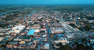
Cotabato City, officially the City of Cotabato, is a first class independent component city in the Bangsamoro Autonomous Region in Muslim Mindanao, Philippines. According to the 2020 census, it has a population of 325,079 people, making it as the most populated city under the independent component city status.

Pikit, officially the Municipality of Pikit is a 1st class municipality in the province of Cotabato, Philippines. According to the 2020 census, it has a population of 67,024 people.
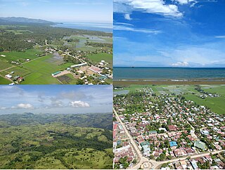
Lebak, officially the Municipality of Lebak, is a 1st class municipality in the province of Sultan Kudarat, Philippines. According to the 2020 census, it has a population of 88,868.

Aleosan, officially the Municipality of Aleosan, is a 3rd class municipality in the province of Cotabato, Philippines. According to the 2020 census, it has a population of 36,892 people.

Kabacan officially the Municipality of Kabacan, is a 1st class municipality in the province of Cotabato, Philippines. According to the 2020 census, it has a population of 77,164 people.
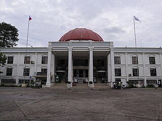
Kidapawan, officially the City of Kidapawan, is a 3rd class component city and capital of the province of Cotabato, Philippines. According to the 2020 Census, it has a population of 160,791 people.

Midsayap, officially the Municipality of Midsayap, is a 1st class municipality in the Province of Cotabato, Philippines. According to the 2020 census, it has a population of 117,365 people.

Santa Barbara, officially the Municipality of Santa Barbara, is a 2nd class municipality in the province of Iloilo, Philippines. According to the 2020 census, it has a population of 67,630 people.
The legislative districts of Cotabato are the representations of the province of Cotabato in the various national legislatures of the Philippines. The province is currently represented in the lower house of the Congress of the Philippines through its first, second, and third congressional districts.

The Spanish fortifications of the Philippines, or fuerzas, are strongholds constructed by Filipinos and Spaniards primarily for protection against local and foreign aggressors during the Spanish colonial period, and during the subsequent American and Japanese occupations. Structures built included fortresses, watchtowers, and bastions. Many are badly damaged, either due to old age or past conflicts. Currently, there are initiatives for restorations of all forts, beginning when the Baluarte Luna of La Union and the Intramuros of Manila were restored in the 2010s. In 2013, a typhoon and earthquake hit Central Visayas and damaged numerous Spanish fortifications, leading to the largest restoration activity for fortifications in Philippine history.

The Philippine Registry of Cultural Property, abbreviated as PRECUP, is a national registry of the Philippine Government used to consolidate in one record all cultural property that are deemed important to the cultural heritage, tangible and intangible, of the Philippines. On June 11, 2018, the entries in the newly updated PRECUP was at 3,921. Additionally, 1,259 out of 1,715 LGUs, or 73 percent of LGUs have established local cultural inventories (LCI).

Historical markers are installed by the National Historical Commission of the Philippines (NHCP) and its predecessor agencies in the Philippines and places abroad that signify important and historic events, persons, structures, and institutions. The commemorative plaques are permanent signs installed by the NHCP in publicly visible locations on buildings, monuments, or in special locations. The NHCP also allows local municipalities and cities to install markers of figures and events of local significance, although these markers are barred from using the seal of the Republic of the Philippines.

Bangsamoro, officially the Bangsamoro Autonomous Region in Muslim Mindanao, is an autonomous region in the Philippines, located in the southwestern portion of the island of Mindanao.

The 2019 Bangsamoro autonomy plebiscite was a two-part plebiscite held in Mindanao, Philippines, that ratified the Bangsamoro Organic Law (BOL) and replaced the Autonomous Region in Muslim Mindanao (ARMM) with the Bangsamoro Autonomous Region in Muslim Mindanao (BARMM), as well as the scope of the said region.
The Special Geographic Area (SGA) is a loose collection of 63 barangays in six municipalities of the province of Cotabato in the Philippines. It is part of the Bangsamoro Autonomous Region in Muslim Mindanao, despite the province of Cotabato itself being part of a separate neighboring region, Soccsksargen.

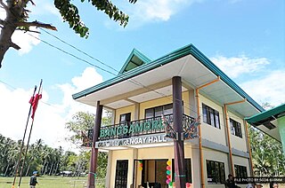
Malidegao, officially the Municipality of Malidegao is a municipality in the province of Cotabato, Philippines. The municipality is part of the Bangsamoro Autonomous Region in Muslim Mindanao despite Cotabato being part of Soccsksargen.

