Twin Forts of Romblon

Last updated
Twin Forts of Romblon
Magkaparis na Tanggulan ng Romblon
Fort San Andres in Romblon, Romblon 1.jpg
Fort San Andres in May 2017, part of the Twin Forts of Romblon.
Philippines relief location map (square).svg
Archaeological site icon (red).svg
Location of Twin Forts of Romblon in the Philippines
Location Romblon, Romblon, Philippines
Coordinates 12°34′43″N122°16′13″E / 12.5785842°N 122.2701715°E / 12.5785842; 122.2701715
Management National Museum of the Philippines

The Twin Forts of Romblon (Filipino : Magkaparis na Tanggulan ng Romblon) are a pair of Spanish fortifications located in the town of Romblon, Romblon in the Philippines. It was built by the Spanish in 1644 to protect the town from Muslim raids and Dutch piracy in the country during the Eighty Years' War. In 2013, the site has been declared a National Cultural Treasure under the protection of the Philippine government through the National Museum of the Philippines.

Contents

History

The town of Romblon in the early 1900s, showing Fort San Andres in the background. Romblon circa 1905.JPG
The town of Romblon in the early 1900s, showing Fort San Andres in the background.
A look inside Fort San Andres. Fort San Andres in Romblon, Romblon 4.jpg
A look inside Fort San Andres.
One of the Spanish-era cannons at Fort San Andres. Fort San Andres 1.JPG
One of the Spanish-era cannons at Fort San Andres.
The monument of Spanish priest Agustin de San Pedro, who supervised the construction of Fort San Andres. Monument of Fr. Agustin de San Pedro.jpg
The monument of Spanish priest Agustin de San Pedro, who supervised the construction of Fort San Andres.

In 1569, Spanish colonizers arrived in Romblon led by conquistador Martin de Goiti who was dispatched by Miguel López de Legazpi to explore the western and northern portion of the Visayas region including Romblon and Mindoro. The Spanish later organized the archipelago into three encomiendas and were administered from Arevalo. In 1582, Spanish chronicler Miguel de Loarca visited Romblon and conducted the first census of the islands. [1]

In 1635, Augustinian Recollect missionaries arrived in Romblon to establish Catholic missions and settlements. They helped the Spanish authorities establish peace and order in the islands. With Spain's involvement in the Eighty Years' War beginning in 1568, these missions and settlements soon became vulnerable to piracy by the Dutch East India Company. In an attack in 1646, the Dutch pillaged and destroyed the town of Romblon. The town was also a frequent target of Muslim pirates from Mindanao, who have been at war with the Spanish since 1565. [2] [3]

To help protect their colonial settlements and outposts from Dutch and Muslim piracy, the Spanish colonial government ordered the construction of various fortifications and watchtowers throughout the country. In Romblon, the construction of fortifications was supervised by Augustinian Recollect priest Agustin de San Pedro, also known as "El Padre Capitan". In 1644, San Pedro began supervision for the construction of twin fortifications atop Calvary Hill and San Antonio Hill overlooking Romblon town. These fortifications were built by local laborers using locally available coral and limestone. Upon completion in 1650, the twin forts were dedicated and named Fuerza de Santiago (after Saint James the Great) and Fuerza de San Andres (after Saint Andrew). [2] [3] [4]

Features

Currently, Fort San Andres is the only surviving structure of the Twin Forts of Romblon, as Fort Santiago atop Calvary Hill is now in ruins and has been covered by wildlife. Fort San Andres is located between Barangay II and Barangay Capaclan, atop San Antonio Hill which overlooks the town and its natural harbor. It is accessible via a stone staircase from Termopilas Street as well as through the narrow access road from Sabang Road. The fort is quadrilateral in shape, with four turrets on each corner, and has a total area of 290 square metres (3,100 sq ft). The four walls and towers of the fort each have a parapet with three embrasures from which cannons can be fired toward enemy positions. There is a wooden door on the southern wall of the fort through which serve as its primary entrance. On the middle of the fort are four stone columns that used to provide support for a thatched roof that used to cover the part of the fort facing away from the sea. [4] [5] [6]

National Cultural Treasure

In 2013, the National Museum of the Philippines declared the Twin Forts of Romblon, along with the town's Spanish colonial bridges, the Saint Joseph Cathedral, and its Triada de Aguas fountain as National Cultural Treasures. The declaration places the fort under the protection and conservation of the Philippine government through the National Museum. A plaque was installed on the fort that year marking its designation. [7] [8] [9]

In 2012, prior to its designation as a National Cultural Treasure, the fort underwent extensive restoration conducted by the National Commission for Culture and the Arts (NCAA). The restoration, which involved the restoration and replacement of missing coral stone in both interior and exterior walls, the removal of earth fill at the interior chamber and the provision of drainage system, the reinforcement of the wall foundation, rehabilitation of the remaining two turrets, rehabilitation of the top section of the fort, and rip rapping around the fort to prevent soil erosion, was funded through a ₱2 million grant from the agency. The restoration was supported by the local government and the Save the Fort San Andres Movement, Inc., a local non-profit organization advocating for the conservation of the fort. [4]

Related Research Articles

<span class="mw-page-title-main">Romblon</span> Province in Mimaropa, Philippines

Romblon, officially the Province of Romblon, is an archipelagic province of the Philippines located in the Mimaropa region. Its main components include Romblon, Romblon, an archipelagic municipality of the same name that also serves as the provincial capital; Tablas, the largest island, covering nine municipalities ; Sibuyan with its three towns; as well as the smaller island municipalities of Corcuera, Banton, Concepcion, San Jose. The province lies south of Marinduque and Quezon, east of Oriental Mindoro, north of Aklan and Capiz, and west of Masbate. According to the 2020 census, it has a total population of 308,985.

<span class="mw-page-title-main">Intramuros</span> Historic walled city and district of Manila, Philippines

Intramuros is the 0.67-square-kilometer (0.26 sq mi) historic walled area within the city of Manila, the capital of the Philippines. It is administered by the Intramuros Administration with the help of the city government of Manila.
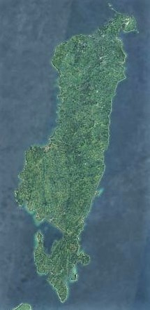
<span class="mw-page-title-main">Tablas Island</span>

Tablas is the largest of the islands that comprise the province of Romblon in the Philippines. The name of the island is of Spanish origin. Before the colonization of the Philippines, Tablas was known as the Island of Osigan. At the time of contact with Westerners, Osigan had a population of 256 people living in small villages. Wax was produced in this island.
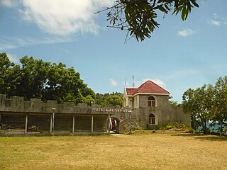
<span class="mw-page-title-main">Banton, Romblon</span> Municipality in Romblon, Philippines

Banton, officially the Municipality of Banton, is a 5th class municipality in the province of Romblon, Philippines. According to the 2020 census, it has a population of 5,737 people.
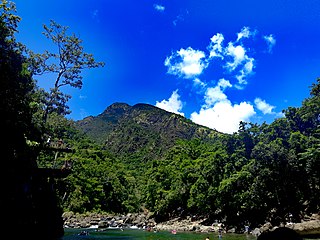
<span class="mw-page-title-main">Cajidiocan</span> Municipality in Romblon, Philippines

Cajidiocan, officially the Municipality of Cajidiocan, is a 3rd class municipality in the province of Romblon, Philippines. According to the 2020 census, it has a population of 23,259 people. The municipality is located on Sibuyan Island, which has been dubbed as the "Galapagos of Asia" due to its pristine natural environment and high endemism rate for flora and fauna.

<span class="mw-page-title-main">Romblon, Romblon</span> Capital of Romblon, Philippines

Romblon, officially the Municipality of Romblon, is a 3rd class municipality and capital of the province of Romblon, Philippines. According to the 2020 census, it has a population of 40,554 people. The archipelagic municipality is the capital of the province of Romblon and the seat of its provincial government. It includes Romblon Island as well as the nearby islands of Lugbon, Alad and Cobrador.

<span class="mw-page-title-main">San Andres, Romblon</span> Municipality in Romblon, Philippines

San Andres, officially the Municipality of San Andres,, is a 5th class municipality in the province of Romblon, Philippines. According to the 2020 census, it has a population of 15,940 people.

<span class="mw-page-title-main">San Jose, Romblon</span> Municipality in Romblon, Philippines

San Jose, officially the Municipality of San Jose, is a 5th class municipality in the province of Romblon, Philippines. According to the 2020 census, it has a population of 11,759 people.

<span class="mw-page-title-main">Santa Fe, Romblon</span> Municipality in Romblon, Philippines

Santa Fe, officially the Municipality of Santa Fe, is a 5th class municipality in the province of Romblon, Philippines. According to the 2020 census, it has a population of 17,802 people.

<span class="mw-page-title-main">San Sebastian Church (Manila)</span> Roman Catholic church in Manila, Philippines

The Minor Basilica and Parish of San Sebastian, also known as the Shrine of Our Lady of Mount Carmel and commonly known as San Sebastian Church or San Sebastian Basilica, is a minor basilica of the Roman Catholic Church in Manila, Philippines. It is under the jurisdiction of the Archdiocese of Manila.
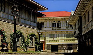
<span class="mw-page-title-main">Architecture of the Philippines</span>

The architecture of the Philippines reflects the historical and cultural traditions in the country. Most prominent historic structures in the archipelago are influenced by Austronesian and American architectures.

<span class="mw-page-title-main">Spanish colonial fortifications in the Philippines</span>

The Spanish fortifications of the Philippines, or fuerzas, are strongholds constructed by Filipinos and Spaniards primarily for protection against local and foreign aggressors during the Spanish colonial period, and during the subsequent American and Japanese occupations. Structures built included fortresses, watchtowers, and bastions. Many are badly damaged, either due to old age or past conflicts. Currently, there are initiatives for restorations of all forts, beginning when the Baluarte Luna of La Union and the Intramuros of Manila were restored in the 2010s. In 2013, a typhoon and earthquake hit Central Visayas and damaged numerous Spanish fortifications, leading to the largest restoration activity for fortifications in Philippine history.

<span class="mw-page-title-main">Banton Church</span> Roman Catholic church in Romblon, Philippines

Saint Nicholas of Tolentino Parish Church, commonly known as Banton Church, is a Roman Catholic church in the municipality of Banton in Romblon province in the Philippines. It is under the jurisdiction of the Diocese of Romblon. The church is allegedly one of the oldest churches in the country, constructed between 1644 and 1650 during the Spanish colonial period. The façade and tower of the present church is Modern.

<span class="mw-page-title-main">Punta Cruz Watchtower</span> Historic watchtower in Bohol, Philippines

The Fort of Saint Vincent Ferrer or commonly known as Punta Cruz Watchtower (Tagalog: Bantayan ng Punta Cruz) is a Spanish colonial era watchtower located at the western tip of the municipality of Maribojoc, Bohol, Philippines. Also known as Maribojoc Watchtower because of its geographical location, it is located three kilometers (1.9 mi) away from Maribojoc Church. It is known for being the "only perfect isosceles triangle" tower-fort structure in the Philippines.
<span class="mw-page-title-main">Bacarra Church</span> Roman Catholic church in Ilocos Norte, Philippines

Saint Andrew the Apostle Parish, commonly known as Bacarra Church, is a Roman Catholic church located in the municipality of Bacarra, Ilocos Norte, Philippines under the jurisdiction of the Diocese of Laoag.

<span class="mw-page-title-main">Masinloc Church</span> Roman Catholic church in Zambales, Philippines

The Diocesan Shrine and Parish of San Andres, commonly known as Masinloc Church, is an 18th-century Baroque Roman Catholic church located at Brgy. South Poblacion, Masinloc, Zambales, Philippines. The parish church, dedicated to Saint Andrew the Apostle, is under the jurisdiction of the Diocese of Iba. The church structure, a standout among Spanish-era churches in the Central Luzon region for having been built with coral stone instead of adobe stone, was declared a National Cultural Treasure by the National Museum of the Philippines along with 25 other Spanish-era churches in 2001.

<span class="mw-page-title-main">Historic Bridges of Romblon</span> Spanish colonial bridges in the Philippines

The Historic Bridges of Romblon are a group of bridges that were built during the Spanish and American colonial era over the Casalogan River in the town of Romblon, Romblon in the Philippines. In March 2013, these bridges were declared an Important Cultural Property by the Philippine government and was placed under the protection and conservation of the National Museum of the Philippines.

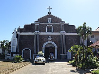
<span class="mw-page-title-main">Romblon Cathedral</span> Roman Catholic church in Romblon, Philippines

Saint Joseph Cathedral Parish, commonly known as Romblon Cathedral, is a Roman Catholic cathedral in Romblon town, in the province of Romblon, Philippines. One of the province's known landmarks, it is the seat of the Diocese of Romblon and was declared a National Cultural Treasure in 2001 by the National Museum of the Philippines.

<span class="mw-page-title-main">Fuerza de San José</span>

Fuerza de San José is a 17th-century Spanish fortification located in the municipality of Banton, on the homonymous island, in Romblon, Philippines. Together with Fuerza de San Andrés and Fuerza de Santiago, it is part of the ancient fortification system of the Sibuyan Sea islands, built under the command of Agustín de San Pedro in order to defend the locals from the attacks that devastated the coasts of the archipelago, especially Moorish incursions from the southern islands. Considered by locals a symbol of greatness and resistance, it played a fundamental role in the defense of Banton in the first decades of Spanish rule of the region, and witnessed numerous battles.

References

  1. Blair, Emma & Robertson, James Alexander (9 August 2005). The Philippine Islands, 1493–1803 Volume V., 1582–1583. Project Gutenberg. Relacion de las Islas Filipinas by Miguel de Loarca. Retrieved 3 January 2021.
  2. 1 2 "Romblon: History". Philippine Provincial Profile. Manila: League of Provinces of the Philippines. 2000. Retrieved 3 January 2021.
  3. 1 2 "History" (PDF). Profile of Romblon Province. Romblon: Philippine Statistical Authority. 2013. Retrieved 3 January 2021.
  4. 1 2 3 "NCCA completes restoration of Fort San Andres in Romblon". NEDA Mimaropa. Retrieved 3 January 2021.
  5. "The Forgotten Forts of Romblon". www.lakwatsero.com. 2 November 2010. Retrieved 3 January 2021.
  6. Villareal, Melo (1 August 2014). "Visiting Fort San Andres In Romblon". outoftownblog.com. Retrieved 3 January 2021.
  7. Cultural Properties Division. "2013 Heritage Pride: NM declarations of National Cultural Treasures (NCTs) and Important Cultural Properties (ICPs)". National Museum of the Philippines. Retrieved 3 January 2021.
  8. Lao, Levine Andro (26 May 2013). "Romblon cathedral, ancient Hispanic forts declared National Cultural Treasures". Philippine Daily Inquirer. Retrieved 3 January 2021.
  9. Henares, Ivan (26 January 2014). "Updated Philippine Registry of Cultural Property (PRECUP)". Ivan About Town. Retrieved 3 January 2021.

See also