
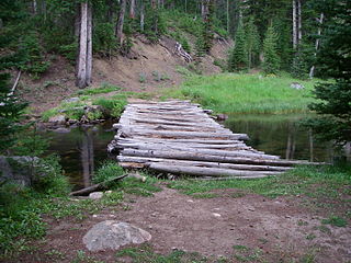
The Sawtooth National Recreation Area (SNRA) is a national recreation area in central Idaho, United States that is managed as part of Sawtooth National Forest. The recreation area, established on August 22, 1972, is managed by the U.S. Forest Service, and includes the Sawtooth, Hemingway–Boulders, and Cecil D. Andrus–White Clouds wilderness areas. Activities within the 730,864-acre (2,957.70 km2) recreation area include hiking, backpacking, White water rafting, camping, rock climbing, kayaking, mountain biking, fishing, and hunting.

The White Cloud Mountains are part of the Rocky Mountains of the western United States, located in central Idaho, southeast of Stanley in Custer County. The range is located within the Sawtooth National Recreation Area (SNRA) and partially within the Cecil D. Andrus–White Clouds Wilderness.

Castle Peak is a mountain in the western United States, the highest peak in the White Cloud Mountains of central Idaho and the Idaho Batholith. Located in Custer County, it is the 25th highest peak in the state, and the ninth most prominent.
Baker Lake is an alpine lake in Custer County, Idaho, United States, located in the White Cloud Mountains in the Sawtooth National Recreation Area. The name is derived from the fact that the lake is adjacent to mining claims held by the Baker family for many years.
Cornice Lake is an alpine lake in Custer County, Idaho, United States, located in the White Cloud Mountains in the Sawtooth National Recreation Area. The lake is in the Four Lakes Basin and is most easily accessed from Sawtooth National Forest trail 683.
Heart Lake is an alpine lake in Custer County, Idaho, United States, located in the White Cloud Mountains in the Sawtooth National Recreation Area. No trail lead to the lake, but it is most easily accessed from Sawtooth National Forest road 209.
Phyllis Lake is an alpine lake in Custer County, Idaho, United States, located in the White Cloud Mountains in the Sawtooth National Recreation Area. The lake is accessed from Sawtooth National Forest road 053.
Washington Lake is an alpine lake in Custer County, Idaho, United States, located in the White Cloud Mountains in the Sawtooth National Recreation Area. The lake is accessed from Sawtooth National Forest trails 109 and 203.
Sheep Lake is an alpine lake in Custer County, Idaho, United States, located in the White Cloud Mountains in the Sawtooth National Recreation Area. The lake can be accessed from Sawtooth National Forest trail 601.
Slide Lake is an alpine lake in Custer County, Idaho, United States, located in the White Cloud Mountains in the Sawtooth National Recreation Area. The lake can be accessed from Sawtooth National Forest trail 601.

Shelf Lake is an alpine lake in Custer County, Idaho, United States, located in the White Cloud Mountains in the Sawtooth National Recreation Area. The lake is named for a distinct rock shelf extending around the south and west shores of the lake.

Scoop Lake is an alpine lake in Custer County, Idaho, United States, located in the White Cloud Mountains in the Sawtooth National Recreation Area. The lake is accessed from Sawtooth National Forest trail 683.
Emerald Lake is an alpine lake in Custer County, Idaho, United States, located in the White Cloud Mountains in the Sawtooth National Recreation Area. While no trails lead to the lake, it can be accessed from Sawtooth National Forest trail 047.

Shallow Lake is an alpine lake in Custer County, Idaho, United States, located in the White Cloud Mountains in the Sawtooth National Recreation Area. While no trails lead to the lake, it can be accessed from Sawtooth National Forest trail 047.

Chamberlain Basin is a drainage basin that contains a chain of ten alpine and glacial Paternoster lakes in Custer County, Idaho, United States, located in the White Cloud Mountains in the Sawtooth National Recreation Area. Lakes are located on the upper portion of Chamberlain Creek in the Germania Creek watershed, a tributary of the East Fork Salmon River. Castle Peak, the highest summit in the White Cloud Mountains, rises to the east and north of Chamberlain Basin. Sawtooth National Forest trail 047 crosses the basin, although most people begin their trips at the Fourth of July Creek trailhead. Individual lakes do not have official names and are listed from lowest to highest elevation.

Merriam Peak, at 10,920 feet (3,330 m) is one of the peaks of the White Cloud Mountains of Custer County, Idaho. It was named for John H. Merriam who played an instrumental role in protecting the area from being mined for molybdenum. Merriam Peak is located in the middle of the range just north of Castle Peak, the highest point in the range. The peak is located in the White Clouds roadless area of Sawtooth National Recreation Area.
Washington Peak at 10,519 feet (3,206 m) above sea level is a peak in the White Cloud Mountains of Idaho. The peak is located in Sawtooth National Recreation Area in Custer County 2.37 mi (3.81 km) from Fourth of July Peak, its line parent. It is the 264th highest peak in Idaho.

Fourth of July Peak at 10,713 feet (3,265 m) above sea level is a peak in the White Cloud Mountains of Idaho. The peak is located in Sawtooth National Recreation Area in Custer County 2.54 mi (4.09 km) from Castle Peak, its line parent. It is the 201st highest peak in Idaho and rises to the west of Fourth of July and Washington lakes.

Patterson Peak at 10,872 feet (3,314 m) above sea level is a peak in the White Cloud Mountains of Idaho. The peak is located in Sawtooth National Recreation Area in Custer County 2.70 mi (4.35 km) west of Castle Peak, its line parent. Patterson Peak is about 1.5 mi (2.4 km) northeast of Fourth of July Peak, and it rises to the east of Fourth of July Lake. Glacier, Rock, Emerald, and Cornice lakes are in the basin to the northeast of the peak.
The Cecil D. Andrus–White Clouds Wilderness is a 90,769-acre (367.33 km2) protected area in the western United States, located in Custer County, Idaho. The Sawtooth National Recreation Area, in the Sawtooth National Forest, manages the majority of the wilderness, with 450 acres (180 ha) managed by the Bureau of Land Management at the wilderness's eastern edge along the East Fork Salmon River. The wilderness encompasses part of the White Cloud Mountains and is north of the Hemingway–Boulders Wilderness and west of the Jim McClure–Jerry Peak Wilderness.


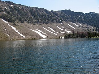
 Fourth of July Lake at lower right