Yukon is the smallest and westernmost of Canada's three territories. It is the most densely populated territory in Canada, with an estimated population of 46,704 as of 2024, though it has a smaller population than all provinces. Whitehorse, the territorial capital, is the largest settlement in any of the three territories.

The Mackenzie River is a river in the Canadian boreal forest. It forms, along with the Slave, Peace, and Finlay, the longest river system in Canada, and includes the second largest drainage basin of any North American river after the Mississippi.
Highway 97 is a major highway in the Canadian province of British Columbia. It is the longest continuously numbered route in the province, running 2,081 km (1,293 mi) and is the only route that runs the entire north–south length of British Columbia, connecting the Canada–United States border near Osoyoos in the south to the British Columbia–Yukon boundary in the north at Watson Lake, Yukon.

The Stewart–Cassiar Highway, also known as the Dease Lake Highway and the Stikine Highway as well as the Thornhill –Kitimat Highway from Kitimat to Thornhill, is the northwesternmost highway in the Canadian province of British Columbia. A scenic route through some of the province's most isolated areas, the highway first gained designation as British Columbia Highway 37 in the year 1975. At that time, its southern terminus was at the community of New Hazelton on the BC Highway 16. In 1975, with the completion of a new bridge over the Kitimat River, the highway's Yellowhead junction was relocated to a point on Highway 16 just south of the site of Kitwanga. Highway 37 was then extended south to Kitimat in 1986 superseding what was then designated Highway 25. At the north end, the highway briefly stretches into the Yukon, becoming Yukon Highway 37.

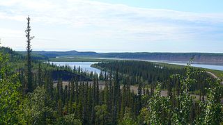
The Liard River of the North American boreal forest flows through Yukon, British Columbia and the Northwest Territories, Canada. Rising in the Saint Cyr Range of the Pelly Mountains in southeastern Yukon, it flows 1,115 km (693 mi) southeast through British Columbia, marking the northern end of the Rocky Mountains and then curving northeast back into Yukon and Northwest Territories, draining into the Mackenzie River at Fort Simpson, Northwest Territories. The river drains approximately 277,100 km2 (107,000 sq mi) of boreal forest and muskeg.

Watson Lake is a town in Yukon, Canada, located at mile 635 on the Alaska Highway close to the British Columbia border. It had a population of 1,133 in 2021. The town is named for Frank Watson, an American-born trapper and prospector, who settled in the area at the end of the 19th century.
The Liard River First Nation, also known as the Liard First Nation is a First Nation in the southeastern Yukon in Canada. Its main centres are Upper Liard and Watson Lake along the Alaska Highway. The language originally spoken by the people of this First Nation was Kaska and the First Nation is a member of the Kaska Tribal Council which is pursuing land claims in the Yukon and northern British Columbia. Their Indian and Northern Affairs Canada band number is 502.
The Kaska or Kaska Dena are a First Nations people of the Athabaskan-speaking ethnolinguistic group living mainly in northern British Columbia and the southeastern Yukon in Canada. The Kaska language, originally spoken by the Kaska, is an Athabaskan language.
Upper Liard is a chiefly First Nation settlement immediately west of Watson Lake in Canada's Yukon. It is situated at historical mile 642 of the Alaska Highway. Most of the residents are citizens of the Liard River First Nation, who also prominently populate the Two Mile area just north of Watson Lake.

The Rocky Mountain Trench, also known as the Valley of a Thousand Peaks or simply the Trench, is a large valley on the western side of the northern part of North America's Rocky Mountains. The Trench is both visually and cartographically a striking physiographic feature extending approximately 1,600 km (1,000 mi) from Flathead Lake, Montana, to the Liard River, just south of the British Columbia–Yukon border near Watson Lake, Yukon. The trench bottom is 3–16 km (1.9–9.9 mi) wide and is 600–900 m (2,000–3,000 ft) above sea level. The general orientation of the Trench is an almost straight 150/330° geographic north vector and has become convenient as a visual guide for aviators heading north or south.

The Kechika River is a tributary of the Liard River, about 300 kilometres (190 mi) long, in northern British Columbia, Canada. The Kechika flows generally northwest through the northernmost section of the Rocky Mountain Trench before turning east to join the Liard, a major branch of the Mackenzie River system. The river's 22,700 km2 (8,800 sq mi) drainage basin is characterized by high glaciated peaks, boreal forest, and open tundra. With no settlements, roads or dams along its course, the Kechika is considered "one of British Columbia's finest examples of wilderness and undisturbed wildlife habitat."
John McLeod was a Scottish-born explorer of Canada, in his capacity as a fur trader with the North West Company and Hudson's Bay Company. He was born at Valtos, Lochs in the Isle of Lewis. He is remembered primarily for his explorations of several major rivers of the southwestern Northwest Territories, southern Yukon Territory, and northern British Columbia.
Liard River Hot Springs Provincial Park is a provincial park in British Columbia, Canada. It is home to the second largest natural hot springs in Canada, after Deer River Hot Springs 15 km to the north east. It is a natural river of hot water rather than a spring fed man made pool. The park is part of the larger Muskwa-Kechika Management Area. The community of Liard River, British Columbia is located nearby.
Liard River is a river in the Yukon Territory, British Columbia and the Northwest Territories, Canada. The Liard River is an officially named Grand Canyon.

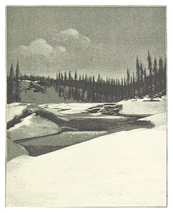
The South Nahanni River is a major tributary of the Liard River, located roughly 500 km (310 mi) west of Yellowknife in the Northwest Territories of Canada. It is the centerpiece of Nahanni National Park Reserve. It flows from the Mackenzie Mountains in the west, through the Selwyn Mountains, growing as it heads east over the majestic Virginia Falls, and finally empties into the Liard River. The Nahanni has a unique geological history. It was formed when the area was a broad flat plain, forming a winding course typical of flatland rivers. As the mountains lifted, the river cut four deep canyons into the rock, maintaining its eccentric course.

The history of the Yukon covers the period from the arrival of Paleo-Indians through the Beringia land bridge approximately 20,000 years ago. In the 18th century, Russian explorers began to trade with the First Nations people along the Alaskan coast, and later established trade networks extending into Yukon. By the 19th century, traders from the Hudson's Bay Company were also active in the region. The region was administered as a part of the North-Western Territory until 1870, when the United Kingdom transferred the territory to Canada and it became the North-West Territories.
Frances Lake is a lake of Yukon, Canada. With an area of 9,941 hectares it is the largest lake in southeast Yukon and the largest in territory that does not flow into the Yukon River, instead draining to the Frances River and then the Beaufort Sea via the Liard and Mackenzie rivers. The lake lies at an elevation of 734 m (2,408 ft) has an average depth of 31 m (102 ft) and a maximum depth of 93 m (305 ft).
The Tintina Trench is a roughly 970-kilometre-long (600-mile) valley extending from southwestern Yukon, Canada to the Yukon Flats in the central portion of the U.S. state of Alaska. It is a prominent topographic lineament along the northern extension of the Northern Rocky Mountain Trench in British Columbia and it has its origin from the Tintina Fault.
Egnell Creek is a tributary of the Hackett River in northwest part of the province of British Columbia, Canada. It flows generally southwest about 24 km (15 mi) to join the Hackett River near the Hackett's confluence with the Sheslay River, which in turn is a tributary of the Inklin River, the main southeast fork of the Taku River. Mount Egnell is located near the creek's mouth, as is the historic locality known as Egnell or Sheslay, once a telegraph station on the Yukon Telegraph Line.


