Franklin Township, Jackson County, Kansas

Last updated

Franklin Township
Map highlighting Franklin Township, Jackson County, Kansas.svg
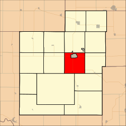
Location in Jackson County
Coordinates: 39°26′00″N95°44′21″W / 39.43333°N 95.73917°W / 39.43333; -95.73917
Country United States
State Kansas
County Jackson
Area
  Total
33.42 sq mi (86.57 km2)
  Land32.33 sq mi (83.73 km2)
  Water1.10 sq mi (2.84 km2)  3.28%
Elevation
1,125 ft (343 m)
Population
 (2000)
  Total
776
  Density24/sq mi (9.3/km2)
GNIS feature ID 0478189

Franklin Township is a township in Jackson County, Kansas, United States. As of the 2000 census, its population was 776. The southwesternmost part of the township is located within the Prairie Band Potawatomi Indian Reservation.

Contents

History

Franklin Township was formed in 1856. [1] It was named for Ben Franklin. [2]

Geography

Franklin Township covers an area of 33.43 square miles (86.57 square kilometers); of this, 1.1 square miles (2.84 square kilometers) or 3.28 percent is water. The stream of Banner Creek runs through this township.

Communities

(This list is based on USGS data and may include former settlements.)

Adjacent townships

Cemeteries

The township contains two cemeteries: Bruck and Holton.

Major highways

References

  1. Barr, Elizabeth N. (1907). Business directory and history of Jackson County. p. 13.
  2. Barr, Elizabeth N. (1907). Business directory and history of Jackson County. p. 33.