Waverly is a city in Coffey County, Kansas, United States. As of the 2020 census, the population of the city was 574.

Hepler is a city in Crawford County, Kansas, United States. As of the 2020 census, the population of the city was 90.
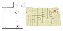
Mulberry is a city in Crawford County, Kansas, United States. As of the 2020 census, the population of the city was 409.

Jennings is a city in Decatur County, Kansas, United States. As of the 2020 census, the population of the city was 81.

Norcatur is a city in Decatur County, Kansas, United States. As of the 2020 census, the population of the city was 159.

Gove City, more commonly known as Gove, is a city in and the county seat of Gove County, Kansas, United States. As of the 2020 census, the population of the city was 80.

Meriden is a city in Jefferson County, Kansas, United States. As of the 2020 census, the population of the city was 744.

Edgerton is a city in Johnson County, Kansas, United States, and part of the Kansas City metropolitan area. As of the 2020 census, the population of the city was 1,748. It is home to a large BNSF intermodal train facility named Logistics Park Kansas City.

Kingman is a city in and the county seat of Kingman County, Kansas, United States. As of the 2020 census, the population of the city was 3,105.

Meade is a city in and the county seat of Meade County, Kansas, United States. As of the 2020 census, the population of the city was 1,505.

Corning is a city in Nemaha County, Kansas, United States. As of the 2020 census, the population of the city was 212.

Lyndon is a city in and the county seat of Osage County, Kansas, United States. As of the 2020 census, the population of the city was 1,037.

Minneapolis is a city in and the county seat of Ottawa County, Kansas, United States. As of the 2020 census, the population of the city was 1,946.

Andale is a city in Sedgwick County, Kansas, United States. As of the 2020 census, the population of the city was 941.
Mount Hope is a city in Sedgwick County, Kansas, United States. As of the 2020 census, the population of the city was 806.

Hoxie is a city in and the county seat of Sheridan County, Kansas, United States. As of the 2020 census, the population of the city was 1,211.

Mayfield is a city in Sumner County, Kansas, United States. As of the 2020 census, the population of the city was 75.

Alma is a city in and the county seat of Wabaunsee County, Kansas, United States. As of the 2020 census, the population of the city was 802.

Alta Vista is a city in Wabaunsee County, Kansas, United States. As of the 2020 census, the population of the city was 409.

Haddam is a city in Washington County, Kansas, United States. It is named after Haddam, Connecticut. As of the 2020 census, the population of the city was 110.