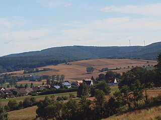
The Werra, a river in central Germany, is the right-bank headwater of the Weser. "Weser" is a synonym in an old dialect of German. The Werra has its source near Eisfeld in southern Thuringia. After 293 kilometres (182 mi) the Werra joins the river Fulda in the town of Hann. Münden, forming the Weser. If the Werra is included as part of the Weser, the Weser is the longest river entirely within German territory at 744 kilometres (462 mi).
Schmalkalden-Meiningen is a Landkreis in the southwest of Thuringia, Germany. Its neighboring districts are the districts Wartburgkreis, Gotha, Ilm-Kreis, the district-free city Suhl, the district Hildburghausen, the Bavarian district Rhön-Grabfeld, and the district Fulda in Hesse.
Wartburgkreis is a Kreis (district) in the west of Thuringia, Germany. Neighboring districts are the districts Unstrut-Hainich-Kreis, Gotha, Schmalkalden-Meiningen, and the districts Fulda, Hersfeld-Rotenburg and Werra-Meißner-Kreis in Hesse.

The Rhön Mountains are a group of low mountains in central Germany, located around the border area where the states of Hesse, Bavaria and Thuringia come together. These mountains, which are at the extreme southeast end of the East Hesse Highlands, are partly a result of ancient volcanic activity. They are separated from the Vogelsberg Mountains by the river Fulda and its valley. The highest mountain in the Rhön is the Wasserkuppe, which is in Hesse. The Rhön Mountains are a popular tourist destination and walking area.

Bad Salzungen is a town in Thuringia, Germany. It is the capital of the Wartburgkreis district.

Vacha is a town in the Wartburgkreis district, in Thuringia, Germany. It is situated on the river Werra, 15 km west of Bad Salzungen, and 23 km east of Bad Hersfeld.
Tiefenort is a village and a former municipality in the Wartburgkreis district of Thuringia, Germany. Since July 2018, it is part of the town Bad Salzungen. It is situated on the river Werra, 5 km west of Bad Salzungen, and 8 km east of Vacha, Germany.

Barchfeld is a village and a former municipality in the Wartburgkreis district of Thuringia, Germany. Since 31 December 2012, it is part of the municipality Barchfeld-Immelborn.
Marksuhl is a village and a former municipality in the Wartburgkreis district of Thuringia, Germany. Since July 2018, it is part of the municipality Gerstungen.
The East Hesse Highlands describes a heavily wooded range of hills lying mainly in the German state of Hesse, but also extending a little way into Lower Saxony to the north, Thuringia to the east and Bavaria to the southeast. The region is sandwiched between the West Hesse Depression to the west, the Weser Uplands to the north, the Thuringian Basin to the northeast, the northwestern edge of the Thuringian Forest to the east, the Spessart to the south and the Wetterau to the southwest.
The Haferberg is a hill, 580.4 m above sea level (NN), in the Kaufungen Forest in Hesse and Lower Saxony in Germany.

Monte Kali and Kalimanjaro are local colloquial names for the spoil heap or spoil tip that towers over the town of Heringen, Hesse, Germany. It is one of a number of sites where the K+S chemical company dumps sodium chloride, a byproduct of potash mining and processing, a major industry in the area.

The Hopfenberg is a wooded hill near Winterstein in the borough of Waltershausen, in the county of Gotha in the German state of Thuringia.

The Pleß is a mountain, 645.4 m above sea level (NHN), in the county of Schmalkalden-Meiningen in the Salzungen Werra Highland in the German state of Thuringia.

Bad Salzungen station is the railway station of the town of Bad Salzungen in the German state of Thuringia. It is located on the Werra Railway and on the Werra Valley Railway.

The Salzungen Werra Upland is a natural region in Germany that forms part of the East Hesse Highlands in the German states of Hesse and Thuringia.

The Seulingswald is a hill range in the German Central Uplands which reaches heights of up to 480.3 m above sea level (NHN). It is part of the Fulda-Werra Uplands in the East Hesse Highlands within the Hessian county of Hersfeld-Rotenburg; small ridges extend into the Thuringian county of Wartburgkreis. It is a sandstone range and one of the largest contiguous woodland areas in Hesse.

The Hornungskuppe is a wooded hill, 439 m above sea level (NHN), in the Thuringian Zipfel on the border of Hesse and Thuringia in Germany. It is part of the natural region of the Seulingswald.

Bocksberg is a levelled, medieval hilltop castle on the top of the cone-shaped hill of Bocksberg in the Rhön Mountains near Geisa and Schleid.
Wartburgkreis II – Eisenach is an electoral constituency represented in the Landtag of Thuringia. It elects one member via first-past-the-post voting. Under the current constituency numbering system, it is designated as constituency 6. It covers the city of Eisenach and central-western parts of Wartburgkreis.


