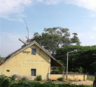
Holenarasipura is a town and taluk in Hassan district of Karnataka. The town is situated on the banks of the Hemavati, one of the tributaries of the Kaveri.

Athipattu is a census town in Chennai in Thiruvallur district in the state of Tamil Nadu, India. The neighbourhood is served by Athipattu railway station of the Chennai Suburban Railway network. it is a suburb in northern part of Chennai.
Bina Railway Colony is a census town in Sagar District of state of Madhya Pradesh in India.

Chakpara is a census town in Bally Jagachha CD Block of Howrah Sadar subdivision in Howrah district in the Indian state of West Bengal. It is a part of Kolkata Urban Agglomeration.

Chanpatia is a town and a notified area in Paschim Champaran district in the state of Bihar, India.
Chinchani is a census town in Palghar district in the state of Maharashtra, India.

Gummudipoondi is an industrial town in Chennai Metropolitan Region of Thiruvallur district in the Indian state of Tamil Nadu. Notably, it is the first legislation of Tamil Nadu.

Karuvanthuruthy is a census town in Kozhikode district in the Indian state of Kerala.
Kesabpur is a census town in Domjur CD Block of Howrah Sadar subdivision in Howrah district in the Indian state of West Bengal. It is a part of Kolkata Urban Agglomeration.

Lohian Khas is a town and a nagar panchayat in Jalandhar district in the Indian state of Punjab. There was 11 Wards in this town recently two more wards are constituted now currently 13 Wards represent this lohian town. A bus stand and railway station also situated here. As per Rail department's terminology lohian station comes under the category of Rail Junction, this type of terminology used where three or more rail tracks joins together and this imortant to mention here that historical city Patiala from railway point of view not comes under the category of junction By train people go to Makhu, Ferozpur, Sultanpur Lodhi, Kapurthala, Nakodar, Jalandhar and Ludhiana. There are schools for computer education and Ielts academies also here.

Manapakkam is a census town and part of the Chennai Metro city, in the Indian state of Tamil Nadu. Manapakkam is located along the Mount-Poonamallee Road in Chennai. It is now a home to many IT companies.
Meghnagar is a census town in Jhabua district in the Indian state of Madhya Pradesh.
Natibpur is a census town in Domjur CD Block of Howrah Sadar subdivision in Howrah district in the Indian state of West Bengal. It is a part of Kolkata Urban Agglomeration.
Pathiriyad is a census town in Kannur district in the Indian state of Kerala.
Ramchandrapur is a census town in Sankrail CD Block of Howrah Sadar subdivision in Howrah district in the Indian state of West Bengal. It is a part of Kolkata Urban Agglomeration.
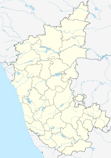
{{Infobox settlement | name = Raybag | other_name = Raibag | nickname = Bagi ur | settlement_type = town/taluka | image_skyline = | image_alt = | image_caption = | pushpin_map = India Karnataka#India3 | pushpin_label_position = right | pushpin_map_alt = | pushpin_map_caption = Location in Karnataka, India | coordinates = 16.48°N 74.78°E | subdivision_type = Country | subdivision_name = India | subdivision_type1 = State | subdivision_name1 = Karnataka | subdivision_type2 = District | subdivision_name2 = Belgaum | established_title = | established_date = | founder = | named_for = | government_type = | governing_body = Nagar Palika | unit_pref = Metric | area_footnotes = | area_rank = | area_total_km2 = | elevation_footnotes = | elevation_m = 590 | population_total = 18,984 | population_as_of = 2011 | population_rank = | population_density_km2 = auto | population_demonym = | population_footnotes = | demographics_type1 = Languages | demographics1_title1 = Official | demographics1_info1 = [[ಕನ್ನಡ][Kannada]] | timezone1 = IST | utc_offset1 = +5:30 | postal_code_type = | postal_code = 591317 | registration_plate = KA23 | website = karnataka.gov.in | iso_code = IN-KA | footnotes = }} Raybag is a panchayat town and taluka in Belgaum district in the Indian state of Karnataka. It derives its name from the two words namely "Raya'' and "bagh" in which "Raya'' means king and "bagh" means tiger.

Singaperumal Koil is a census town located close to Chengalpet and Maraimalai Nagar in Chengalpattu district in the Indian state of Tamil Nadu.
Talegaon Dabhade is a town in Mawal Taluka, Pune district, in the Indian state of Maharashtra. It is 120 km (75 mi) from Mumbai and 35 km (22 mi) from Pune.
Thandla is a town in Thandla Tehsil in Jhabua District of Madhya Pradesh, India. It belongs to Indore Division. It is located 30 km north of the District headquarters of Jhabua. It is a Tehsil headquarter.
Tirodi is a census town in Balaghat district in the Indian state of Madhya Pradesh.


 India
India 