
Niiza is a city in Saitama Prefecture, Japan. As of 1 January 2021, the city had an estimated population of 166,208 in 76,639 households and a population density of 7300 persons per km2. The total area of the city is 22.78 square kilometres (8.80 sq mi).

Ōgaki is a city located in Gifu, Japan. As of 31 October 2018, the city had an estimated population of 161,539, and a population density of 782 persons per km2 in 65,931 households. The total area of the city was 206.57 square kilometres (79.76 sq mi). Ōgaki was the final destination for the haiku poet Matsuo Bashō on one of his long journeys as recounted in his book Oku no Hosomichi. Every November the city holds a Bashō Festival.

Kashima is a city located in Ibaraki Prefecture, Japan. As of 1 July 2020, the city had an estimated population of 67,197 in 28,873 households and a population density of 634 persons per km2. The percentage of the population aged over 65 was 31.5%. The total area of the city is 106.02 square kilometres (40.93 sq mi). Kashima is the home of the J. League's Kashima Antlers. Its home field, Kashima Soccer Stadium, was used as a site during the 2002 FIFA World Cup. The city is also the site of the Kashima Shrine, one of the oldest Shinto shrines in eastern Japan, and considered the birthplace of many influential styles of Japanese swordsmanship (Kenjutsu).

Ōme is a city located in the western portion of Tokyo, Japan. As of 1 March 2021, the city had an estimated population of 131,895 in 63,917 households, and a population density of 1300 persons per km2. The total area of the city is 103.31 square kilometres (39.89 sq mi).

Shida Kartli is a landlocked administrative region (Mkhare) in eastern Georgia. Comprises a central part of the historical-geographic province of Shida Kartli. With an area of 5,729 square kilometres (2,212 sq mi), Shida Kartli is the 8th largest Georgian region by land area. With 284,081 inhabitants, it is Georgia's seventh-most-populous region. Shida Kartli's capital and largest city, Gori, is the 5th largest city in Georgia.

Estevan is the eighth-largest city in Saskatchewan, Canada. It is approximately 16 km (9.9 mi) north of the Canada–United States border. The Souris River runs by the city. This city is surrounded by the Rural Municipality of Estevan No. 5.

Tobishima is a village located in Ama District, Aichi Prefecture, in the Tōkai region of Japan. As of 1 October 2019, the town had an estimated population of 4,609 in 1765 households, and a population density of 206 persons per km². The total area of the village was 22.42 square kilometres (8.66 sq mi).

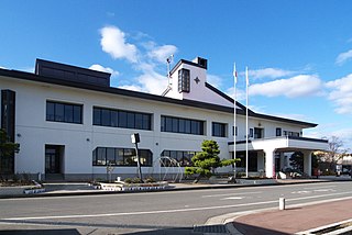
Kitaaiki is a village located in Nagano Prefecture, Japan. As of 1 April 2019, the village had an estimated population of 755 in 350 households, and a population density of 13 persons per km². The total area of the village is 56.32 square kilometres (21.75 sq mi).

Fujimi is a town located in Nagano Prefecture, Japan. As of 1 April 2019, the town had an estimated population of 14,485 in 5958 households, and a population density of 102 persons per km². The total area of the town is 144.76 square kilometres (55.89 sq mi).

Tatsuno is a town located in Nagano Prefecture, Japan. As of 1 June 2019, the town had an estimated population of 18,951 in 7917 households, and a population density of 112 persons per km². The total area of the town is 169.20 square kilometres (65.33 sq mi).

Shingō is a village located in Aomori Prefecture, Japan. As of 31 March 2020, the village has an estimated population of 2,408 in 922 households and a population density of 16 persons per km². The total area of the village is 150.77 square kilometres (58.21 sq mi).

Onjuku is a town located in Chiba, Japan. As of 30 November 2018, the town had an estimated population of 7,523 in 3683 households and a population density of 300 persons per km². The total area o the town is 24.86 square kilometres (9.60 sq mi). The name of the town is made of two kanji characters: the first 御 meaning "honorable", and the second 宿 meaning "residence".

Meiwa is a town located in Gunma Prefecture, Japan. As of 1 October 2020, the town had an estimated population of 11154 in 4303 households, and a population density of 570 persons per km². The total area of the town is 19.64 square kilometres (7.58 sq mi).

Yamatsuri is a town located in Fukushima Prefecture, Japan. As of 1 March 2020, the town had an estimated population of 5702 in 2095 households, and a population density of 48 persons per km². The total area of the town was 118.27 square kilometres (45.7 sq mi).
Noda is a village located in Iwate Prefecture, Japan. As of 31 March 2020, the village had an estimated population of 4,201, and a population density of 52 persons per km² in 1660 households. The total area of the village is 80.84 square kilometres (31.21 sq mi).

Namegata is a city located in Ibaraki Prefecture, Japan. As of 1 July 2020, the city had an estimated population of 32,144 in 11,412 households and a population density of 144.5 persons per km². The percentage of the population aged over 65 was 35.9%. The total area of the city is 222.48 square kilometres (85.90 sq mi).

Cova Figueira is a city in the southeastern part of the island of Fogo, Cape Verde. In 2010 its population was 1,230, making it the most populated place in the municipality. It is situated 22 km east of the island capital São Filipe. Since 2005, it serves as the seat of Santa Catarina do Fogo Municipality. Its elevation is 480 meters above sea level. The volcano Pico do Fogo is 7.7 km to the northwest. Nearby places include Figueira Pavão in the southwest, Mãe Joana and Estância Roque in the west and Tinteira in the north. Cova Figueira was elevated to a city in 2010.

Seubersdorf is a municipality in the district of Neumarkt in Bavaria in Germany.

Matsukawa is a village located in Nagano Prefecture, Japan. As of 1 April 2019, the village had an estimated population of 9,689 in 3813 households, and a population density of 210 persons per km². The total area of the village is 47.07 square kilometres (18.17 sq mi).

Waldkirchen is a small village in the municipality of Seubersdorf in the German state of Bavaria. It is in the Upper Palatinate, in the Neumarkt district. It has a total population of about 25 people.


