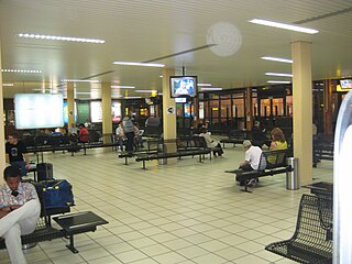
Transport in Guinea is composed by a variety of systems that people in the country use to get around as well as to and from domestic and international destinations. The railway from Conakry to Kankan ceased operating in the mid-1980s. Most vehicles in Guinea are 20+ years old, and cabs are any four-door vehicle which the owner has designated as being for hire. Domestic air services are intermittent. Conakry International Airport is the largest airport in the country, with flights to other cities in Africa as well as to Europe.
PNG Air is an airline based on the grounds of Jacksons International Airport, Port Moresby, Papua New Guinea. It operates scheduled domestic and international flights, as well as contract corporate charter work. Its main base is Jacksons International Airport.
Lancaster Regional Airport is two miles south of Lancaster, in Dallas County, Texas. Formerly Lancaster Airport, the National Plan of Integrated Airport Systems for 2011–2015 categorized it as a general aviation reliever airport.

Léon-Mba International Airport is an airport situated in Libreville, Gabon. It is the main international airport in the country and was constructed in the 1950s.
La Fría Airport, also known as Francisco García de Hevia International Airport, is an airport serving La Fría, a town in the Táchira state of Venezuela. The runway is 2 kilometres (1.2 mi) northwest of the town.
Gbenko Airport is an airstrip serving Banankoro in Guinea. It is 4 miles (6.4 km) north of Banankoro, near the village of Gbenko.
Faranah Airport is an airport serving the city of Faranah in Guinea. The airport is 2 kilometres (1.2 mi) west of the city, across the Niger River.
Kankan Airport is an airport serving Kankan, capital of the Kankan Region in Guinea. It is 7 kilometres (4.3 mi) northeast of the city, 2 kilometres (1.2 mi) south of the village of Diankana.

Kissidougou Airport is an airport serving Kissidougou, a city in the Faranah Region of Guinea. The airport is 3 kilometres (1.9 mi) southwest of the city.
Sambailo Airport is an airport serving Koundara, a town in the Boké Region of Guinea. It is 11 kilometres (6.8 mi) northwest of Koundara, at the village of Sambailo.
Tata Airport is an airport serving Labé in Guinea.
Nzérékoré Airport is an airport serving Nzérékoré in Guinea. The airport is in the countryside, 12 kilometres (7.5 mi) northeast of the city.
Sangarédi Airport is an airport serving Sangarédi in Guinea. The airport is 12 kilometres (7.5 mi) northeast of the city.
Siguiri Airport is an airport serving Siguiri, a river port in western Guinea. The airport is south of the town and 2 kilometres (1.2 mi) west of the Niger River.

Pilot Point Airport is a state-owned, public-use airport located in Pilot Point, a city in the Lake and Peninsula Borough of the U.S. state of Alaska. Scheduled airline service to King Salmon Airport is provided by Grant Aviation.

Clearfield–Lawrence Airport is a public use airport located two nautical miles northeast of the central business district of Clearfield, a borough in Clearfield County, Pennsylvania, United States. It is owned by the Clearfield–Lawrence Airport Authority.

Annobón Airport is an airport in San Antonio de Palé, Annobón, Equatorial Guinea.
President Obiang Nguema International Airport, is an airport located 1.0 kilometre (0.6 mi) southwest of the town of Mengomeyén, in the mainland province of Wele-Nzas, Equatorial Guinea. The airport is named after Teodoro Obiang Nguema Mbasogo, who has been president of Equatorial Guinea since 1979.
Beyla Airport is an airport serving the town of Beyla in the Nzérékoré Region of Guinea. The airport is 9 kilometres (5.6 mi) west of Beyla.


