Frisco Peak is a summit near the north‑center edge of Beaver County, Utah, United States. [1]
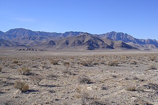
At an elevation of 9,629 feet (2,935 m), [1] it is the highest peak within the San Francisco Mountains. It looks over the Wah Wah Valley to the west. Because of its relative location and elevation, it is the site of multiple radio transmission facilities. [2]
The name of the peak is a contraction of the mountain range in which it is located. [3]

The geography of the U.S. State of Colorado is diverse, encompassing both rugged mountainous terrain, vast plains, desert lands, desert canyons, and mesas. Colorado is a landlocked U.S. state. In 1861, the United States Congress defined the boundaries of the new Territory of Colorado exclusively by lines of latitude and longitude, stretching from 37°N to 41°N latitude, and from 102°02'48"W to 109°02'48"W longitude. Starting in 1868, official surveys demarcated the boundaries, deviating from the parallels and meridians in several places. Later surveys attempted to correct some of these mistakes but in 1925 the U.S. Supreme Court affirmed that the earlier demarcation was the official boundary. The borders of Colorado are now officially defined by 697 boundary markers connected by straight boundary lines. Colorado, Wyoming, and Utah are the only states that have their borders defined solely by straight boundary lines with no natural features. The southwest corner of Colorado is the Four Corners Monument at 36°59'56"N, 109°2'43"W. This is the only place in the United States where four states meet: Colorado, New Mexico, Arizona, and Utah.
The Beaver Dam Wash is a seasonal stream near the southwestern Utah-Nevada border in the United States. At its southern end in northern Arizona, near the point where it empties into the Virgin River, the stream flows throughout the year. Part of the wash is in the Beaver Dam Wash National Conservation Area, managed by the Bureau of Land Management. The wash was so named on account of beaver dams which once were built on its course.

Frisco is a ghost town in Beaver County, Utah, United States. It was an active mining camp from 1879 to 1929. At its peak in 1885, Frisco was a thriving town of 6,000 people.
The Confusion Range is a north-south trending mountain range in west-central Utah, United States. It is bounded by Snake Valley to the west, Tule Valley to the east, the Great Salt Lake Desert to the north, and the Ferguson Desert to the south. The range trends into the Burbank Hills, Mountain Home Range, and the Wah Wah Mountains to the south. In the central part of the range, an offshoot of the mountains to the west is known as the Conger Range. The Confusion Range is named for its "rugged isolation and confusing topography."
Trout Creek is an unincorporated community, in far western Juab County, Utah, United States.

The Ferguson Desert is a small valley in the Hamlin-Snake Watershed of west-central Utah, southeast of the Snake Valley to the northwest, and is bound by the Burbank Hills to the west, the Tunnel Springs Mountains, Pine Valley, and Wah Wah Valley to the south, and the House Range to the north and east; Antelope Valley from the southwest is the southeast border of the Burbank Hills. It is named after James (Jim) Ferguson of Ibapah, Utah. He established a large ranch in the area. The term desert comes from the large hardpan that covers the area.

The Burbank Hills are a small northwest-southeast mountain range in western Utah, United States that lie entirely within the Hamlin-Snake Watershed, between the Snake Range and the Ferguson Desert. It is bounded by Snake Valley to the north, west, and south; and trends into the Tunnel Springs Mountains, to the southeast, opposite the Antelope Valley on its southeast border. It was named after the settlement of Burbank, Utah, and Margie Burbank Clay, the wife of local Judge E. W. Clay in the 1870s.
Mollie's Nipple or Molly's Nipple is the name given to as many as seven peaks, at least one butte, at least one well, and some other geological features in Utah. Some sources claim there are eleven geological features in Utah that bear this name. At least some of those names are attributed to John Kitchen – a pioneer of an early exploration of Utah, who named them to commemorate a nipple of his wife Molly.

The Cricket Mountains are a 35-mile (56 km) long mountain range located in central-south Millard County, Utah, United States, on the east border of Sevier Lake, in the Great Basin Desert.

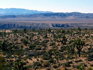
The San Francisco Mountains are a 20-mile-long (32 km) mountain range located in north‑central Beaver County, Utah, United States that extend into central-south Millard County.

The U.S. state of Utah has the solar potential to provide all of the electricity used in the United States. Utah is one of the seven states with the best potential for solar power, along with California, Nevada, Arizona, New Mexico, Colorado, and Texas. Utah's only investor owned utility currently allows partial net metering for residential systems up to 25 kW and up to 2 MW for non-residential users. In the past RMP allowed full net metering, and partial net metering. Neither of these Schedules allows for new customers to sign up any longer. Utah's municipal utilities and electric cooperatives set their own net metering policies.
Crystal Spring is a spring in northern Beaver County, Utah, United States.
Diamond Gulch is a gulch in eastern Juab County, Utah, United States.
38°31′13″N113°17′15″W / 38.52028°N 113.28750°W
| | This article about a location in Utah is a stub. You can help Wikipedia by expanding it. |