The Forestry Commission is a non-ministerial government department responsible for the management of publicly owned forests and the regulation of both public and private forestry in England. It was formerly also responsible for Forestry in Wales and Scotland, however on 1 April 2013, Forestry Commission Wales merged with other agencies to become Natural Resources Wales, whilst two new bodies were established in Scotland on 1 April 2019.

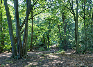
In the United Kingdom, an ancient woodland is a woodland that has existed continuously since 1600 or before in England, Wales and Northern Ireland. Planting of woodland was uncommon before those dates, so a wood present in 1600 is likely to have developed naturally.
Cuckmere Valley is a civil parish in the Wealden District of East Sussex, England. As its name suggests, the parish consists of a number of small settlements in the lower reaches of the River Cuckmere.

Long Man is a civil parish in the Wealden District of East Sussex, England which includes the villages of Wilmington, Milton Street and Folkington. The parish is named after the Long Man of Wilmington, a 69.2-metre (227 ft) chalk figure in the parish.

The Sussex Wildlife Trust (SWT) is a conservation charity which aims to protect natural life in Sussex. It was founded in 1961 and is one of 46 wildlife trusts across the UK and the Isle of Man and Alderney. As of 2019, it has 33,000 members and manages 2,000 hectares of land for nature. It is a registered charity and in the year to 31 March 2019 it had an income of £5.7 million and expenditure of £4 million, resulting in net income of £1.7 million.

Delamere Forest is a large wood in the village of Delamere in Cheshire, England. The woodland, which is managed by Forestry England, covers an area of 972 hectares making it the largest area of woodland in the county. It contains a mixture of deciduous and evergreen trees.

East Dean and Friston is a civil parish in the Wealden District of East Sussex, England.The two villages in the parish are in a dry valley on the South Downs – between Eastbourne three miles (4.8 km) to the east and Seaford an equal distance to the west. The main A259 road goes through both village centres. The coast and much of the land between it and the A259 from the east edge of Seaford to the west edge of Eastbourne is owned by the National Trust, and this has prevented further development to the area.

Willingdon and Jevington is one of the civil parishes in the Wealden District of East Sussex, England. The two villages lie one mile (1.6 km) south of Polegate. The two parishes, two decades ago, were separate; the merger of the two has produced a parish of over 7,000 people. Willingdon is part of the built-up area which is Eastbourne, and lies on the main A22 road, whilst Jevington is on a minor road leading to Friston. In addition under the name of Willingdon it is also an electoral ward.
The following are lists of recreational walks in East Sussex, England

Kielder is a small, remote village in western Northumberland, England. Located at the head of Kielder Water and in the north west of Kielder Forest, the village is within three miles of the Scottish border.

Dalby Forest is a forest located on the southern slopes of the North York Moors National Park in North Yorkshire, England. It is maintained by Forestry England. Dalby Forest, along with Langdale Forest and Cropton Forest, forms part of the North Riding Forest Park, found within the North York Moors National Park.

The English Lowlands beech forests are a terrestrial ecoregion in the United Kingdom, as defined by the World Wide Fund for Nature (WWF) and the European Environment Agency (EEA). It covers 45,600 km2 (17,600 sq mi) of Southern England, approximately as far as the border with Devon and South Wales in the west, into the Severn valley in the north-west, into the East Midlands in the north, and up to the border of Norfolk in the north-east of its range. The WWF code for this ecoregion is PA0421.

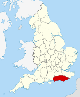
Sussex is a historic county and cultural region in the south of England corresponding roughly in area to the ancient Kingdom of Sussex. It is bounded on the north by Surrey, north-east by Kent, south by the English Channel, and west by Hampshire, and is divided for local government into West Sussex and East Sussex and the city of Brighton and Hove. The city of Brighton & Hove was created a unitary authority in 1997, and was granted City status in 2000. Until then Chichester had been Sussex's only city. By convention, Chichester is Sussex's capital city and Lewes is Sussex's county town.

The United Kingdom, being in the British Isles, is ideal for tree growth, thanks to its mild winters, plentiful rainfall, fertile soil and hill-sheltered topography. Growth rates for broadleaved (hardwood) trees exceed those of mainland Europe, while conifer (softwood) growth rates are three times those of Sweden and five times those of Finland. In the absence of people, much of Great Britain would be covered with mature oaks, except for Scotland. Although conditions for forestry are good, trees do face damage threats arising from fungi, parasites and pests. The development of afforestation and the production and supply of timber in Wales come under Natural Resources Wales, as set out in the Forestry Act 1967.

Scotland is ideal for tree growth, thanks to its mild winters, plentiful rainfall, fertile soil and hill-sheltered topography. As of 2019 about 18.5% of the country was wooded. Although this figure is well below the European Union (EU) average of 43%, it represents a significant increase compared to the figure of 100 years previously: in 1919 it was estimated that only 5% of the country's total land area was covered in forest. The Scottish Government's Draft Climate Change Plan has set an aim of increasing coverage to 21% of Scotland by 2032, with the rate of afforestation rising to 15,000 hectares per year by 2024.

St Leonard's Forest SSSI is an 85.4-hectare (211-acre) biological Site of Special Scientific Interest east of Horsham in West Sussex. The SSSI is in two separate areas, with the western part being in the 289-hectare (710-acre) Forestry Commission managed St Leonard's Forest.


