It is surrounded by the former Gangapraspur VDC to the east, Koilabas VDC to the south, Bela VDC to the west and Chailahi VDC to the north. The North-South Damodar road runs through Gadhawa and communicates with the Indian border via Koilabas VDC and to the East-West highway (Mahendra highway) via Chailahi VDC. The majority of the population consists of Tharu, Khas Brahmin, and Yadav. There are a few Muslims. Most people are agriculturalists; however, a few are employed in small businesses.There are 8 wards in Gadhawa rural municipality including ward number 6 (Balakhuti)village.
↑ Census figures for 1991 "Nepal Census 2001". Nepal's Village Development Committees. Digital Himalaya. Archived from the original on 12 October 2008. Retrieved 21 September 2008.
External links
Dang District(PDF) (Map). Office for the Coordination of Humanitarian Affairs (OCHA), United Nations, Nepal. 15 June 2006. Archived(PDF) from the original on 23 September 2018. Map of roads in Dang District.
Dang District(PDF) (Map). Office for the Coordination of Humanitarian Affairs (OCHA), United Nations, Nepal. 4 March 2008. Archived(PDF) from the original on 10 July 2019. Map of former VDCs in Dang District.
Bardiya District, one of the seventy-seven Districts of Nepal, is part of Lumbini Province of Nepal. The district, with Gulariya as its headquarters, covers an area of 2,025 km2 (782 sq mi) and according to the 2001 census the population was 382,649 in 2011 it has 426,576.
Ghorahi is the largest city of Nepal and largest sub-metropolitan city by area and population of Lumbini Province. The city lies in Lumbini Province in the Mid-Western part of Nepal. It is the largest city of Dang Deukhuri District of southwest Nepal. Located in the Inner Terai region, it lies 413 kilometres (257 mi) south-west of Nepal's capital Kathmandu and is one of the Counter Magnets being developed as an alternative centre of growth to help ease the migration and population explosion in the Kathmandu metropolitan area. It is the largest city of the Rapti Zone and is surrounded by the Sivalik Hills to the south and Mahabharata Range to the north.
A village development committee in Nepal was the lower administrative part of its Ministry of Federal Affairs and Local Development. Each district had several VDCs, similar to municipalities but with greater public-government interaction and administration. There were 3,157 village development committees in Nepal. Each village development committee was further divided into several wards depending on the population of the district, the average being nine wards.
Bijauri is a town and Village Development Committee in Dang Deokhuri District in Lumbini Province of south-western Nepal. At the time of the 1991 Nepal census it had a population of 9,729 persons living in 1599 individual households.
Chailahi is a town and Village Development Committee in Dang Deokhuri District in Lumbini Province of south-western Nepal. At the time of the 1991 Nepal census it had a population of 10,800 persons living in 1485 individual households. It lies in the east west highway and lied 23 km east to districts capital Ghorahi.
Gobardiha is a village of Gadawa Village Council in Dang Deukhuri District in Lumbini Province of south-western Nepal. At the time of the 2011 Nepal census, it had a population of 15,322, where the total female population was 7991 and the male population was 7331 in 2,873 individual households.
Koilabas is a bazaar town situated in Gadhawa Rural Municipality in Dang Deokhuri District in Lumbini Province of south-western Nepal. The town is situated on the southern edge of the Dudhwa Range of the Siwaliks, at Nepal's border with Uttar Pradesh 5 km from the village Jarwa on the other side. Indian and Nepalese nationals may cross the border unrestricted however there is a customs checkpoint for goods. Koilabas has regular bus service to Tulsipur on the Gorakhpur-Gonda Loop of Indian Railways.
Urahari is a village and former Village Development Committee that is now part of Tulsipur Sub-Metropolitan City in Dang Deokhuri District in Lumbini Province of south-western Nepal. In 2014, Urahari VDC was annexed into Tulsipur. At the time of the 1991 Nepal census it had a population of 8,764 persons living in 1288 individual households.
Rampur is a town and Village Development Committee in Dang Deukhuri District in Lumbini Province of south-western Nepal. At the time of the 1991 Nepal census it had a population of 9,422 persons living in 1576 individual households.
Saudiyar is a town and Village Development Committee in Dang Deokhuri District in Lumbini Province of south-western Nepal. At the time of the 1991 Nepal census it had a population of 8,052 persons living in 1067 individual households.
Dhikurpokhari is a suburb and former Village Development Committee in Kaski District in the Gandaki Province of northern-central Nepal. At the time of the 1991 Nepal census it had a population of 7,392 persons living in 1,427 individual households.
Babare is a village in Kalinchowk Rural Municipality in Dolakha District in the Bagmati Province of north-eastern Nepal. At the time of the 1991 Nepal census it had a population of 3,392 people living in 739 individual households.
Melung is a Rural municipality located within the Dolakha District of the Bagmati Province of Nepal. The municipality spans 86.54 square kilometres (33.41 sq mi) of area, with a total population of 20,210 according to a 2011 Nepal census.
Khandadevi is a populated place and a ward of Khandadevi Rural Municipality. It was a village development committee before 10 March 2017. At the time of the 1991 Nepal census it had a population of 3,751 people living in 650 individual households.
Kanepokhari Rural Municipality is a Gaunpalika located in the center of Morang District, Province No. 1, Nepal.
Badahara (बडहरा) is the name of a village in Dang, Lumbini Province, Nepal. It is now located in Gadhawa Rural Municipality ward number 1, but before the consolidation of four VDCs into Gadhawa Rural Municipality in 2015, it was part of the Gobardiya, village development committee (VDC), ward No. 2.
Sundar Haraicha is a municipality in Morang District of Koshi Province in Nepal. It is centered around Biratchowk town which is the gateway to Biratnagar. It borders Itahari Sub- Metropolitan city to the West, Dharan Sub- Metropolitan city to the Northwest and Belbari municipality to the East and is connected by the Mahendra Highway. It is one of the fastest growing cities in the Eastern Nepal and the second largest city of Morang district after Biratnagar with 121,305 inhabitants living in 26,677 households. It consists the town centres of Biratchowk and Gothgaun which are parts of the Greater Birat Development Area which incorporates the cities of Biratnagar-Itahari-Gothgau-Biratchowk-Dharan primarily located on the Koshi Highway in Eastern Nepal, with an estimated total urban agglomerated population of 804,300 people living in 159,332 households.
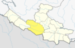
Gadhawa Rural Municipality is located in Deukhuri valley of Dang district of Lumbini Province, Nepal. This rural municipality was declared on Falgun 12, 2073 Vikram Samvat. It lies from 195 meter to 885 meter above sea level. The former Gadhawa VDC office was the administrative center of Gadhawa Rural Municipality for 4 years of its inception and then the office of the executive was moved to a new building. According to the preliminary report of population census 2078, Gadhawa Rural Municipality has 46275 population where male and female comprises 22650 (48.95%) and 23625 (51.05%) population respectively. During local level restructuring, this rural municipality was formed by annexing former four VDCs named Gobardiya, Gangapraspur, Gadhawa and Koilabas. This rural municipality has a 358.57 square km area and is divided into 8 wards. It is surrounded by Arghakhanchi and Kapilvastu districts from the east, Rajapur Rural Municipality from the west, Lamahi Municipality and Rapti Rural Municipality in the north, and India in the south direction.
Rajpur Rural Municipality is a municipal unit in Dang District, Lumbini Province in western Nepal. It was formed by a combination of the erstwhile Bela and Rajpur Village Development Committees. The center of the Rural Municipality is located at Gangdi.
This page is based on this Wikipedia article Text is available under the CC BY-SA 4.0 license; additional terms may apply. Images, videos and audio are available under their respective licenses.