Banke District (Nepali: बाँके जिल्ला[bãke], a part of Lumbini Province, is one of the 77 districts of Nepal. The district, located in midwestern Nepal with Nepalganj as its district headquarters, covers an area of 2,337 km2 and had a population of 385,840 in 2001 and 491,313 in 2011. There are three main cities in the Banke District: Nepalganj, Kohalpur and Khajura Bajaar.

Bardiya District, one of the seventy-seven Districts of Nepal, is part of Lumbini Province of Nepal. The district, with Gulariya as its headquarters, covers an area of 2,025 km2 (782 sq mi) and according to the 2001 census the population was 382,649 in 2011 it has 426,576.
Kailali District, a part of Sudurpashchim Province in Terai plain, is one of the 77 districts of Nepal. The district, with Dhangadhi as its district headquarters, covers an area of 3,235 square kilometres (1,249 sq mi) and has a population 911,155 and, .

Kapilvastu district, often Kapilbastu, is one of the districts of Lumbini Province, Nepal. The district, with Kapilbastu municipality as its district headquarters, covers an area of 1,738 square kilometres (671 sq mi) and in 2001 had a population of 481,976, which increased to 571,936 in 2011 and later according 2021 census it further increased to 686,739 Kapilvastu district has 3 number of seats for central whereas 6 seats for state level elections.

Pyuthan District (Nepali: प्युठान जिल्ला[piu̯ʈʰan], is a "hill" district some 250 km west of Kathmandu in Lumbini Province in midwestern Nepal. Pyuthan covers an area of 1,309 km2 with population of 212,484 in 2001 and 226,796 in 2011. Pyuthan Khalanga is the district's administrative center.
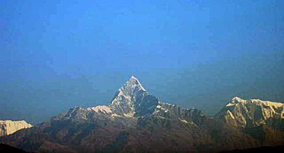
Machhapuchchhre is a Gaunpalika and former village development committee in Kaski District in the Gandaki Province of northern-central Nepal. At the time of the 1991 Nepal census it had a population of 1,881 persons living in 378 individual households.
Galchhi is a Gaupalika(Nepali: गाउपालिका ; gaupalika) Formerly: village development committee) in Dhading District in the Bagmati Province of central Nepal. The local body was formed by merging three VDCs namely Baireni, Kalleri and Goganpani. Currently, it has a total of 8 wards. The population of the rural municipality is 27784 according to the data collected on 2017 Nepalese local elections.

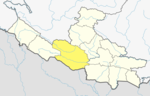
Nawalpur or is a district located in Gandaki Province of Nepal. It is 1 out of 11 districts of Gandaki Province. The headquarter of the district is Kawasoti.

Gadhawa Rural Municipality is located in Deukhuri valley of Dang district of Lumbini Province, Nepal. This rural municipality was declared on Falgun 12, 2073 Vikram Samvat. It lies from 195 meter to 885 meter above sea level. The former Gadhawa VDC office was the administrative center of Gadhawa Rural Municipality for 4 years of its inception and then the office of the executive was moved to a new building. According to the preliminary report of population census 2078, Gadhawa Rural Municipality has 46275 population where male and female comprises 22650 (48.95%) and 23625 (51.05%) population respectively. During local level restructuring, this rural municipality was formed by annexing former four VDCs named Gobardiya, Gangapraspur, Gadhawa and Koilabas. This rural municipality has a 358.57 square km area and is divided into 8 wards. It is surrounded by Arghakhanchi and Kapilvastu districts from the east, Rajapur Rural Municipality from the west, Lamahi Municipality and Rapti Rural Municipality in the north, and India in the south direction.
Lamahi Municipality is a municipality in Dang District of Lumbini Province, Nepal. It was created in 2015 as part of the conversion from the old zone/village development committee structure to the province/municipality structure. In 2011 the municipality had a population of 47,655 with 9,432 households.
Rajpur Rural Municipality is a municipal unit in Dang District, Lumbini Province in western Nepal. It was formed by a combination of the erstwhile Bela and Rajpur Village Development Committees. The center of the Rural Municipality is located at Gangdi.
Ghiring Rural Municipality (Ghiring Gaupalika) (Nepali: घिरिङ्ग गाउँपालिका) is a Gaunpalika in Tanahaun District in Gandaki Province of Nepal. On 12 March 2017, the government of Nepal implemented a new local administrative structure, in which VDCs have been replaced with municipal and Village Councils. Ghiring is one of these 753 local units.
Myagde Rural Municipality (Myagde Gaupalika) (Nepali: म्याग्दे गाउँपालिका) is a Gaunpalika in Tanahaun District in Gandaki Province of Nepal. On 12 March 2017, the government of Nepal implemented a new local administrative structure, in which VDCs have been replaced with municipal and Village Councils. Myagde is one of these 753 local units.
Ajirkot Rural Municipality is a Gaunpalika in Gorkha District in Gandaki Province of Nepal. On 12 March 2017, the government of Nepal implemented a new local administrative structure, with the implementation of the new local administrative structure, VDCs have been replaced with municipal and Village Councils. Ajirkot is one of these 753 local units.
Rapti Rural Municipality is a Gaunpalika in Dang District in Lumbini Province of Nepal. On 12 March 2017, the government of Nepal implemented a new local administrative structure, with the implementation of the new local administrative structure, VDCs have been replaced with municipal and Village Councils. Rapti is one of these 753 local units.
Dangisharan Rural Municipality is a Gaunpalika in Dang District in Lumbini Province of Nepal. On 12 March 2017, the government of Nepal implemented a new local administrative structure, with the implementation of the new local administrative structure, VDCs have been replaced with municipal and Village Councils. Dangisharan is one of these 753 local units.
Babai Rural Municipality is a Gaunpalika in Dang District in Lumbini Province of Nepal. On 12 March 2017, the government of Nepal implemented a new local administrative structure, with the implementation of the new local administrative structure, VDCs have been replaced with municipal and Village Councils. Babai is one of these 753 local units. Babai Rural Municipality has area of 257.48 km2. Babai RM is surrounded by Shantinagar Rural Municipality and Dangisharan Rural Municipality in the east, Banke district in the west, Salyan district in the north and in south there is Dangisharan Rural Municipality and Banke district.
Banglachuli Rural Municipality is a Gaunpalika in Dang District in Lumbini Province of Nepal. On 12 March 2017, the government of Nepal implemented a new local administrative structure, with the implementation of the new local administrative structure, VDCs have been replaced with municipal and Village Councils. Banglachuli is one of these 753 local units.
Benighat Rorang is a rural municipality located within the Dhading District of the Bagmati Province of Nepal. The rural municipality spans 29.17 square kilometres (11.26 sq mi), with a total population of 31,475 according to a 2011 Nepal census.
Sarumarani is a Rural municipality located within the Pyuthan District of the Lumbini Province of Nepal. The rural municipality spans 157.97 square kilometres (60.99 sq mi) of area, with a total population of 18,627 according to a 2011 Nepal census.