
Gagarin, known until 1968 as Gzhatsk (Гжатск), is a town and the administrative centre of Gagarinsky District of Smolensk Oblast, Russia, located on the Gzhat River, 240 kilometers (150 mi) northeast of Smolensk, the administrative centre of the oblast. Population: 31,721 (2010 Russian census); 28,789 (2002 Census); 28,867 (1989 Soviet census).
Alexeyevsky District is the name of several administrative and municipal districts in Russia. The districts' name generally derives from or is related to the male first name Alexey.

Krasninsky District is the name of several administrative and municipal districts in Russia:

Pochinkovsky District is the name of several administrative and municipal districts in Russia:

Smolensky District is the name of several administrative and municipal districts in Russia:
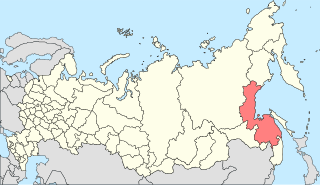
Vyazemsky District is the name of several administrative and municipal districts in Russia.

Roslavl is a town and the administrative center of Roslavlsky District in Smolensk Oblast, Russia. It is a road and rail junction and a market town. Population: 54,900 (2010 Russian census); 57,701 (2002 Census); 60,470 (1989 Soviet census).
Dukhovshchina is a town and the administrative center of Dukhovshchinsky District in Smolensk Oblast, Russia, located on the Vostitsa River 57 kilometers (35 mi) northeast of Smolensk, the administrative center of the oblast. Population: 4,371 (2010 Russian census); 4,683 (2002 Census); 5,747 (1989 Soviet census).
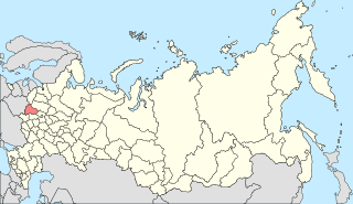
Rudnyansky District is the name of several administrative and municipal districts in Russia:
Malakhovka is the name of several inhabited localities in Russia.
Leninsky District is the name of several administrative and municipal divisions in Russia. The districts are named after Vladimir Lenin, the founder of the Soviet state.
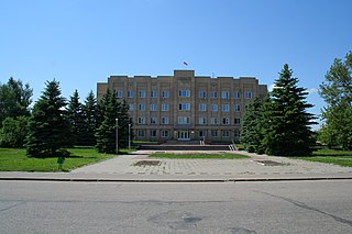
Gagarinsky District is an administrative and municipal district (raion), one of the twenty-five in Smolensk Oblast, Russia. It is located in the northeast of the oblast. The area of the district is 2,904.59 square kilometers (1,121.47 sq mi). Its administrative center is the town of Gagarin. Population: 48,928 ; 46,401 (2002 Census); 21,978 (1989 Soviet census). The population of Gagarin accounts for 64.8% of the district's total population.
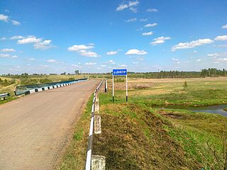
Kholm-Zhirkovsky District is an administrative and municipal district (raion), one of the twenty-five in Smolensk Oblast, Russia. It is located in the north of the oblast. The area of the district is 2,033.40 square kilometers (785.10 sq mi). Its administrative center is the urban locality of Kholm-Zhirkovsky. Population: 10,717 ; 12,815 (2002 Census); 15,966 (1989 Soviet census). The population of the administrative center accounts for 32.6% of the district's total population.

Safonovsky District is an administrative and municipal district (raion), one of the twenty-five in Smolensk Oblast, Russia. It is located in the northern central part of the oblast. The area of the district is 2,258.46 square kilometers (872.00 sq mi). Its administrative center is the town of Safonovo. Population: 61,572 ; 65,251 (2002 Census); 17,115 (1989 Soviet census). The population of Safonovo accounts for 74.9% of the district's total population.
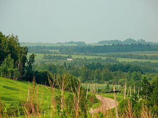
Smolensky District is an administrative and municipal district (raion), one of the twenty-five in Smolensk Oblast, Russia. It is located in the west of the oblast and borders with Demidovsky District in the north, Dukhovshchinsky District in the northeast, Kardymovsky District in the east, Pochinkovsky District in the south, Monastyrshchinsky District in the southwest, Krasninsky District in the west, and with Rudnyansky District in the northwest. The area of the district is 2,494.98 square kilometers (963.32 sq mi). Its administrative center is the city of Smolensk. Population: 44,964 ; 47,281 (2002 Census); 50,620 (1989 Soviet census).

Tyomkinsky District is an administrative and municipal district (raion), one of the twenty-five in Smolensk Oblast, Russia. It is located in the northeast of the oblast. The area of the district is 1,324.22 square kilometers (511.28 sq mi). Its administrative center is the rural locality of Tyomkino. Population: 6,348 ; 6,916 (2002 Census); 8,160 (1989 Soviet census). The population of the administrative center accounts for 38.0% of the district's total population.

Ugransky District is an administrative and municipal district (raion), one of the twenty-five in Smolensk Oblast, Russia. It is located in the east of the oblast. The area of the district is 2,868.52 square kilometers (1,107.54 sq mi). Its administrative center is the rural locality of Ugra. Population: 8,916 ; 11,022 (2002 Census); 14,005 (1989 Soviet census). The population of Ugra accounts for 48.0% of the district's total population.

Vyazemsky District is an administrative and municipal district (raion), one of the twenty-five in Smolensk Oblast, Russia. It is located in the northeast of the oblast. The area of the district is 3,337.90 square kilometers (1,288.77 sq mi). Its administrative center is the town of Vyazma. Population: 80,436 ; 81,305 (2002 Census); 25,106 (1989 Soviet census). The population of Vyazma accounts for 71.0% of the district's total population.

Yelninsky District is an administrative and municipal district (raion), one of the twenty-five in Smolensk Oblast, Russia. It is located in the southeast of the oblast and borders with Dorogobuzhsky District in the north, Ugransky District in the east, Spas-Demensky District of Kaluga Oblast in the southeast, Roslavlsky District in the south, Pochinkovsky District in the west, and with Glinkovsky District in the northwest. The area of the district is 1,808.15 square kilometers (698.13 sq mi). Its administrative center is the town of Yelnya. Population: 14,948 ; 17,457 (2002 Census); 19,699 (1989 Soviet census). The population of Yelnya accounts for 67.5% of the district's total population.
Rudnyanskoye Urban Settlement is the name of several municipal formations in Russia.


