References
- ↑ "Gardi". Geographic Names Information System . United States Geological Survey, United States Department of the Interior . Retrieved February 20, 2016.
- ↑ "Gardi CDP, Georgia". United States Census Bureau . Retrieved March 13, 2022.
- ↑ Krakow, Kenneth K. (1975). Georgia Place-Names: Their History and Origins (PDF). Macon, GA: Winship Press. p. 91. ISBN 0-915430-00-2.
- ↑ "Decennial Census of Population and Housing by Decades". US Census Bureau.
- 1 2 3 "P2 Hispanic or Latino, and Not Hispanic or Latino by Race – 2020: DEC Redistricting Data (PL 94-171) – Gardi CDP, Georgia". United States Census Bureau .
Municipalities and communities of Wayne County, Georgia, United States | ||
|---|---|---|
| Cities | 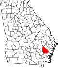 | |
| Town | ||
| CDP | ||
| Unincorporated community | ||
| Ghost town | ||
31°32′18″N81°47′53″W / 31.53833°N 81.79806°W
| | This Wayne County, Georgia state location article is a stub. You can help Wikipedia by expanding it. |