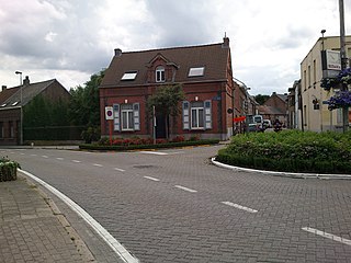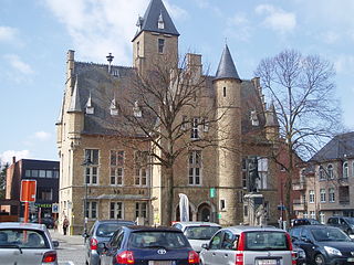
Middelkerke is a municipality located in the Belgian province of West Flanders, on the North Sea, west of Ostend. The municipality comprises the villages of Leffinge, Lombardsijde, Mannekensvere, Middelkerke proper, Schore, Sint-Pieters-Kapelle, Slijpe, Westende and Wilskerke. On January 1, 2006, Middelkerke had a total population of 17,841. The total area is 75.65 km2 which gives a population density of 236 inhabitants per km2.

Hooglede is a municipality located in the Belgian province of West Flanders. The municipality comprises the towns of Gits and Hooglede proper. On January 1, 2006, Hooglede had a total population of 9,831. The total area is 37.84 km2 which gives a population density of 260 inhabitants per km2.

Koksijde is a town and a municipality in Belgium. It is located on the North Sea coast in the southwest of the Flemish province of West Flanders.

Denderleeuw is a municipality located in the Belgian province of East Flanders in the Denderstreek. The municipality comprises the towns of Denderleeuw proper, Iddergem and Welle. In 2021, Denderleeuw had a total population of 20.730. The total area is 13.77 km2. The river Dender flows through the municipality.

Haaltert is a municipality located in the Belgian province of East Flanders in the Denderstreek. The municipality comprises the towns of Denderhoutem, Haaltert proper, Heldergem and Kerksken. In 2021, Haaltert had a total population of 18,892. The total area is 30.30 km². The current mayor of Haaltert is Veerle Baeyens, from the N-VA.

Herzele is a municipality located in the Belgian province of East Flanders in the Denderstreek. The municipality comprises the villages of Borsbeke, Herzele proper, Hillegem, Ressegem, Sint-Antelinks, Sint-Lievens-Esse, Steenhuize-Wijnhuize and Woubrechtegem. In 2021, Herzele had a total population of 18,414. The total area is 47.40 km2. The current mayor of Herzele is Johan Van Tittelboom, from the Open Flemish Liberals and Democrats party.

Hamme is a municipality located in the Belgian province of East Flanders. The municipality comprises the settlements of Hamme proper, Kastel Moerzeke, Sint-Anna and Zogge. In 2018, Hamme had a total population of 24,827. The total area is 40.21 km². The current mayor of Hamme is Herman Vijt, from the CD&V party.

Lebbeke is a municipality located in the Belgian province of East Flanders in the Denderstreek. The municipality comprises the towns of Denderbelle, Lebbeke proper and Wieze. In 2021, Lebbeke had a total population of 19,560. The total area is 27.31 km². Lebbeke is home to the chocolate factory Callebaut.

Lochristi is a municipality located in the Belgian province of East Flanders. The municipality is composed of the towns of Beervelde, Lochristi proper, Zaffelare and Zeveneken. As of 2021, Lochristi had a total population of 22,621. The total area is 60.34 km2 (23.30 sq mi).

Merelbeke is a municipality located in the Flemish province of East Flanders, in Belgium. The municipality comprises the villages of Bottelare, Lemberge, Melsen, Merelbeke proper, Munte and Schelderode. In 2021, Merelbeke had a total population of 24,779. The total area is 36.65 km2.

Maarkedal is a municipality located in the Belgian province of East Flanders. The municipality comprises the towns of Etikhove, Maarke-Kerkem, Nukerke and Schorisse, and part of the hamlet of Louise-Marie. In 2021, Maarkedal had a total population of 6,362. The total area is 45.63 km2.

Zwalm is a municipality located in Flanders, in the Flemish province of East Flanders, in Belgium. The municipality comprises the villages of Beerlegem, Dikkele, Hermelgem, Hundelgem, Meilegem, Munkzwalm, Nederzwalm, Paulatem, Roborst, Rozebeke, Sint-Blasius-Boekel, Sint-Denijs-Boekel and Sint-Maria-Latem. In 2021, Zwalm had a total population of 8,244. The total area is 33.82 km2.

Niel is a municipality located in the Belgian province of Antwerp. The municipality only comprises the town of Niel proper. In 2021, Niel had a total population of 10,493. The total area is 5.27 km2.

Wuustwezel is a municipality located in the north of the Belgian province of Antwerp.

Zandhoven is a municipality in the Belgian province of Antwerp. The municipality comprises the villages of Massenhoven, Pulderbos, Pulle, Viersel and Zandhoven proper. In 2021, Zandhoven had a population of 13,124. The total area is 40.10 km2.

Zoersel is a municipality located in the Belgian province of Antwerp. The municipality comprises the towns of Halle, St. Antonius, and Zoersel proper. In 2021, Zoersel had a total population of 22,142. The total area is 38.65 km2.

Bonheiden is a municipality located in the Belgian province of Antwerp. The municipality comprises the towns of Bonheiden proper and Rijmenam. In 2021, Bonheiden had a total population of 15,177. The total area is 29.27 km2 (11.30 sq mi).

Bornem is a municipality located in the Belgian province of Antwerp. The municipality comprises the village of Bornem proper, Hingene, Mariekerke and Weert, and Wintam. There are also the hamlets of Branst, Buitenland, Eikevliet and Wintam. In 2021, Bornem had a total population of 21,428. The total area is 45.76 km2.

Lille is a municipality located in the Belgian Antwerp Province. The municipality comprises the towns of Lille, Gierle, Poederlee, and Wechelderzande. In 2021, Lille had a total population of 16,517. The total area is 59.62 km².

Vorselaar is a municipality located in the Belgian province of Antwerp. The municipality comprises only the town of Vorselaar proper. In 2021, Vorselaar had a total population of 7,995. The total area is 27.62 km2.


