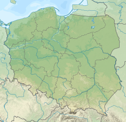
Suwałki is a city in northeastern Poland with a population of 69,206 (2021). It is the capital of Suwałki County and one of the most important centers of commerce in the Podlaskie Voivodeship. Suwałki is the largest city and the capital of the historical Suwałki Region. Until 1999 it was the capital of Suwałki Voivodeship. Suwałki is located about 30 km (19 mi) from the southwestern Lithuanian border and gives its name to the Polish protected area known as Suwałki Landscape Park. The Czarna Hańcza river flows through the city.

The Czarna Hańcza, Chornaya Hancha is the largest river of the Suwałki Region of north-eastern Poland and the Sapockin region of north-western Belarus. It is known for having large postglacial boulders. Originating near Lake Hańcza and flowing through lake Hańcza and Wigry Lake, the Czarna Hańcza is a tributary of the river Neman beyond the borders of Belarus and Lithuania. It flows through the city of Suwałki.

Suwałki Region is a historical region around the city of Suwałki in northeastern Poland near the border with Lithuania. It encompasses the powiats of Augustów, Suwałki, and Sejny, and roughly corresponds to the southern part of the former Suwałki Governorate.
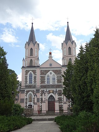
Puńsk is a village in the Podlaskie Voivodeship in northeastern Poland, seat of the Gmina Puńsk in the Sejny County. It is located only 5 km (3.1 mi) from the border with Lithuania.

Kampinos Forest is a large forest complex located in Masovian Voivodeship, west of Warsaw in Poland.

The Sejny Uprising or Seinai Revolt refers to a Polish uprising against the Lithuanian authorities in August 1919 in the ethnically mixed area surrounding the town of Sejny. When German forces, which occupied the territory during World War I, retreated from the area in May 1919, they turned over administration to the Lithuanians. Trying to prevent an armed conflict between Poland and Lithuania, the Entente drew a demarcation line, known as the Foch Line. The line assigned much of the disputed Suwałki (Suvalkai) Region to Poland and required the Lithuanian Army to retreat. While the Lithuanians retreated from some areas, they refused to leave Sejny (Seinai), because of its major Lithuanian population. Polish irregular forces began the uprising on August 23, 1919, and soon received support from the regular Polish Army. After several military skirmishes, Polish forces secured Sejny and the Lithuanians retreated behind the Foch Line.
The Suwałki Agreement, Treaty of Suvalkai, or Suwalki Treaty was an agreement signed in the town of Suwałki between Poland and Lithuania on October 7, 1920. It was registered in the League of Nations Treaty Series on January 19, 1922.

Protected areas of Poland include the following categories, as defined by the Act on Protection of Nature of 16 April 2004, by the Polish Parliament:

Drawsko Landscape Park is a protected area in north-western Poland, established in 1979, covering an area of 414.3 square kilometres (160.0 sq mi).

Janów Forests Landscape Park,, is a Polish Landscape Park designated protected area in southeastern Poland.
Powidz Landscape Park is a protected area in west-central Poland, established in 1998, covering an area of 246 square kilometres (95 sq mi).

Rudno Landscape Park is a protected area in southern Poland. The area of the park is 58.139 km², while its buffer zone is 67.13 km². Established in 1981.

Sobibór Landscape Park is a protected area created in Lublin Voivodeship, eastern Poland in 1983. It takes its name from the village of Sobibór.

Spała Landscape Park is a protected area in central Poland, established in 1995, covering an area of 128.75 square kilometres (49.71 sq mi). It takes its name from the village of Spała.
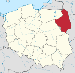
Podlaskie Voivodeship is a voivodeship (province) in northeastern Poland. The name of the province refers to the historical region of Podlachia, and part of its territory corresponds to that region. The capital and largest city is Białystok.

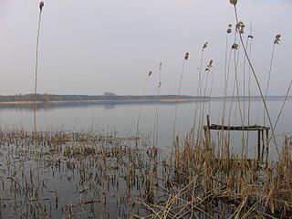
Pogubie Wielki is a lake located in the Masurian Plains, on the terrain of the Puszcza Piska, to the South-Western direction of Pisz, in Poland,

The Lithuania–Poland border is the state border between the Republic of Lithuania and the Republic of Poland. The length of the border is 104 kilometres (65 mi). It runs from the Lithuania–Poland–Russia tripoint southeast to the Belarus–Lithuania–Poland tripoint. It is an internal border of the European Union and the Schengen Zone.

Chrząszczewska Island is an island in West Pomeranian Voivodeship, north-western Poland, with an area of 10 square kilometres (3.9 sq mi). It is located in Kamieński Lagoon, in Kamień County, linked with the mainland by bridge around the town of Kamień Pomorski. The island is limited by Kamieński Lagoon to the north, Promna Bay to the east, Cicha Bay to the south and the river of Dziwna to the west and south-west.

Chłop Lake is a ribbon lake located within the Pszczew Landscape Park, in the Lubusz Voivodeship, in the Międzyrzecz County, in the Gmina Pszczew. About 1 km from the northern end of the lake lies the town of Pszczew.

Lake Lubie is a lake in Poland located in the Łagów Lake District, situated in the Lubusz Voivodeship, in Świebodzin County, in the Gmina Lubrza. It is the second deepest lake on average in the Lubusz Lake District. The lake was formed as a result of the Weichselian glaciation and has a regular shoreline.