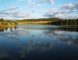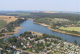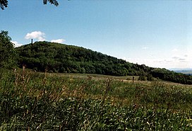
The Ore Mountains lie along the Czech–German border, separating the historical regions of Bohemia in Czech Republic and Saxony in Germany. The highest peaks are the Klínovec in the Czech Republic, which rises to 1,244 metres (4,081 ft) above sea level and the Fichtelberg in Germany.

Altenberg is a town in the Sächsische Schweiz-Osterzgebirge district, in the Free State of Saxony, Germany.

Geising is a Stadtteil of Altenberg in the Sächsische Schweiz-Osterzgebirge district, in the Free State of Saxony, Germany. It is situated in the Ore Mountains, close to the border with the Czech Republic, 13 km (8.1 mi) north of Teplice, and 32 km (20 mi) south of Dresden. Since 1 January 2011, it is part of the town Altenberg.

The Dresden S-Bahn is a network of S-Bahn-type commuter train services in Dresden and the surrounding area. It is commissioned by Verkehrsverbund Oberelbe (VVO) from DB Regio Verkehrsbetrieb Südostsachsen and currently consists of three services operating over a 127.7 km-long (79.3 mi) network.

Krupka is a town in Teplice District in the Ústí nad Labem Region of the Czech Republic. It has about 13,000 inhabitants. The town is located in the Ore Mountain Mining Region, an UNESCO World Heritage Site, and during the late Middle Ages it was one of the world-leading producers of tin and silver. The centre of Krupka is well preserved and is protected by law as an urban monument zone.

The Red Weißeritz is a river of Saxony, Germany.

The Saxon Class V K were German 0-8-0T narrow gauge steam locomotives operated by the Royal Saxon State Railways which had been primarily intended for the Müglitztalbahn. In 1925 the Deutsche Reichsbahn incorporated arranged these locomotives as DRG Class 99.61.

The Heidenau–Kurort Altenberg railway, also known in German as the Müglitztalbahn is a German railway in Saxony. Branching off the Elbe Valley Railway, it connects the town of Heidenau near Dresden with the towns of Glashütte and Altenberg in Erzgebirge, where it terminates. The total length is 38 km, with a total incline of 634 meters. The scenic track follows primarily the Müglitz river, passing the towns of Dohna, Glashütte and Geising.

The Rax-Schneeberg Group is a mountain range in the Northern Limestone Alps on the Styrian-Lower Austrian border in Austria.

Hirschsprung is a village and a former municipality in the eastern Ore Mountains in Saxony, Germany. It is 35 kilometres (22 mi) south of Dresden, 6 kilometres (3.7 mi) from Czech border. Since 1965 it has been part of the town of Altenberg.

The Müglitz is a river, about 49 km (30 mi) long, and a left tributary of the Elbe in the German state of Saxony.

The Ore Mountains/Vogtland Nature Park extends across the upper slopes of the Vogtland and Ore Mountains in southeastern Germany along its international border with Czech Republic. It is the longest nature park in Germany with a total length of 120 km. Its management organisation is the Zweckverband Naturpark Erzgebirge/Vogtland. It includes the following conservation areas:

The Cross-border Mining Education Trail from Krupka to Geising, Altenberg, Zinnwald and Cínovec to Dubí is a 40 km long mining history educational trail in the upper Eastern Ore Mountains in Germany and the Czech Republic. It links seventy sites connected with the history of mining and settlement in this cross-border region of the Ore Mountains. The educational trail describes the development of what was once the most important tin mining regions in Central Europe. In order to hike the trail, a walking map is recommended that contains detailed maps and short descriptions of the waypoints en route and the opening times of the museums.

The Kohlhaukuppe is a 786-metre-high (2,579 ft) mountain in the Eastern Ore Mountains near Geising not far from the border with the Czech Republic.

The Städtebahn Sachsen is a railway company that operated regional train services in Saxony, Germany by order of Verkehrsverbund Oberelbe. Städtebahn is a subsidiary of Nordbayerische Eisenbahngesellschaft (NBE) and started its operations in 2010.

The Ore Mountain Ski Hiking Trail is a long distance, cross-country, ski hiking trail along the whole length of the Ore Mountain crest between Schöneck/Vogtl. and Altenberg.
The Kammweg ("Ridgeway") was a long-distance path opened in 1904 along the crest of the Elster Mountains, Ore Mountains, Bohemian Switzerland, Lusatian Mountains, Ještěd Mountains, Jizera and Giant Mountains, Śnieżnik Mountains and High Ash Mountains. This path was once the longest tourist trail in the German-speaking region of Europe. Since 2011 the ridgeway tradition has been continued with the Ore Mountains-Vogtland Ridgeway, which runs on the German side of the border.

Bouřňák is a mountain in the Ore Mountains, in the municipality of Moldava in the Czech Republic. The mountain is known as one of the most important ski resorts of the Ore Mountains. The windswept beech forest on the northeast side of the summit, an area of 3.26 ha, has been placed under protection since 1979 as a natural monument.

Black Mountain is a small mountain range in eastern Slovakia. It forms part of the Slovak Ore Mountains. The range is located roughly between the city of Košice to the southeast and the municipalities of Krompachy to the northwest and Kysak to the northeast and has an area of about 250 km². Its highest point is the Roháčka between Margecany and Kluknava.

The Saxon III K were a class of six 0-6-2T locomotives of the Royal Saxon State Railways with a track gauge of 750 mm. In 1925, the Deutsche Reichsbahn grouped these locomotives into their DRG Class 99.754.


