
The Ore Mountains lie along the Czech–German border, separating the historical regions of Bohemia in the Czech Republic and Saxony in Germany. The highest peaks are the Klínovec in the Czech Republic at 1,244 metres (4,081 ft) above sea level and the Fichtelberg in Germany at 1,215 metres (3,986 ft).

Saxon Switzerland is a hilly climbing area and national park in the Elbe Sandstone Mountains. It is located around the Elbe valley south-east of Dresden in Saxony, Germany, adjoining Bohemian Switzerland in the Czech Republic. Together with the Czech part, the region is known as Saxon-Bohemian Switzerland.

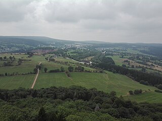
Altenberg is a town in the Sächsische Schweiz-Osterzgebirge district, in Saxony, Germany.

The 140-kilometre-long Silver Road is the first and longest holiday route in the German Free State of Saxony. Against the background of the importance of mining in the history of Saxony, the road links those sights and tourist attractions of the Ore Mountains and its foreland that relate to the centuries-old mining and smelting industries of the region.

The Royal Saxon State Railways were the state-owned railways operating in the Kingdom of Saxony from 1869 to 1918. From 1918 until their merger into the Deutsche Reichsbahn the title 'Royal' was dropped and they were just called the Saxon State Railways.
Mittelsachsen is a district (Kreis) in the Free State of Saxony, Germany.
Saxon Switzerland-Eastern Ore Mountains is a district (Kreis) in Saxony, Germany. It is named after the mountain ranges Saxon Switzerland and Eastern Ore Mountains.
The Saxon Highlands and Uplands refer to a natural region mainly in the south of Saxony with small elements also in southeast Thuringia and northeast Bavaria. It comprises, from (south)west to (north)east, of the Vogtland, the Ore Mountains, Saxon Switzerland, the Upper Lusatian Plateau and the Zittau Hills.

The Zittau Mountains, formerly also called the Lusatian Ridge, refer to the German part of the Lusatian Mountains that straddle the Saxon-Bohemian border in the extreme southeast of the German state of Saxony.

The Ore Mountain passes are crossings and passages over the crest of the Ore Mountains in Central Europe, over which tracks, roads, railway lines and pipelines run from the Free State of Saxony in the Federal Republic of Germany to Bohemia in the Czech Republic and vice versa.

The Ore Mountains/Vogtland Nature Park extends across the upper slopes of the Vogtland and Ore Mountains in southeastern Germany along its international border with Czech Republic. It is the longest nature park in Germany with a total length of 120 km. Its management organisation is the Zweckverband Naturpark Erzgebirge/Vogtland. It includes the following conservation areas:

The Central or Middle Ore Mountains is a natural region that forms the central-western part of the Ore Mountains in the German federal state of Saxony. It is part of the overarching unit, the Saxon Highlands and Uplands. It forms the eastern part of the former major units, the Lower Western Ore Mountains and Upper Western Ore Mountains and is separated from the Eastern Ore Mountains in the east by the (included) valley of the Flöha, and from the Western Ore Mountains in the west by the (excluded) valley of the Schwarzwasser and, below its mouth, by the Zwickauer Mulde.
The Western Ore Mountains is a natural region that forms the westernmost part of the Ore Mountains in the German state of Saxony. It is also part of the major landscape unit known as the Saxon Highlands and Uplands. It extends eastwards to include the valley of the Schwarzwasser, and, below its mouth, that of the Zwickauer Mulde, and incorporates the western parts of the former major units known as the Lower and Upper Western Ore Mountains, no. 423, as well as the Southern Slopes of the Ore Mountains, no. 420.

The Saxon Elbeland is a term used in more recent times which describes a region along the Elbe, whose boundaries are not clearly defined, but which extends roughly from the Elbe Sandstone Mountains to Torgau. The best-known cities and town in this area are Dresden, Meißen, Riesa and Torgau. The term is largely synonymous with the region along the river known as the Upper Elbe (Oberelbe), i.e. the German section of the Elbe River nearest its source region.
The Kammweg ("Ridgeway") was a long-distance path opened in 1904 along the crest of the Elster Mountains, Ore Mountains, Bohemian Switzerland, Lusatian Mountains, Ještěd Mountains, Jizera and Giant Mountains, Śnieżnik Mountains and High Ash Mountains. This path was once the longest tourist trail in the German-speaking region of Europe. Since 2011 the ridgeway tradition has been continued with the Ore Mountains-Vogtland Ridgeway, which runs on the German side of the border.

The Georgenfelder Hochmoor is a raised bog (Hochmoor) in the German Ore Mountains of central Europe, not far from Zinnwald-Georgenfeld. It is part of a larger bog or moor complex, that lies to the south, mainly on the far side of the Germany's national border in the Czech Republic and which, since time immemorial, has been known simply as "The Lake". The Georgenfelder Hochmoor is one of the oldest nature reserves in Saxony.

The classification of natural regions of Saxony shown here was produced between 1994 and 2001 by a working group called "Ecosystem and Regional Character" at the Saxonian Academy of Sciences in Leipzig as part of the research and development project "Natural Regions and Natural Region Potential of the Free State of Saxony" at a scale of 1:50,000 as the basis for the rural development and regional planning. This was also supported by the Saxon State Ministry of the Environment and Agriculture and the Saxon Ministry of the Interior.
Eastern Ore Mountains is a nature park near Teplice, Czech Republic. The nature park was founded in 1995. It covers an area of 40 km2. The nature park is known for its diverse habitats, including peat bogs and mountain meadows. The nature park Eastern Ore Mountains lies in the UNESCO World Heritage Site Ore Mountains. It is part of the special protection area Východní Krušné Hory, which was founded in 2005, because of the population of black grouse and other endangered bird species within it.


