Saxon Uplands

Last updated
Frankenstein in the Ore Mountain Foreland Frankenstein-Sommer.jpg
Frankenstein in the Ore Mountain Foreland

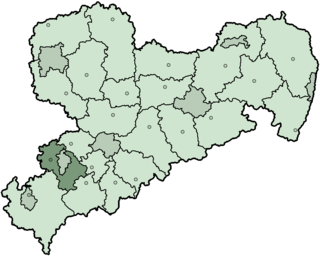
The Saxon Uplands, [1] Saxon Hills [2] or Ore Mountain Foreland (German : Erzgebirgsvorland) is a strip of countryside of about 200 m to 500 m above  sea level (NN) high, in the German state of Saxony, that lies immediately north of the German Ore Mountains and runs mainly through the areas of Zwickauer Land, Zwickau, Chemnitzer Land, Chemnitz, Mittelsachsen and the country south of Dresden. It borders on the Upper Pleißeland to the extreme west, the Ore Mountain Basin in the south and the Mulde Loess Hills to the north and east.

German language West Germanic language

German is a West Germanic language that is mainly spoken in Central Europe. It is the most widely spoken and official or co-official language in Germany, Austria, Switzerland, South Tyrol (Italy), the German-speaking Community of Belgium, and Liechtenstein. It is also one of the three official languages of Luxembourg and a co-official language in the Opole Voivodeship in Poland. The languages which are most similar to German are the other members of the West Germanic language branch: Afrikaans, Dutch, English, the Frisian languages, Low German/Low Saxon, Luxembourgish, and Yiddish. There are also strong similarities in vocabulary with Danish, Norwegian and Swedish, although those belong to the North Germanic group. German is the second most widely spoken Germanic language, after English.

Normalnull

Normalnull or Normal-Null is an outdated official vertical datum used in Germany. Elevations using this reference system were to be marked "Meter über Normal-Null". Normalnull has been replaced by Normalhöhennull.

Saxony State in Germany

Saxony, officially the Free State of Saxony, is a landlocked federal state of Germany, bordering the federal states of Brandenburg, Saxony Anhalt, Thuringia, and Bavaria, as well as the countries of Poland and the Czech Republic. Its capital is Dresden, and its largest city is Leipzig.

Contents

Immediately north of the Western and Central Ore Mountains lie the cities of Zwickau and Chemnitz in the Ore Mountain Basin, whose western extension, the Upper Pleißeland is usually considered part of the basin today. Northeast of Chemnitz a narrow strip of land, the Mulde Loess Hills (Mulde-Lösshügelland) is squeezed in between the Dresden Basin (Elbtalkessel) and the eastern section of the Ore Mountains. [3]

Western Ore Mountains

The Western Ore Mountains is a natural region that forms the westernmost part of the Ore Mountains in the German federal state of Saxony. It is also part of the major landscape unit known as the Saxon Highlands and Uplands. It extends eastwards to include the valley of the Schwarzwasser, and, below its mouth, that of the Zwickauer Mulde, and incorporates the western parts of the former major units known as the Lower and Upper Western Ore Mountains, no. 423, as well as the Southern Slopes of the Ore Mountains, no. 420.

Central Ore Mountains

The Central or Middle Ore Mountains is a natural region that forms the central-western part of the Ore Mountains in the German federal state of Saxony. It is part of the overarching unit, the Saxon Highlands and Uplands. It forms the eastern part of the former major units, the Lower Western Ore Mountains and Upper Western Ore Mountains and is separated from the Eastern Ore Mountains in the east by the (included) valley of the Flöha, and from the Western Ore Mountains in the west by the (excluded) valley of the Schwarzwasser and, below its mouth, by the Zwickauer Mulde.

Zwickau Place in Saxony, Germany

Zwickau is a town in Saxony, Germany, and the capital of the Zwickau district. It is situated in a valley at the foot of the Erzgebirge mountains, it is part of Central Germany and geographically linked to the urban areas of Leipzig-Halle, Dresden and Chemnitz, the town has approximately 100,000 inhabitants. From 1834 until 1952 Zwickau was the seat of the government of the south-western region of Saxony.

Natural divisions

The Ore Mountains are often divided into the following areas (main units based on Meynen, and, in brackets, the Federal Office for Nature Conservation (Bundesamt für Naturschutz or BfN):

The Ore Mountain Basin or Erzgebirge Basin is a natural region in the German federal state of Saxony, that is part of the Saxon Lowland. To the north it borders on the Mulde Loess Hills and to the south on several natural regions in the Saxon Highlands and Uplands.

Related Research Articles

Ore Mountains low mountain range in central Europe

The Ore Mountains or Ore Mountain Range in Central Europe have formed a natural border between Saxony and Bohemia for around 800 years, from the 12th to the 20th centuries. Today, the border between Germany and the Czech Republic runs just north of the main crest of the mountain range. The highest peaks are the Klínovec, which rises to 1,244 metres (4,081 ft) above sea level and the Fichtelberg.

Zwickauer Mulde river in Germany

The Zwickauer Mulde is a river in Saxony, Germany. It is the left tributary of the Mulde and 166 km in length.

Zwickauer Land District in Saxony, Germany

Zwickauer Land is a former Kreis (district) in the south-west of the Free State of Saxony, Germany. Neighboring districts were Chemnitzer Land, Stollberg, Aue-Schwarzenberg, Vogtlandkreis, and the districts Greiz and Altenburger Land in Thuringia. The district-free city of Zwickau was located in the center of the district and nearly completely surrounded by it.

North German Plain plain in Germany

The North German Plain or Northern Lowland is one of the major geographical regions of Germany. It is the German part of the North European Plain. The region is bounded by the coasts of the North Sea and the Baltic Sea to the north and Germany's Central Uplands to the south.

Royal Saxon State Railways transport company

The Royal Saxon State Railways were the state-owned railways operating in the Kingdom of Saxony from 1869 to 1918. From 1918 until their merger into the Deutsche Reichsbahn the title 'Royal' was dropped and they were just called the Saxon State Railways.

The Saxon Loess Fields refer to a natural region that lies mainly within the state of Saxony in central Germany. In addition, small areas of this region extend to the northwest and west into Saxony-Anhalt, to the southeast into Thuringia and to the northeast into Brandenburg. It more-or-less combines the BfN's major regions listed as D19 Saxon Upland and Ore Mountain Foreland, and D14, Upper Lusatia (Oberlausitz); only the range of Central Uplands hills, the Lusatian Mountains, has been excluded and instead forms part of the Saxon Highlands and Uplands.

Dresden Basin valley

The Dresden Basin is a roughly 45 km long and 10 km wide area of the Elbe Valley between the towns of Pirna and Meißen. The city of Dresden lies in the Dresden Basin.

The Saxon-Bohemian Chalk Sandstone Region is a natural region in south Saxony on the southern border with the Czech Republic. It forms part of the northern perimeter of the Bohemian Massif and comprises Saxon Switzerland, the German part of the Elbsandsteingebirge and the Zittau Hills, a small section of the Lusatian Mountains on German soil. Because the boundary between the Elbsandsteingebirge and the Lusatian Uplands is on Czech territory, the two natural regions are physically separated.

The Zwickau–Schwarzenberg railway is a main line railway in the German state of Saxony. It extends from Zwickau through the valleys of the Zwickauer Mulde and the Schwarzwasser via Bad Schlema and Aue to Schwarzenberg. It opened in 1858 and it is one of the oldest railways in Germany. It is now served by Regionalbahn trains, operated by Erzgebirgsbahn between Zwickau and Johanngeorgenstadt.

Ore Mountains/Vogtland Nature Park nature park in Saxony, Germany

The Ore Mountains/Vogtland Nature Park extends across the upper slopes of the Vogtland and Ore Mountains in southeastern Germany along its international border with Czech Republic. It is the longest nature park in Germany with a total length of 120 km. Its management organisation is the Zweckverband Naturpark Erzgebirge/Vogtland. It includes the following conservation areas:

Leipzig Bay landscape in Germany

The Leipzig Bay(German: Leipziger Tieflandsbucht) or Leipzig Basin or Saxon Lowland or Saxon Bay is a relatively lakeless and highly fertile landscape in Central Germany, in northwestern Saxony and southeastern Saxony-Anhalt.

The Central Saxon Hills, is a region of Hügelland with indistinct boundaries in the centre of the German state of Saxony.

Eastern Upper Lusatia is a natural region in Saxony and, in a broader sense, part of the Western Sudetes range including the Lower Silesian Voivodeship. The current Saxon division of natural regions view the region as part of the Saxon Loess Fields and divides it into 12 subdivisions at the level of meso-geochores.

West Lusatian Hill Country and Uplands

The West Lusatian Hill Country and Uplands, sometimes just the West Lusatian Hills, is a natural region in Saxony. It is divided into the West Lusatian Foothills in the east and the Lusatian Plateau in the west and forms the westernmost extremity of the Sudetes range.

Natural regions of Saxony

The classification of natural regions of Saxony shown here was produced between 1994 and 2001 by a working group called "Ecosystem and Regional Character" at the Saxonian Academy of Sciences in Leipzig as part of the research and development project "Natural Regions and Natural Region Potential of the Free State of Saxony" at a scale of 1:50,000 as the basis for the rural development and regional planning. This was also supported by the Saxon State Ministry of the Environment and Agriculture and the Saxon Ministry of the Interior.

References

  1. Dickinson, Robert E (1964). Germany: A regional and economic geography (2nd ed.). London: Methuen. ASIN   B000IOFSEQ.
  2. Elkins, T H (1972). Germany (3rd ed.). London: Chatto & Windus, 1972. ASIN   B0011Z9KJA.
  3. Map of the natural regions in Saxony Archived 2011-07-19 at the Wayback Machine . at www.umwelt.sachsen.de (pdf, 859 kB)

See also

Geography of Germany

Germany is a country in west-central Europe, that stretches from the Alps, across the North European Plain to the North Sea and the Baltic Sea. Germany has the second largest population in Europe and is seventh largest in area. The territory of Germany covers 357,021 km2 (137,847 sq mi), consisting of 349,223 km2 (134,836 sq mi) of land and 7,798 km2 (3,011 sq mi) of waters.

Natural regions of Germany

This division of Germany into major natural regions takes account primarily of geomorphological, geological, hydrological, and pedological criteria in order to divide the country into large, physical units with a common geographical basis. Political boundaries play no part in this, apart from defining the national border.