
The Ore Mountains lie along the Czech–German border, separating the historical regions of Bohemia in the Czech Republic and Saxony in Germany. The highest peaks are the Klínovec in the Czech Republic at 1,244 metres (4,081 ft) above sea level and the Fichtelberg in Germany at 1,215 metres (3,986 ft).
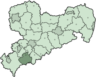
Aue-Schwarzenberg is a former district in Saxony, Germany. It was bounded by the Czech Republic and the districts of Vogtlandkreis, Zwickauer Land, Stollberg and Annaberg.

The Zwickauer Mulde is a river in Saxony, Germany. It is the left tributary of the Mulde and 166 km (103 mi) in length.
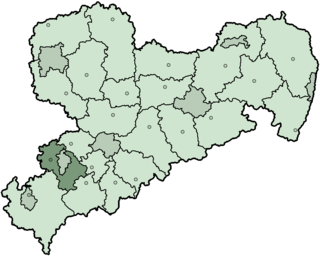
Zwickauer Land is a former Kreis (district) in the south-west of Saxony, Germany. Neighboring districts were Chemnitzer Land, Stollberg, Aue-Schwarzenberg, Vogtlandkreis, and the districts Greiz and Altenburger Land in Thuringia. The district-free city of Zwickau was located in the center of the district and nearly completely surrounded by it.

Vogtland is a region spanning the German states of Bavaria, Saxony and Thuringia and north-western Bohemia in the Czech Republic. It overlaps with and is largely contained within Euroregio Egrensis. The name alludes to the former leadership by the Vögte of Weida, Gera and Plauen.
The Freiberger Mulde is the right-hand, 124-kilometre-long (77 mi) headstream of the river Mulde, whose catchment covers an area of 2,981 km2 (1,151 sq mi) in the Czech Republic and Germany in central Saxony. It has a volumetric flow of 35.3 m3/s (1,250 cu ft/s) which is greater than that of the other headstream, the Zwickauer Mulde who flow is about 26.4 m3/s (930 cu ft/s), which is nevertheless the longer stream.

Adorf is a small town and municipality in the Vogtlandkreis to the south-west of the Free State of Saxony, Germany. Gettengrün, a village within the municipality, borders on the Czech Republic.

The Chemnitz–Adorf railway is a branch line in Saxony, Germany that was built and operated by the Chemnitz-Aue-Adorfer Eisenbahn-Gesellschaft (CAAE). The 115 km long line originally ran from Chemnitz in a southwesterly direction along the valley of the River Zwönitz to Aue. From Aue the line ran along the Zwickauer Mulde to Muldenberg and up to Schöneck and through Markneukirchen to Adorf in Vogtland.

The Elster Mountains is a small mountain range within the Fichtel Mountains in Germany and the Czech Republic. They lie in a region known as Vogtland, and take their name from the river Elster, or more precisely the White Elster which has its source in these hills, near the Czech town of Aš.
Erzgebirgskreis is a district (Kreis) in the Free State of Saxony, Germany. It is named after the Ore Mountains, a mountain range in the southern part of the district which forms part of the Germany–Czech Republic border. It borders the districts of Vogtlandkreis and Zwickau, the urban district Chemnitz, the district Mittelsachsen and the Czech Republic.
Mittelsachsen is a district (Kreis) in the Free State of Saxony, Germany.
The Saxon Uplands, Saxon Hills or Ore Mountain Foreland is a strip of countryside of about 200 m to 500 m above sea level (NN) high, in the German state of Saxony, that lies immediately north of the German Ore Mountains and runs mainly through the areas of Zwickauer Land, Zwickau, Chemnitzer Land, Chemnitz, Mittelsachsen and the country south of Dresden. It borders on the Upper Pleißeland to the extreme west, the Ore Mountain Basin in the south and the Mulde Loess Hills to the north and east.
The Saxon Highlands and Uplands refer to a natural region mainly in the south of Saxony with small elements also in southeast Thuringia and northeast Bavaria. It comprises, from (south)west to (north)east, of the Vogtland, the Ore Mountains, Saxon Switzerland, the Upper Lusatian Plateau and the Zittau Hills.

The Eastern Ore Mountains form a natural region of Saxony that covers the eastern part of the Saxon Ore Mountains range. Together with the Western and Central Ore Mountains, it is part of the larger Saxon Highlands and Uplands region. Its southern continuation beyond the German border covers an area of roughly the same extent in the Czech Republic.

The Ore Mountains/Vogtland Nature Park extends across the upper slopes of the Vogtland and Ore Mountains in southeastern Germany along its international border with Czech Republic. It is the longest nature park in Germany with a total length of 120 km. Its management organisation is the Zweckverband Naturpark Erzgebirge/Vogtland. It includes the following conservation areas:
The Central or Middle Ore Mountains is a natural region that forms the central-western part of the Ore Mountains in the German federal state of Saxony. It is part of the overarching unit, the Saxon Highlands and Uplands. It forms the eastern part of the former major units, the Lower Western Ore Mountains and Upper Western Ore Mountains and is separated from the Eastern Ore Mountains in the east by the (included) valley of the Flöha, and from the Western Ore Mountains in the west by the (excluded) valley of the Schwarzwasser and, below its mouth, by the Zwickauer Mulde.
The Ore Mountain Basin or Erzgebirge Basin is a natural region in the German federal state of Saxony, that is part of the Saxon Lowland. To the north it borders on the Mulde Loess Hills and to the south on several natural regions in the Saxon Highlands and Uplands.

The Leipzig Bay(German: Leipziger Tieflandsbucht) or Leipzig Basin or Saxon Lowland or Saxon Bay is a very flat, originally lakeless and highly fertile plain in Central Germany, in northwestern Saxony and southeastern Saxony-Anhalt, anchored by the foothills of the Harz mountains in the northwest and of the Ore Mountains in the southeast.

The Central Saxon Hills, is a region of Hügelland with indistinct boundaries in the centre of the German state of Saxony.

The classification of natural regions of Saxony shown here was produced between 1994 and 2001 by a working group called "Ecosystem and Regional Character" at the Saxonian Academy of Sciences in Leipzig as part of the research and development project "Natural Regions and Natural Region Potential of the Free State of Saxony" at a scale of 1:50,000 as the basis for the rural development and regional planning. This was also supported by the Saxon State Ministry of the Environment and Agriculture and the Saxon Ministry of the Interior.
