
Human geography or anthropogeography is the branch of geography which studies spatial relationships between human communities, cultures, economies, and their interactions with the environment, examples of which include urban sprawl and urban redevelopment. It analyzes spatial interdependencies between social interactions and the environment through qualitative and quantitative methods. This multidisciplinary approach draws from sociology, anthropology, economics, and environmental science, contributing to a comprehensive understanding of the intricate connections that shape lived spaces.
In geography, regions, otherwise referred to as areas, zones, lands or territories, are portions of the Earth's surface that are broadly divided by physical characteristics, human impact characteristics, and the interaction of humanity and the environment. Geographic regions and sub-regions are mostly described by their imprecisely defined, and sometimes transitory boundaries, except in human geography, where jurisdiction areas such as national borders are defined in law. More confined or well bounded portions are called locations or places.
Economic geography is the subfield of human geography that studies economic activity and factors affecting it. It can also be considered a subfield or method in economics.

A bioregion is a geographical area, on land or at sea, defined not by administrative boundaries but by distinct communities of plant and animal species, ecological systems, topographic features, and human cultures. The term is used within the research fields of Biology, Ecology, Biogeography, and Biocultural Anthropology. It was adopted and popularized in the mid-1970s by a school of philosophy called Bioregionalism, which seeks to understand the relationships between human culture and the natural environment within which communities develop over time. Bioregions can be defined at many scales, but are generally considered to be smaller than a Biogeographical Realm or continental-scale Ecoprovince, but larger than a Biotope or local-scale Ecoregion, as defined by the U.S. Environmental Protection Agency.

Landscape ecology is the science of studying and improving relationships between ecological processes in the environment and particular ecosystems. This is done within a variety of landscape scales, development spatial patterns, and organizational levels of research and policy. Landscape ecology can be described as the science of "landscape diversity" as the synergetic result of biodiversity and geodiversity.
Urban geography is the subdiscipline of geography that derives from a study of cities and urban processes. Urban geographers and urbanists examine various aspects of urban life and the built environment. Scholars, activists, and the public have participated in, studied, and critiqued flows of economic and natural resources, human and non-human bodies, patterns of development and infrastructure, political and institutional activities, governance, decay and renewal, and notions of socio-spatial inclusions, exclusions, and everyday life. Urban geography includes different other fields in geography such as the physical, social, and economic aspects of urban geography. The physical geography of urban environments is essential to understand why a town is placed in a specific area, and how the conditions in the environment play an important role with regards to whether or not the city successfully develops. Social geography examines societal and cultural values, diversity, and other conditions that relate to people in the cities. Economic geography is important to examine the economic and job flow within the urban population. These various aspects involved in studying urban geography are necessary to better understand the layout and planning involved in the development of urban environments worldwide.
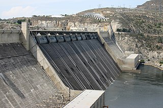
Land use planning or Land-use regulation is the process of regulating the use of land by a central authority. Usually, this is done to promote more desirable social and environmental outcomes as well as a more efficient use of resources. More specifically, the goals of modern land use planning often include environmental conservation, restraint of urban sprawl, minimization of transport costs, prevention of land use conflicts, and a reduction in exposure to pollutants. In the pursuit of these goals, planners assume that regulating the use of land will change the patterns of human behavior, and that these changes are beneficial. The first assumption, that regulating land use changes the patterns of human behavior is widely accepted. However, the second assumption - that these changes are beneficial - is contested, and depends on the location and regulations being discussed.
Regional geography is one of the major traditions of geography. It focuses on the interaction of different cultural and natural geofactors in a specific land or landscape, while its counterpart, systematic geography, concentrates on a specific geofactor at the global level.

Geography of Asia reviews geographical concepts of classifying Asia, comprising 58 countries and territories.

In anthropology and geography, a cultural area, cultural region, cultural sphere, or culture area refers to a geography with one relatively homogeneous human activity or complex of activities (culture). Such activities are often associated with an ethnolinguistic group and with the territory it inhabits. Specific cultures often do not limit their geographic coverage to the borders of a nation state, or to smaller subdivisions of a state.

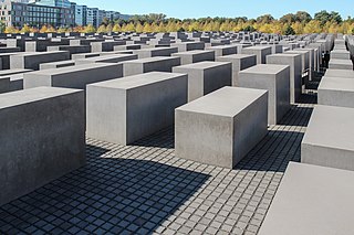
Cultural landscape is a term used in the fields of geography, ecology, and heritage studies, to describe a symbiosis of human activity and environment. As defined by the World Heritage Committee, it is the "cultural properties [that] represent the combined works of nature and of man" and falls into three main categories:
- "a landscape designed and created intentionally by man"
- an "organically evolved landscape" which may be a "relict landscape" or a "continuing landscape"
- an "associative cultural landscape" which may be valued because of the "religious, artistic or cultural associations of the natural element."

The modifiable areal unit problem (MAUP) is a source of statistical bias that can significantly impact the results of statistical hypothesis tests. MAUP affects results when point-based measures of spatial phenomena are aggregated into spatial partitions or areal units as in, for example, population density or illness rates. The resulting summary values are influenced by both the shape and scale of the aggregation unit.
Geography is the study of the lands, features, inhabitants, and phenomena of Earth. Geography is an all-encompassing discipline that seeks an understanding of Earth and its human and natural complexities—not merely where objects are, but also how they have changed and come to be. While geography is specific to Earth, many concepts can be applied more broadly to other celestial bodies in the field of planetary science. Geography has been called "a bridge between natural science and social science disciplines."

A continent is any of several large geographical regions. Continents are generally identified by convention rather than any strict criteria. A continent could be a single landmass or a part of a very large landmass, as in the case of Asia or Europe. Due to this, the number of continents varies; up to seven or as few as four geographical regions are commonly regarded as continents. Most English-speaking countries recognize seven regions as continents. In order from largest to smallest in area, these seven regions are Asia, Africa, North America, South America, Antarctica, Europe, and Australia. Different variations with fewer continents merge some of these regions; examples of this are merging Asia and Europe into Eurasia, North America and South America into America, and Africa, Asia, and Europe into Afro-Eurasia.
The sociology of space is a sub-discipline of sociology that mostly borrows from theories developed within the discipline of geography, including the sub fields of human geography, economic geography, and feminist geography. The "sociology" of space examines the social and material constitution of spaces. It is concerned with understanding the social practices, institutional forces, and material complexity of how humans and spaces interact. The sociology of space is an inter-disciplinary area of study, drawing on various theoretical traditions including Marxism, postcolonialism, and Science and Technology Studies, and overlaps and encompasses theorists with various academic disciplines such as geography and architecture. Edward T. Hall developed the study of Proxemics which concentrates on the empirical analysis of space in psychology.

The following outline is provided as an overview of and topical guide to geography:
This glossary of geography terms is a list of definitions of terms and concepts used in geography and related fields, including Earth science, oceanography, cartography, and human geography, as well as those describing spatial dimension, topographical features, natural resources, and the collection, analysis, and visualization of geographic data. It is split across two articles:
Territorialisation of Carbon Governance (ToCG) is a concept used in political geography or environmental policy which is considered to be a new logic of environmental governance. This method creates carbon-relevant citizens who become enrolled in the process of governing the climate. The territorialisation of carbon governance transforms climate change from a global to local issue. It embodies political practices that serve to connect the causes and consequences of global climate change to local communities.

Reef Life Survey is a marine life monitoring programme based in Hobart, Tasmania. It is international in scope, but predominantly Australian, as a large proportion of the volunteers are Australian. Most of the surveys are done by volunteer recreational divers, collecting biodiversity data for marine conservation. The database is available to marine ecology researchers, and is used by several marine protected area managements in Australia, New Zealand, American Samoa and the eastern Pacific.

The uncertain geographic context problem or UGCoP is a source of statistical bias that can significantly impact the results of spatial analysis when dealing with aggregate data. The UGCoP is very closely related to the Modifiable areal unit problem (MAUP), and like the MAUP, arises from how we divide the land into areal units. It is caused by the difficulty, or impossibility, of understanding how phenomena under investigation in different enumeration units interact between enumeration units, and outside of a study area over time. It is particularly important to consider the UGCoP within the discipline of time geography, where phenomena under investigation can move between spatial enumeration units during the study period. Examples of research that needs to consider the UGCoP include food access and human mobility.


