
Bridgeport, Connecticut is a major city of Connecticut located on Long Island Sound at the mouth of the Pequonnock River.

Bridgeport, Connecticut is a major city of Connecticut located on Long Island Sound at the mouth of the Pequonnock River.
Bridgeport Harbor is bordered by Long Island Sound and is formed by the estuary of the Pequonnock River and Yellow Mill and Johnson's Creeks, both tidal inlets. Between the estuary and Yellow Mill Pond is a peninsula, East Bridgeport, also known as the East Side, which was once the site of some of the largest manufacturing establishments in Connecticut, most of which no longer exist. On the far side of the Yellow Mill Pond inlet is the East End of Bridgeport, which is the easternmost portion of the city, which includes Pleasure Beach. Above the East End is the Mill Hill neighborhood and the border with Stratford, Connecticut. West of the Harbor and the Pequonnock River is the main portion of the city, with Downtown Bridgeport lining the river, the South End fronting on the lower harbor and Long Island Sound, the West Side between Fairfield, Connecticut and Downtown, and the North End extending from Downtown and the West Side to the border with Trumbull, Connecticut. Numerous factories, some of which are no longer in operation, line western sections the Metro North/New Haven Railroad line from the Bridgeport Station in Downtown, under Interstate 95 in the South End, and through the West Side and into Fairfield. The city is surrounded by hills up to 300 feet in height in the North End, the Upper East Side, and Mill Hill.
There are two major parks in Bridgeport, the "Park City." Beardsley is in the northeasterly part of the city and also contains Connecticut's only zoo, the Beardsley Zoo. It borders Bunnell's Pond, a 33-acre lake. Seaside is west of the harbor entrance and along the Sound in the South End. It has statues in honor of Elias Howe, who is credited with the invention of the sewing machine and who built a factory to manufacture his invention in the city 1863; and of P.T. Barnum, the showman, who lived in Bridgeport after 1846. He contributed much to the city, including the development of the East Side, Mountain Grove Cemetery, and Seaside Park. Seaside Park also has a soldiers' and sailors' monument. In the vicinity were located many upscale residences, now mostly demolished or converted to institutional use.
Aside from the Pequonnock River and Yellow Mill Pond, there is Cedar Creek, a canal-like tidal creek that lies between Black Rock and Seaside Park. Black Rock Harbor lies at the mouth of the creek.

The principal municipal buildings in Bridgeport are the city's two hospitals (St. Vincent's Medical Center and Bridgeport Hospital), the Barnum Museum, the Klein Memorial Auditorium, City Hall, the Fairfield County Courthouse, and the Main Post Office.
The "Park City" now has these parks:


Bridgeport comprises eight major subdivisions, most of which are divided into smaller neighborhoods:
Under the Köppen climate classification, Bridgeport has a temperate climate (Cfa), with long, hot summers, and cool to cold winters, with precipitation spread fairly evenly throughout the year. Bridgeport, like the rest of coastal Connecticut, lies in the broad transition zone between the colder continental climates of the northern United States and southern Canada to the north, and the warmer temperate and subtropical climates of the middle and south Atlantic states to the south.
The warm/hot season in Bridgeport is from mid-April through early November. Late day thundershowers are common in the hottest months (June, July, August, September), despite the mostly sunny skies. The cool/cold season is from late November though mid March. Winter weather is far more variable than summer weather along the Connecticut coast, ranging from sunny days with higher temperatures to cold and blustery conditions with occasional snow. Like much of the Connecticut coast and nearby Long Island, NY, some of the winter precipitation is rain or a mix and rain and wet snow in Bridgeport. Bridgeport averages about 34 inches (85 cm) of snow annually, compared to inland areas like Hartford and Albany which average 45–60 inches (110–150 cm) of snow annually.
Although infrequent, tropical cyclones (hurricanes/tropical storms) have struck Connecticut and the Bridgeport metropolitan area. Hurricane landfalls have occurred along the Connecticut coast in 1903, 1938, 1944, 1954 (Carol), 1960 (Donna), Hurricane Gloria in 1985, and Hurricane Sandy in 2012.
Bridgeport lies in USDA garden zone 7a, averaging about 92 days annually with freeze. Coastal Connecticut is the broad transition zone where so-called "subtropical indicator" plants and other broadleaf evergreens can successfully be cultivated. As such, Southern Magnolias, Needle Palms, Windmill palm, Loblolly Pines, and Crape Myrtles are grown in private and public gardens. Like much of coastal Connecticut, Long Island, NY, and coastal New Jersey, the growing season is rather long in Bridgeport—averaging 210 days from April 8 to November 5 according to the National Weather Service in Bridgeport.
The average monthly temperature ranges from 31.4 °F (−0.3 °C) in January to 75.7 °F (24.3 °C) in July. The record low is −7 °F (−22 °C), set on January 22, 1984, while the record high is 103 °F (39 °C), set on July 22 in 1957 and 2011. [1]
Precipitation averages 44.9 inches (1,140 mm) annually, and is somewhat evenly distributed throughout the year, with March and April the wettest months. Annual snowfall averages 33.6 inches (85 cm), falling almost entirely from December to March. As is typical of coastal Connecticut, snow cover does not usually last long, with an average of 33 days per winter with snow cover of at least 1 inch (2.5 cm).
| Climate data for Bridgeport, Connecticut (Sikorsky Airport), 1991–2020 normals, extremes 1948–present | |||||||||||||
|---|---|---|---|---|---|---|---|---|---|---|---|---|---|
| Month | Jan | Feb | Mar | Apr | May | Jun | Jul | Aug | Sep | Oct | Nov | Dec | Year |
| Record high °F (°C) | 69 (21) | 67 (19) | 84 (29) | 91 (33) | 97 (36) | 97 (36) | 103 (39) | 100 (38) | 99 (37) | 89 (32) | 78 (26) | 76 (24) | 103 (39) |
| Mean maximum °F (°C) | 57 (14) | 55 (13) | 65 (18) | 76 (24) | 85 (29) | 91 (33) | 94 (34) | 92 (33) | 86 (30) | 78 (26) | 68 (20) | 60 (16) | 95 (35) |
| Average high °F (°C) | 38.4 (3.6) | 40.5 (4.7) | 47.4 (8.6) | 58.3 (14.6) | 68.4 (20.2) | 77.7 (25.4) | 83.4 (28.6) | 81.9 (27.7) | 75.4 (24.1) | 64.4 (18.0) | 53.6 (12.0) | 43.8 (6.6) | 61.1 (16.2) |
| Daily mean °F (°C) | 31.4 (−0.3) | 33.1 (0.6) | 39.3 (4.1) | 50.0 (10.0) | 60.0 (15.6) | 69.6 (20.9) | 75.7 (24.3) | 74.5 (23.6) | 67.6 (19.8) | 56.4 (13.6) | 46.0 (7.8) | 37.0 (2.8) | 53.4 (11.9) |
| Average low °F (°C) | 24.4 (−4.2) | 25.7 (−3.5) | 32.3 (0.2) | 41.7 (5.4) | 51.7 (10.9) | 61.5 (16.4) | 67.9 (19.9) | 67.0 (19.4) | 59.8 (15.4) | 48.3 (9.1) | 38.4 (3.6) | 30.2 (−1.0) | 45.7 (7.6) |
| Mean minimum °F (°C) | 7 (−14) | 10 (−12) | 18 (−8) | 30 (−1) | 41 (5) | 50 (10) | 59 (15) | 57 (14) | 46 (8) | 34 (1) | 24 (−4) | 16 (−9) | 5 (−15) |
| Record low °F (°C) | −7 (−22) | −6 (−21) | 4 (−16) | 18 (−8) | 31 (−1) | 41 (5) | 49 (9) | 44 (7) | 36 (2) | 26 (−3) | 13 (−11) | −4 (−20) | −7 (−22) |
| Average precipitation inches (mm) | 3.18 (81) | 3.12 (79) | 4.09 (104) | 4.16 (106) | 3.58 (91) | 3.77 (96) | 3.32 (84) | 3.98 (101) | 3.96 (101) | 3.84 (98) | 3.11 (79) | 3.98 (101) | 44.09 (1,121) |
| Average snowfall inches (cm) | 8.5 (22) | 10.7 (27) | 7.0 (18) | 0.9 (2.3) | 0 (0) | 0 (0) | 0 (0) | 0 (0) | 0 (0) | 0.1 (0.25) | 0.9 (2.3) | 5.5 (14) | 33.6 (85.85) |
| Average precipitation days (≥ 0.01 inch) | 11.2 | 10.4 | 11.2 | 11.4 | 12.12 | 11.2 | 8.9 | 9.2 | 8.2 | 9.9 | 9.4 | 11.5 | 124.62 |
| Average snowy days (≥ 0.1 inch) | 4.5 | 4.2 | 2.6 | 0.3 | 0 | 0 | 0 | 0 | 0 | 0.1 | 0.4 | 2.9 | 15 |
| Source: NOAA [1] [2] | |||||||||||||
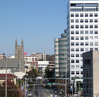
Fairfield County is a county in the southwestern corner of the U.S. state of Connecticut, as well as the State's fastest-growing from 2010 to 2020 and largest in terms of population. As of the 2020 census, the county's population was 957,419, representing 26.6% of Connecticut's overall population. The closest to the center of the New York metropolitan area, the county contains four of the state's largest cities–Bridgeport (1st), Stamford (2nd), Norwalk (6th), and Danbury (7th)–whose combined population of 433,368 is nearly half the county's total population.
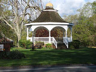
Monroe is a town located in eastern Fairfield County, Connecticut, United States. The population was 18,825 at the 2020 census.
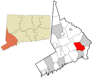
Trumbull is a town located in Fairfield County, Connecticut. It borders on the cities of Bridgeport and Shelton and the towns of Stratford, Fairfield, Easton and Monroe. The population was 36,827 during the 2020 census. Trumbull was the home of the Golden Hill Paugussett Indian Nation for thousands of years before the English settlement was made in 1639. The town was named after Jonathan Trumbull (1710–1785), a merchant, patriot and statesman when it was incorporated in 1797. Aviation pioneer Igor Sikorsky lived in Trumbull during his active years when he designed, built, and flew fixed-wing aircraft and put the helicopter into mass production for the first time.
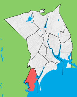
Black Rock is a neighborhood in the southwestern section of the city of Bridgeport, Connecticut. It borders Fairfield and the Ash Creek tidal estuary on the west, the West Side/West End of Bridgeport on the north and east, and Black Rock Harbor and Long Island Sound on the south. Black Rock comprises census tracts 701 and 702 and part of census tract 703. It includes two historic districts listed on the National Register of Historic Places. Residences comprise 86% of properties in Black Rock, 10% are commercial, and 4% are industrial or other property classes.

The history of Bridgeport, Connecticut was, in the late 17th and most of the 18th century, one of land acquisitions from the native inhabitants, farming and fishing. From the mid-18th century to the mid-19th century, Bridgeport's history was one of shipbuilding, whaling and rapid growth. Bridgeport's growth accelerated even further from the mid-19th century to the mid-20th century with the advent of the railroad, Industrialization, massive immigration, labor movements until, at its peak population in 1950, Bridgeport with some 159,000 people was Connecticut's second most populous city. In the late 20th century, Bridgeport's history was one of deindustrialization and declining population, though it overtook Hartford as the state's most populous city by 1980.
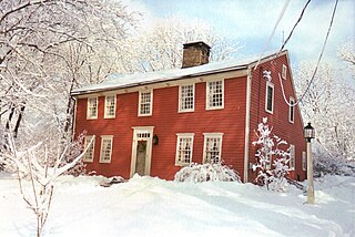
Nichols, a historic village in southeastern Trumbull in Fairfield County, Connecticut, is named after the family who maintained a large farm in its center for almost 300 years. The Nichols Farms Historic District, which encompasses part of the village, is listed on the National Register of Historic Places. Originally home to the Golden Hill Paugussett Indian Nation, the area was colonized by the English during the Great Migration of the 1630s as a part of the coastal settlement of Stratford. The construction of the Merritt Parkway through the village, and the subsequent closing of stores and factories, turned the village into a bedroom community in 1939. Aviation pioneer Igor Sikorsky lived in three separate homes in Nichols during his active years between 1928 and 1951, when he designed, built and flew fixed-wing aircraft and put the helicopter into mass production for the first time.

Route 108 in the U.S. state of Connecticut, locally called Nichols Avenue and Huntington Turnpike, is a two-lane state highway that runs northerly from US 1, Boston Post Road in Stratford, through Trumbull, to Route 110 in downtown Shelton. Originally called the Farm Highway, it was laid out to the south side of Mischa Hill in Trumbull on December 7, 1696 and is considered to be the third oldest documented highway in Connecticut after the Mohegan Road in Norwich (1670) and the Boston Post Road or US 1 (1673).

Nichols Farms is a historic area within the town of Trumbull, Connecticut. The Nichols Farms Historic District, which encompasses part of the area, is listed on the National Register of Historic Places.

Route 127 is a state highway in southwestern Connecticut, running entirely from Bridgeport to Trumbull. It serves as a minor arterial, connecting all four major limited access highways in the Bridgeport area.

Rooster River is a river in Fairfield County, Connecticut that lies on and serves as the border between Bridgeport and Fairfield. It has flooded on numerous occasions and so has its own flood control project.

Trumbull, a town in Fairfield County, Connecticut, in the New England region of the United States, was originally home to the Golden Hill Paugussett Indian Nation, and was colonized by the English during the Great Migration of the 1630s as a part of the coastal settlement of Stratford.

Bridgeport is the most populous city and a major port in the U.S. state of Connecticut. With a population of 148,654 in 2020, it is also the fifth-most populous in New England. Located in Fairfield County at the mouth of the Pequonnock River on Long Island Sound, it is 60 miles (97 km) from Manhattan and 40 miles (64 km) from The Bronx. It is bordered by the towns of Trumbull to the north, Fairfield to the west, and Stratford to the east. Bridgeport and other settlements in Fairfield County make up the Bridgeport-Stamford-Norwalk-Danbury metropolitan statistical area, the second largest metropolitan area in Connecticut. The Bridgeport-Stamford-Norwalk-Danbury metropolis forms part of the New York megacity.

The Pequonnock River is a 16.7-mile-long (26.9 km) waterway in eastern Fairfield County, Connecticut. Its watershed is located in five communities, with the majority of it located within Monroe, Trumbull, and Bridgeport. The river has a penchant for flooding, particularly in spring since the removal of a retention dam in Trumbull in the 1950s. There seems to be a sharp difference of opinion among historians as to just what the Indian word Pequonnock signifies. Some insist it meant cleared field or open ground; others are sure it meant broken ground; while a third group is certain it meant place of slaughter or place of destruction.
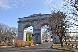
Seaside Park, located in Bridgeport, Connecticut, is a 2.5-mile (4.0 km) long crescent-shaped park bordering Bridgeport Harbor, Long Island Sound, and Black Rock Harbor. The park lies within Bridgeport's South End neighborhood.
Bridgeport Harbor is an inlet on the north side of Long Island Sound in Bridgeport, Connecticut. It was carved by the retreat of the glaciers during the last ice age approximately 13,000 years ago.
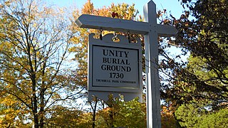
The Unity Burial Ground is a small graveyard located on the southeast end of White Plain in the Nichols section of Trumbull, Connecticut. It is located a few rods north of the site of the first meeting house that was built in the parish of Unity, off of White Plains Road. The cemetery was laid out in 1730 and the first burial was that of 7 year old Samuel Bennitt on June 21, 1731. There are over 110 gravestones, 90 unmarked field stones and 241 known grave sites, and most of the original stones face east. This is unusual, as it runs contrary to the common practice of placing stones so that they face the road. The latest known burial was for Charles E Booth Jr. on August 17, 1935.

The Bridgeport Downtown South Historic District encompasses the historic elements of the southern part of downtown Bridgeport, Connecticut. It is 27 acres (11 ha) in size, roughly bordered on the east by Main and Middle Streets, on the north by Elm Street, the west by Broad Street, and the south by Cesar Batalla Way. This area includes the highest concentration of buildings developed in the commercial downtown between about 1840 and the 1930s, the period of the city's major growth as a manufacturing center, and includes a diversity of architectural styles representative of that time period. The district was listed on the National Register of Historic Places in 1987.

Long Hill is a village/neighborhood and census-designated place (CDP) in the town of Trumbull in Fairfield County, Connecticut, United States. It is located west of the Pequonnock River. The main thoroughfare is Connecticut Route 111, present-day Main Street. It was listed as a census-designated place prior to the 2020 census.
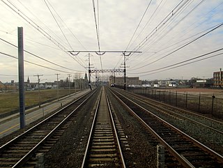
The Barnum station is a planned regional rail station to be located on the Metro-North Railroad's New Haven Line in East Bridgeport, Connecticut. The station will be named after the circus showman and former Bridgeport mayor P. T. Barnum, and will be located on the south side of Barnum Avenue between Seaview Avenue and Pembroke Street. A feasibility study was released in July 2013, followed by preliminary planning funding in July 2014 and an application for planning funding in June 2015. By January 2017, the station was planned to open in 2021. However, the project was indefinitely postponed in January 2019.