Geothermal exploration

Last updated
Geothermal venting in Hengill exploration field, Iceland. Geothermalventing1.jpg
Geothermal venting in Hengill exploration field, Iceland.

Geothermal exploration is the exploration of the subsurface in search of viable active geothermal regions with the goal of building a geothermal power plant, where hot fluids drive turbines to create electricity. [1] Exploration methods include a broad range of disciplines including geology, geophysics, geochemistry and engineering. [2]

Contents

Geothermal regions with adequate heat flow to fuel power plants are found in rift zones, subduction zones and mantle plumes. Hot spots are characterized by four geothermal elements. An active region will have: [1]

  1. Heat Source - Shallow magmatic body, decaying radioactive elements or ambient heat from high pressures
  2. Reservoir - Collection of hot rocks from which heat can be drawn
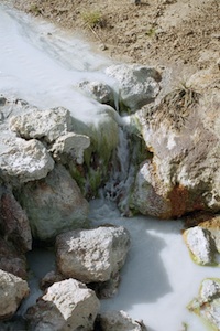
  3. Geothermal Fluid - Gas, vapor and water found within the reservoir
  4. Recharge Area - Area surrounding the reservoir that rehydrates the geothermal system.

Exploration involves not only identifying hot geothermal bodies, but also low-density, cost effective regions to drill and already constituted plumbing systems inherent within the subsurface. [3] This information allows for higher success rates in geothermal plant production as well as lower drilling costs.

As much as 42% of all expenses associated with geothermal energy production can be attributed to exploration. These costs are mostly from drilling operations necessary to confirm or deny viable geothermal regions. [4] Some geothermal experts have gone to say that developments in exploration techniques and technologies have the potential to bring the greatest advancements within the industry. [5]

Methods of exploration

Drilling

Drilling provides the most accurate information in the exploration process, but is also the most costly exploration method.

Thermal gradient holes (TGH), exploration wells (slim holes), and full-scale production wells (wildcats) provide the most reliable information on the subsurface. [4] Temperature gradients, thermal pockets and other geothermal characteristics can be measured directly after drilling, providing valuable information.

Geothermal exploration wells rarely exceed 4 km in depth. Subsurface materials associated with geothermal fields range from limestone to shale, volcanic rocks and granite. [1] Most drilled geothermal exploration wells, up to the production well, are still considered to be within the exploration phase. Most consultants and engineers consider exploration to continue until one production well is completed successfully. [4]

Generally, the first wildcat well has a success rate of 25%. Following more analysis and investigation, success rates then increase to a range from 60% to 80%. Although expenses vary significantly, drilling costs are estimated at $400/ft. [4] Therefore, it is becoming paramount to investigate other means of exploration before drilling operations commence. To increase the chances of successfully drilling, innovations in remote sensing technologies have developed over the last 2 decades. These less costly means of exploration are categorized into multiple fields including geology, geochemistry and geophysics.

Geophysics

Seismology

Seismology has played a significant role in the oil and gas industry and is now being adapted to geothermal exploration. [4] Seismic waves propagate and interact with subterranean components and respond accordingly. Two sub categories exist that are relevant to the source of the seismic signal. [6] Active seismology relies on using induced/man-made vibrations at or near the surface. Passive seismology uses earthquakes, volcanic eruptions or other tectonic activity as sources. [7]

Passive seismic studies use natural wave propagation through the earth. [7] Geothermal fields are often characterized by increased levels of seismicity. Earthquakes of lesser magnitude are much more frequent than ones of larger magnitude. [6] Therefore, these micro earthquakes (MEQ), registering below 2.0 magnitude on the Richter scale, are used to reveal subsurface qualities relating to geothermal exploration. [7] The high rate of MEQ in geothermal regions produce large datasets that do not require long field deployments.

Active Seismology, which has history in the oil and gas industry, involves studying man made vibrational wave propagation. In these studies geophones (or other seismic sensors) are spread across the study site. The most common geophone spreads are in line, offset, in-line with center shot and Fan shooting. [6]

Many analytical techniques can be applied to active seismology studies but generally all include Huygens Principle, Fermat's Principle and Snell's law. These basic principles can be used to identify subsurface anomalies, reflective layers and other objects with high impedance contrasts. [6]

Gravity

Gravimetry studies use changes in densities to characterize subsurface properties. [6] This method is well applied when identifying dense subsurface anomalies including granite bodies, which are vital to locate in the geothermal exploration projects. Subsurface fault lines are also identifiable with gravitational methods. These faults are often identified as prime drilling locations as their densities are much less than surrounding material. Developments in airborne gravitational studies yield large amounts of data, which can be used to model the subsurface 3 dimensionally with relatively high levels of accuracy.

Changes in groundwater levels may also be measured and identified with gravitational methods. This recharge element is imperative in creating productive geothermal systems. Pore density and subsequent overall density are affected by fluid flow and therefore change the gravitational field. When correlated with current weather conditions, this can be measured and modeled to estimate the rate of recharge in geothermal reservoirs. [1]

Unfortunately, there are many other factors that must be realized before data from a gravity study can be interpreted. The average gravitational field the earth produces is 920 cm/c^2. Objects of concern produce a significantly smaller gravitational field. Therefore, instrumentation must detect variations as small as 0.00001%. Other considerations including elevation, latitude and weather conditions must be carefully observed and taken into account. [6]

Resistivity and magnetotellurics

Magnetotellurics (MT) measurements allow detection of resistivity anomalies associated with productive geothermal structures, including faults and the presence of a cap rock, and allow for estimation of geothermal reservoir temperatures at various depths. MT has successfully contributed to the successful mapping and development of geothermal resources around the world since the early 1980s, including in the U.S. and countries located on the Pacific Ring of Fire such as Japan, New Zealand, the Philippines, Ecuador, and Peru.

Geological materials are generally poor electrical conductors and have a high resistivity. Hydrothermal fluids in the pores and fractures of the earth, however, increase the conductivity of the subsurface material. This change in conductivity is used to map the subsurface geology and estimate the subsurface material composition. Resistivity measurements are made using a series of probes distributed tens to hundreds of meters apart, to detect the electrical response of the Earth to injection of electrical impulses in order to reconstruct the distribution of electrical resistance in the rocks. Since flowing geothermal waters can be detected as zones of low resistance, it is possible to map geothermal resources using such a technique. However, care must be exercised when interpreting low resistivity zones since they may also be caused by changes in rock type and temperature.

The Earth's magnetic field varies in intensity and orientation during the day inducing detectable electrical currents in the Earth's crust. The range of the frequency of those currents allows a multispectral analysis of the variation in the electromagnetic local field. As a result, it is possible a tomographic reconstruction of geology, since the currents are determined by the underlying response of the different rocks to the changing magnetic field. [8]

Magnetics

Stream in Icelandic geothermal exploration field. Geothermal stream iceland.jpg
Stream in Icelandic geothermal exploration field.

The most common application magnetism has in geothermal exploration involves identifying the depth of the curie point or curie temperature. At the curie point, materials will change from ferromagnetic to paramagnetic. Locating curie temperatures for known subsurface materials provides estimates on future plant productivity. For example, titanomagnetitite, a common material in geothermal fields, has a curie temperature between 200 and 570 degrees Celsius. Simple geometric anomalies modeled at different depths are used to best estimate the curie depth. [1]

Geochemistry

This science is readily used in geothermal exploration. Scientists within this field relate surface fluid properties and geologic data to geothermal bodies. Temperature, isotopic ratios, elemental ratios, mercury & CO2 concentrations are all data points under close examination. Geothermometers and other instrumentation are placed around field sites to increase the fidelity of subsurface temperature estimates. [4]

US geothermal potential

Geothermal Energy is an underdeveloped energy resource and warrants further investigation and exploration. [2] According to the U.S. Department of Energy, Utah's geothermal capabilities alone, if fully developed, could provide 1/3 of the state's power needs. Currently, the United States is planning to organize national geothermal databases, expand USGS resources nationally and develop geophysical projects to validate advances in exploration technologies. [5] Below lists U.S. counties and regions that potentially can utilize geothermal power and would warrant further exploration. [9]

U.S. StateCounty/Region
ArizonaCochise, Graham, Greenlee, Maricopa, Pima, Pinal, Yauapia, Yuma
CaliforniaAlpine, Colusa, Contra Costa, Imperial, Inyo, Kern, Lake, Lassen, Los Angeles, Modoc, Mono, Monterey, Napa, Orange, Placer, Plumas, Riverside, San Bernardino, San Diego, San Luis Obispo, Santa Barbara, Shasta, Sierra, Sonoma, Ventura
ColoradoArchuleta, Chaffee, Fremont, Garfield, Gunnison, Mineral, Ouray, Park, Routt, Saguache
IdahoAda, Adams, Bear Lake, Blaine, Boise, Bonneville, Camas, Canyon, Caribou, Cassia, Custer, Elmore, Franklin, Fremont, Gem, Lemhi, Oneida, Owyhee, Payette, Teton, Twin Falls, Valley, Washington
MontanaBeaverhead, Deer Lodge, Gallatin, Jefferson, Lewis and Clark, Madison, Park, Roosevelt, Rosebud, Sanders, Silver Bow, Stillwater
NevadaCarson City, Churchill, Douglas, Elk, Eureka, Humboldt, Lincoln, Lyon, Nye, Pershing, Storey, Washoe, White Pine
New MexicoDonna Ana, Grant, Hidalgo, McKinley, Rio Arriba, San Miguel, Sandoval, Valencia
OregonBaker, Clackamas, Crook, Harney, Klamath, Lake, Lane, Linn, Malheur, Marion, Umatilla, Union, Wasco
UtahBox Elder, Cahce, Davis, Iron, Juab, Millard, Salt Lake, San Pete, Sevier, Uintah, Utah, Weber, Washington, Benton, Grant, King, Lincoln, Okanogan, Skamania
Alaska (Not Counties)Adak, Akutan, Baranof, Bell Island Hot Springs, Chena Hot Springs, Circle Hot Springs, Goddard, Makushin, Manley Hot Springs, Melozi Springs, Morzhovoi, Nancy, Portage, Pilgrim Springs, Serpentine Hot Springs, Sitka, Unalaska
NebraskaCheyenne, Keya Paha, Kimball, Scottsbluff
North DakotaMcLean
South DakotaButte, Corson, Dewey, Fall River, Haakon, Harding, Jackson, Jones, Lawrence, Meade, Mellette, Pennington, Perkins, Stanley, Todd, Tripp, Ziebach
TexasAtacosa, Bell, Bexar, Brazoria, Burleson, Concho, Dallas, El Paso, Falls, Gonzale, Hardin, Hill, Karnes, Live Oak, McLennan, Milam, Navarro, Presidio, Webb
WyomingHot Springs, Lincoln, Natrona

Related Research Articles

<span class="mw-page-title-main">Geophysics</span> Physics of the Earth and its vicinity

Geophysics is a subject of natural science concerned with the physical processes and physical properties of the Earth and its surrounding space environment, and the use of quantitative methods for their analysis. Geophysicists, who usually study geophysics, physics, or one of the earth sciences at the graduate level, complete investigations across a wide range of scientific disciplines. The term geophysics classically refers to solid earth applications: Earth's shape; its gravitational, magnetic fields, and electromagnetic fields ; its internal structure and composition; its dynamics and their surface expression in plate tectonics, the generation of magmas, volcanism and rock formation. However, modern geophysics organizations and pure scientists use a broader definition that includes the water cycle including snow and ice; fluid dynamics of the oceans and the atmosphere; electricity and magnetism in the ionosphere and magnetosphere and solar-terrestrial physics; and analogous problems associated with the Moon and other planets.

<span class="mw-page-title-main">Geothermal energy</span> Thermal energy generated and stored in the Earth

Geothermal energy is the thermal energy in the Earth's crust which originates from the formation of the planet and from radioactive decay of materials. The high temperature and pressure in Earth's interior cause some rock to melt and solid mantle to behave plastically. This results in parts of the mantle convecting upward since it is lighter than the surrounding rock. Temperatures at the core–mantle boundary can reach over 4000 °C (7200 °F).

Petroleum geology is the study of origin, occurrence, movement, accumulation, and exploration of hydrocarbon fuels. It refers to the specific set of geological disciplines that are applied to the search for hydrocarbons.

Seismic tomography is a technique for imaging the subsurface of the Earth with seismic waves produced by earthquakes or explosions. P-, S-, and surface waves can be used for tomographic models of different resolutions based on seismic wavelength, wave source distance, and the seismograph array coverage. The data received at seismometers are used to solve an inverse problem, wherein the locations of reflection and refraction of the wave paths are determined. This solution can be used to create 3D images of velocity anomalies which may be interpreted as structural, thermal, or compositional variations. Geoscientists use these images to better understand core, mantle, and plate tectonic processes.

<span class="mw-page-title-main">Reflection seismology</span> Explore subsurface properties with seismology

Reflection seismology is a method of exploration geophysics that uses the principles of seismology to estimate the properties of the Earth's subsurface from reflected seismic waves. The method requires a controlled seismic source of energy, such as dynamite or Tovex blast, a specialized air gun or a seismic vibrator. Reflection seismology is similar to sonar and echolocation.

Induced seismicity is typically earthquakes and tremors that are caused by human activity that alters the stresses and strains on Earth's crust. Most induced seismicity is of a low magnitude. A few sites regularly have larger quakes, such as The Geysers geothermal plant in California which averaged two M4 events and 15 M3 events every year from 2004 to 2009. The Human-Induced Earthquake Database (HiQuake) documents all reported cases of induced seismicity proposed on scientific grounds and is the most complete compilation of its kind.

<span class="mw-page-title-main">Geothermal gradient</span> Rate of temperature increase with depth in Earths interior

Geothermal gradient is the rate of temperature change with respect to increasing depth in Earth's interior. As a general rule, the crust temperature rises with depth due to the heat flow from the much hotter mantle; away from tectonic plate boundaries, temperature rises in about 25–30 °C/km (72–87 °F/mi) of depth near the surface in most of the world. However, in some cases the temperature may drop with increasing depth, especially near the surface, a phenomenon known as inverse or negative geothermal gradient. The effects of weather, sun, and season only reach a depth of approximately 10-20 metres.

Exploration geophysics is an applied branch of geophysics and economic geology, which uses physical methods at the surface of the Earth, such as seismic, gravitational, magnetic, electrical and electromagnetic, to measure the physical properties of the subsurface, along with the anomalies in those properties. It is most often used to detect or infer the presence and position of economically useful geological deposits, such as ore minerals; fossil fuels and other hydrocarbons; geothermal reservoirs; and groundwater reservoirs. It can also be used to detect the presence of unexploded ordnance.

<span class="mw-page-title-main">Petroleum reservoir</span> Subsurface pool of hydrocarbons

A petroleum reservoir or oil and gas reservoir is a subsurface accumulation of hydrocarbons contained in porous or fractured rock formations.

<span class="mw-page-title-main">Magnetotellurics</span> Electromagnetic geophysical technique

Magnetotellurics (MT) is an electromagnetic geophysical method for inferring the earth's subsurface electrical conductivity from measurements of natural geomagnetic and geoelectric field variation at the Earth's surface.

Geophysical survey is the systematic collection of geophysical data for spatial studies. Detection and analysis of the geophysical signals forms the core of Geophysical signal processing. The magnetic and gravitational fields emanating from the Earth's interior hold essential information concerning seismic activities and the internal structure. Hence, detection and analysis of the electric and Magnetic fields is very crucial. As the Electromagnetic and gravitational waves are multi-dimensional signals, all the 1-D transformation techniques can be extended for the analysis of these signals as well. Hence this article also discusses multi-dimensional signal processing techniques.

<span class="mw-page-title-main">Geodynamics</span> Study of dynamics of the Earth

Geodynamics is a subfield of geophysics dealing with dynamics of the Earth. It applies physics, chemistry and mathematics to the understanding of how mantle convection leads to plate tectonics and geologic phenomena such as seafloor spreading, mountain building, volcanoes, earthquakes, faulting. It also attempts to probe the internal activity by measuring magnetic fields, gravity, and seismic waves, as well as the mineralogy of rocks and their isotopic composition. Methods of geodynamics are also applied to exploration of other planets.

<span class="mw-page-title-main">Enhanced geothermal system</span> Type of electricity generation system

An enhanced geothermal system (EGS) generates geothermal electricity without the need for natural convective hydrothermal resources. Until recently, geothermal power systems have exploited only resources where naturally occurring heat, water, and rock permeability are sufficient to allow energy extraction. However, by far the most geothermal energy within reach of conventional techniques is in dry and impermeable rock. EGS technologies enhance and/or create geothermal resources through a variety of stimulation methods, including 'hydraulic stimulation'.

<span class="mw-page-title-main">Geothermal power</span> Power generated by geothermal energy

Geothermal power is electrical power generated from geothermal energy. Technologies in use include dry steam power stations, flash steam power stations and binary cycle power stations. Geothermal electricity generation is currently used in 26 countries, while geothermal heating is in use in 70 countries.

Heavy oil production is a developing technology for extracting heavy oil in industrial quantities. Estimated reserves of heavy oil are over 6 trillion barrels, three times that of conventional oil and gas.

A synthetic seismogram is the result of forward modelling the seismic response of an input earth model, which is defined in terms of 1D, 2D or 3D variations in physical properties. In hydrocarbon exploration this is used to provide a 'tie' between changes in rock properties in a borehole and seismic reflection data at the same location. It can also be used either to test possible interpretation models for 2D and 3D seismic data or to model the response of the predicted geology as an aid to planning a seismic reflection survey. In the processing of wide-angle reflection and refraction (WARR) data, synthetic seismograms are used to further constrain the results of seismic tomography. In earthquake seismology, synthetic seismograms are used either to match the predicted effects of a particular earthquake source fault model with observed seismometer records or to help constrain the Earth's velocity structure. Synthetic seismograms are generated using specialized geophysical software.

<span class="mw-page-title-main">Near-surface geophysics</span> Geophysics of first tens of meters below surface

Near-surface geophysics is the use of geophysical methods to investigate small-scale features in the shallow subsurface. It is closely related to applied geophysics or exploration geophysics. Methods used include seismic refraction and reflection, gravity, magnetic, electric, and electromagnetic methods. Many of these methods were developed for oil and mineral exploration but are now used for a great variety of applications, including archaeology, environmental science, forensic science, military intelligence, geotechnical investigation, treasure hunting, and hydrogeology. In addition to the practical applications, near-surface geophysics includes the study of biogeochemical cycles.

<span class="mw-page-title-main">Outline of geophysics</span> Topics in the physics of the Earth and its vicinity

The following outline is provided as an overview of and topical guide to geophysics:

Geophysical signal analysis is concerned with the detection and a subsequent processing of signals. Any signal which is varying conveys valuable information. Hence to understand the information embedded in such signals, we need to 'detect' and 'extract data' from such quantities. Geophysical signals are of extreme importance to us as they are information bearing signals which carry data related to petroleum deposits beneath the surface and seismic data. Analysis of geophysical signals also offers us a qualitative insight into the possibility of occurrence of a natural calamity such as earthquakes or volcanic eruptions.

<span class="mw-page-title-main">Solar augmented geothermal energy</span> Solar-heated artificial underground lake

Solar augmented geothermal energy (SAGE) is an advanced method of geothermal energy that creates a synthetic geothermal storage resource by heating a natural brine with solar energy and adding enough heat when the sun shines to generate power 24 hours a day. The earth is given enough energy in one hour to provide all electrical needs for a year. Available energy is not the issue, but energy storage is the problem and SAGE creates effective storage and electrical power delivery on demand. This technology is especially effective for geothermal wells that have demonstrated inconsistent heat or idle oil or gas fields that have demonstrated the proper geology and have an abundance of solar.

References

  1. 1 2 3 4 5
    • Manzella, Adela, "Geophysical methods in Geothermal Exploration", Italian National Research Council
  2. 1 2
    • Hulen, J.B. & Wright, P.M. (2001). "Geothermal Energy - Clean Sustainable Energy for the Benefit of Humanity and Environment". U.S. Department of Energy.
  3. 1 2 3 4 5 6
    • Jennejohn, Dan (2009). "Research and Development in Geothermal Exploration and Drilling". Geothermal Energy Association.
  4. 1 2
    • (2010). "Federal Interagency Geothermal Activities". Geothermal Technologies Program Office of Energy Efficiency and Renewable Energy U.S. Department of Energy.
  5. 1 2 3 4 5 6
    • Burger, H., Sheehan A., Jones, C. (2006). "Introduction to Applied Geophysics". W.W. Norton & Company, Inc.
  6. 1 2 3
    • Foulger G. (1982). "Geothermal exploration and reservoir monitoring using earthquakes and the passive seismic method". Geothermics, Volume 11, Issue 4.
    • William E. Glassley. "Geothermal Energy: Renewable Energy and the Environment".