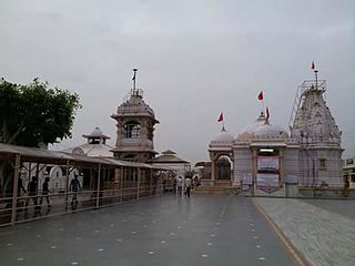
Gandhinagar is the capital of the state of Gujarat in India. Gandhinagar is located approximately 23 km north of Ahmedabad, on the west central point of the Industrial corridor between Delhi, the political capital of India, and Mumbai, the financial capital of India.

Anand is the administrative centre of Anand District in the state of Gujarat, India. It is administered by Anand Municipality. It is part of the region known as Charotar, consisting of Anand and Kheda districts.

Navsari is an administrative district in the state of Gujarat in India, with its headquarters at Navsari city. The district covers an area of 2,211 square kilometres roughly equal to country like Luxembourg and the US state of Delaware, and had a population of 1,329,672 in 2011 roughly equal to country like Estonia and the US state of Hawaii. The district was formed in 1997 after Valsad district was bifurcated into Valsad and Navsari districts.

Motera is a neighbourhood in the northwestern part of the metropolis of Ahmedabad in Gujarat, India. It lies west of the Sabarmati River. It falls under the West Zone of Ahmedabad Municipal Corporation and under the Gandhinagar South constituency of Gujarat Legislative Assembly and under the Gandhinagar constituency of the Lok Sabha. The chief attraction in Motera is the Sardar Patel Stadium. This stadium is the venue for the international cricket matches held in Ahmedabad. Recently stadium is demolished and a new stadium is under construction.

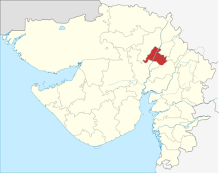
Gandhinagar district is an administrative division of Gujarat, India, whose headquarters are at Gandhinagar, the state capital. It was organized in 1964.

Vadodara District is a district in the eastern part of the state of Gujarat in western India. The city of Vadodara (Baroda), in the western part of the district, is the administrative headquarters. Vadodara District covers an area of 7,794 km². As of 2011, the district had a population of 4,165,626 of which 49.6% were urban, 50.4% were rural, 5.3% were scheduled castes and 27.6% were scheduled tribes. As of 2011 it is the third most populous district of Gujarat, after Ahmadabad and Surat.

Padra is a town and a municipality in the Vadodara district in the Indian state of Gujarat. Padra is located about 16 kilometres from Vadodara city.

Veraval is a municipality and the headquarters of Gir Somnath district in the Indian state of Gujarat. It is 6 km from Somnath. It is also known for the hub of fishing industries in India.

Vatva railway station is a railway station under Western Railway zone in Gujarat state, India. It serves Vatva town. Its code is 'VTA'. It has 4 platforms. Vatva also has Diesel Loco Shed in Vatva. Passenger and MEMU trains halt here.

Rupal is a village in Gandhinagar District of Gujarat state, India. It is located 13 km towards north from District headquarters Gandhinagar. Gujarati is the local language here.

Geratpur railway station is a railway station under Western Railway zone in Gujarat state, India. It serves Geratpur village. Its code is 'GER'. It has 2 platforms. Passenger, MEMU trains halt here.

Barejadi Nandej railway station is a railway station under Western Railway zone in Gujarat state, India. Barejadi Nandej railway station is 17 km far away from Ahmedabad railway station. Passenger, MEMU and few Express trains halt at Barejadi Nandej railway station.

Nabipur is a village in Bharuch district in the Indian state of Gujarat.

Kathana is a large village in Anand district in the Indian state of Gujarat.

Kim is a census town in Surat district in the Indian state of Gujarat.

Barejadi is a village in Ahmedabad district in the Indian state of Gujarat.

Itola is a village in Vadodara district in the Indian state of Gujarat.

Samlaya is a large village in Vadodara district in the Indian state of Gujarat.

Amirgadh is a town in Banaskantha district in the Indian state of Gujarat.

Bhatiya is a large village in Devbhumi Dwarka district in the Indian state of Gujarat.


