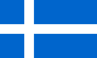
Shetland, also called the Shetland Islands, is an archipelago in Scotland lying between Orkney, the Faroe Islands, and Norway. It is the northernmost region of the United Kingdom.

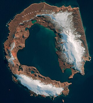
Deception Island is in the South Shetland Islands close to the Antarctic Peninsula with a large and usually "safe" natural harbor, which is occasionally affected by the underlying active volcano. This island is the caldera of an active volcano, which seriously damaged local scientific stations in 1967 and 1969. The island previously held a whaling station. It is now a tourist destination with over 15,000 visitors per year. Two research stations are operated by Argentina and Spain during the summer season. While various countries have asserted sovereignty, it is still administered under the Antarctic Treaty System.

Mousa is a small island in Shetland, Scotland, uninhabited since the nineteenth century. The island is known for the Broch of Mousa, an Iron Age round tower, and is designated as a Special Protection Area for storm-petrel breeding colonies.
The Isle of Noss or Noss is a small, previously inhabited island in Shetland, Scotland. Noss is separated from the island of Bressay by the narrow Noss Sound. It has been run as a sheep farm since 1900, and has been a national nature reserve since 1955.

The Antarctic realm is one of eight terrestrial biogeographic realms. The ecosystem includes Antarctica and several island groups in the southern Atlantic and Indian oceans. The continent of Antarctica is so cold that it has supported only 2 vascular plants for millions of years, and its flora presently consists of around 250 lichens, 100 mosses, 25-30 liverworts, and around 700 terrestrial and aquatic algal species, which live on the areas of exposed rock and soil around the shore of the continent. Antarctica's two flowering plant species, the Antarctic hair grass and Antarctic pearlwort, are found on the northern and western parts of the Antarctic Peninsula. Antarctica is also home to a diversity of animal life, including penguins, seals, and whales.

The South Shetland Islands are a group of Antarctic islands with a total area of 3,687 km2 (1,424 sq mi). They lie about 120 kilometres north of the Antarctic Peninsula, and between 430 and 900 km southwest of the nearest point of the South Orkney Islands. By the Antarctic Treaty of 1959, the islands' sovereignty is neither recognized nor disputed by the signatories and they are free for use by any signatory for non-military purposes.

Livingston Island is an Antarctic island in the Southern Ocean, part of the South Shetlands Archipelago, a group of Antarctic islands north of the Antarctic Peninsula. It was the first land discovered south of 60° south latitude in 1819, a historic event that marked the end of a centuries-long pursuit of the mythical Terra Australis Incognita and the beginning of the exploration and utilization of real Antarctica. The name Livingston, although of unknown derivation, has been well established in international usage since the early 1820s.

Half Moon Island is a minor Antarctic island, lying in McFarlane Strait 1.35 km (0.84 mi) north of Burgas Peninsula, Livingston Island in the South Shetland Islands of the Antarctic Peninsula region. Its surface area is 171 hectares. The Argentine Cámara Base is located on the island. It is only accessible by sea and by helicopter; there is no airport of any kind. The naval base is operational occasionally during the summer, but is closed during the winter.

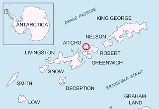
The Aitcho Islands are a group of minor islands on the west side of the north entrance to English Strait separating Greenwich Island and Robert Island in the South Shetland Islands, Antarctica, which are situated between Dee Island to the south and Table Island to the north. The group is separated from Dee Island and Sierra Island to the southwest by Villalón Passage. The area was visited by early 19th century sealers operating from nearby Clothier Harbour. During the austral summer the islands are often visited by Antarctic cruise ships with tourists who land to watch wildlife.

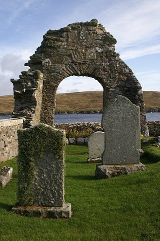
Sandsting is a parish in the West Mainland of Shetland, Scotland, forming a southern arm of the Walls Peninsula. After the parish of Aithsting was annexed into Sandsting in the sixteenth century, it became known as Sandsting and Aithsting parish.

The Scotia Sea Islands tundra is a tundra ecoregion which includes several island groups – South Georgia and the South Sandwich Islands, South Shetland Islands, and Bouvet Island – in the Scotia Sea, where the South Atlantic Ocean meets the Southern Ocean. Most of the terrain is covered with snow and permanent ice, with tundra vegetation - moss, lichen, and algae - on the remainder. The islands support important rookeries for seals, seabirds, and penguins. The islands have no permanent human habitation, and the cold, harsh climate and ending of seal hunting and whaling has prevented settlement.

Yankee Harbour is a small inner harbour entered from Shopski Cove between Glacier Bluff and Spit Point, indenting the south-west side of Greenwich Island in the South Shetland Islands, Antarctica. It is 2.35 km (1.46 mi) long in west-south-west to east-north-east direction, and 1.6 km (0.99 mi) wide, and is bounded by Provadiya Hook to the south-west, Parvomay Neck to the north and east, and Kladara Beach to the south.
Andreaea depressinervis is a species of moss in the family Andreaeaceae that was discovered by Jules Cardot in 1901. It is found on both the South Shetland Islands and the Antarctica.
Andreaea gainii is a species of moss native to western Antarctica and the South Shetland Islands. It grows on exposed rocks and soil.
Andreaea regularis is a species of moss that grows in Antarctica and on the South Shetland Islands.
Dicranoweisia brevipes is a species of moss that occurs on the Antarctic Peninsula and regional islands.

Dicranoweisia crispula, the mountain pincushion, is a species of mosses that lives at both poles. It grows in the South Shetland Islands and on the Antarctic Peninsula.

Coppermine Peninsula is the rugged, rocky promontory forming the northwest extremity of Alfatar Peninsula and Robert Island in the South Shetland Islands, Antarctica. It lies between the English Strait to the west and Carlota Cove to the east. It is 1.7 km long, 500 m wide and rising to 105 m.

Harmony Point is a point which lies close west of Harmony Cove and forms both the south side of the entrance to Malak Sechko Cove and the western extremity of Guangzhou Peninsula and Nelson Island, in the South Shetland Islands of Antarctica. It was charted in 1935 by Discovery Investigations personnel on the Discovery II, and named from association with Harmony Cove.
Narębski Point is a headland on the south-east coast of the Barton Peninsula, at the south-western end of King George Island, in the South Shetland Islands of Antarctica with an average elevation of 0 feet (0 m) above sea level. Korea’s King Sejong Station lies 2 km (1.2 mi) to the north-east.


